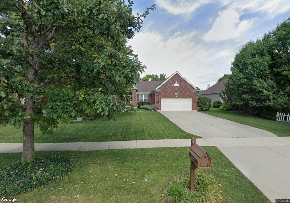
2567 Imgrund Rd North Aurora, IL 60542
Nelson Lake NeighborhoodEstimated Value: $482,071 - $539,000
3
Beds
2
Baths
2,440
Sq Ft
$209/Sq Ft
Est. Value
About This Home
This home is located at 2567 Imgrund Rd, North Aurora, IL 60542 and is currently estimated at $510,768, approximately $209 per square foot. 2567 Imgrund Rd is a home located in Kane County with nearby schools including Fearn Elementary School, Herget Middle School, and West Aurora High School.
Ownership History
Date
Name
Owned For
Owner Type
Purchase Details
Closed on
Nov 22, 2004
Sold by
Neumann Homes Inc
Bought by
Beatus Lou P and Beatus Alice M
Current Estimated Value
Home Financials for this Owner
Home Financials are based on the most recent Mortgage that was taken out on this home.
Original Mortgage
$126,408
Outstanding Balance
$58,713
Interest Rate
4.75%
Mortgage Type
Purchase Money Mortgage
Estimated Equity
$452,055
Create a Home Valuation Report for This Property
The Home Valuation Report is an in-depth analysis detailing your home's value as well as a comparison with similar homes in the area
Home Values in the Area
Average Home Value in this Area
Purchase History
| Date | Buyer | Sale Price | Title Company |
|---|---|---|---|
| Beatus Lou P | $333,000 | Chicago Title Insurance Comp |
Source: Public Records
Mortgage History
| Date | Status | Borrower | Loan Amount |
|---|---|---|---|
| Open | Beatus Lou P | $126,408 |
Source: Public Records
Tax History Compared to Growth
Tax History
| Year | Tax Paid | Tax Assessment Tax Assessment Total Assessment is a certain percentage of the fair market value that is determined by local assessors to be the total taxable value of land and additions on the property. | Land | Improvement |
|---|---|---|---|---|
| 2024 | $10,415 | $151,725 | $12,735 | $138,990 |
| 2023 | $10,044 | $136,936 | $11,494 | $125,442 |
| 2022 | $8,757 | $114,771 | $10,549 | $104,222 |
| 2021 | $8,578 | $109,850 | $10,097 | $99,753 |
| 2020 | $8,500 | $107,275 | $9,860 | $97,415 |
| 2019 | $8,774 | $105,700 | $9,715 | $95,985 |
| 2018 | $8,659 | $101,479 | $9,715 | $91,764 |
| 2017 | $8,793 | $100,326 | $9,605 | $90,721 |
| 2016 | $9,170 | $101,473 | $9,352 | $92,121 |
| 2015 | -- | $98,112 | $8,987 | $89,125 |
| 2014 | -- | $82,995 | $10,000 | $72,995 |
| 2013 | -- | $82,995 | $10,000 | $72,995 |
Source: Public Records
Map
Nearby Homes
- 483 Glover Dr
- 512 Bennett Dr
- 2772 Berman Rd Unit 1A
- 2045 Bartram Rd
- 921 N Deerpath Rd
- 868 Fair Meadow Ct
- 876 Fair Meadow Ct
- 916 Fair Meadow St
- 867 Fair Meadow Ct
- 875 Fair Meadow Ct
- 909 Fair Meadow St
- 917 Fair Meadow St
- Maxfield Plan at Autumn Ridge
- Morgan Plan at Autumn Ridge
- Newbury Plan at Autumn Ridge
- Quinn Plan at Autumn Ridge
- Paxton Plan at Autumn Ridge
- Leyden Plan at Autumn Ridge
- 1799 Breton Ave
- 1679 Patterson Ave
- 2559 Imgrund Rd Unit 3
- 2575 Imgrund Rd Unit 3
- 2551 Imgrund Rd Unit 3
- 2583 Imgrund Rd Unit 3
- 2552 Moutray Ln Unit 3
- 2560 Moutray Ln Unit 3
- 2544 Moutray Ln Unit 3
- 2568 Moutray Ln Unit 3
- 2536 Moutray Ln Unit 3
- 2566 Imgrund Rd Unit 3
- 2543 Imgrund Rd
- 2591 Imgrund Rd Unit 3
- 2558 Imgrund Rd Unit 3
- 625 Meade Blvd
- 2576 Moutray Ln Unit 3
- 2550 Imgrund Rd Unit 3
- 2528 Moutray Ln Unit 2
- 2535 Imgrund Rd
- 2542 Imgrund Rd
- 617 Meade Blvd