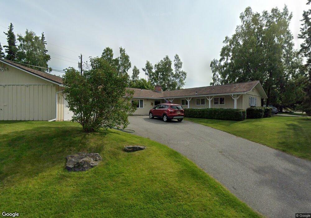
2567 Loussac Dr Anchorage, AK 99517
Turnagain NeighborhoodEstimated Value: $288,000 - $661,000
2
Beds
2
Baths
2,248
Sq Ft
$237/Sq Ft
Est. Value
About This Home
This home is located at 2567 Loussac Dr, Anchorage, AK 99517 and is currently estimated at $533,807, approximately $237 per square foot. 2567 Loussac Dr is a home located in Anchorage Municipality with nearby schools including Turnagain Elementary School, Romig Middle School, and West High School.
Ownership History
Date
Name
Owned For
Owner Type
Purchase Details
Closed on
Jun 29, 2006
Sold by
Dittrich John Paul
Bought by
Marjorie A Dittrich Gst Non Exempt Marit and Dittrich John Paul
Current Estimated Value
Purchase Details
Closed on
Jun 3, 2004
Sold by
Horton Beth
Bought by
Dittrich Beth Horton
Purchase Details
Closed on
Sep 11, 2002
Sold by
Brown Allen E and Brown Margaret L
Bought by
Horton Beth
Purchase Details
Closed on
Oct 1, 1990
Sold by
Rettig Roland L and Rettig Flor M
Bought by
Brown Allen E and Brown Margaret L
Home Financials for this Owner
Home Financials are based on the most recent Mortgage that was taken out on this home.
Original Mortgage
$160,400
Interest Rate
10.15%
Mortgage Type
New Conventional
Create a Home Valuation Report for This Property
The Home Valuation Report is an in-depth analysis detailing your home's value as well as a comparison with similar homes in the area
Home Values in the Area
Average Home Value in this Area
Purchase History
| Date | Buyer | Sale Price | Title Company |
|---|---|---|---|
| Marjorie A Dittrich Gst Non Exempt Marit | -- | None Available | |
| Marjorie A Dittrich Bypass Trust | -- | None Available | |
| Dittrich Beth Horton | -- | -- | |
| Dittrich Beth Horton | -- | -- | |
| Horton Beth | -- | -- | |
| Brown Allen E | -- | -- |
Source: Public Records
Mortgage History
| Date | Status | Borrower | Loan Amount |
|---|---|---|---|
| Previous Owner | Brown Allen E | $160,400 |
Source: Public Records
Tax History Compared to Growth
Tax History
| Year | Tax Paid | Tax Assessment Tax Assessment Total Assessment is a certain percentage of the fair market value that is determined by local assessors to be the total taxable value of land and additions on the property. | Land | Improvement |
|---|---|---|---|---|
| 2025 | $5,683 | $607,400 | $222,200 | $385,200 |
| 2024 | $5,683 | $577,000 | $208,300 | $368,700 |
| 2023 | $5,308 | $536,700 | $208,300 | $328,400 |
| 2022 | $5,668 | $536,600 | $208,300 | $328,300 |
| 2021 | $8,603 | $477,400 | $208,300 | $269,100 |
| 2020 | $4,796 | $483,300 | $208,300 | $275,000 |
| 2019 | $4,455 | $472,300 | $208,300 | $264,000 |
| 2018 | $4,374 | $466,700 | $208,300 | $258,400 |
| 2017 | $4,783 | $475,400 | $208,300 | $267,100 |
| 2016 | $4,514 | $501,800 | $200,300 | $301,500 |
| 2015 | $4,514 | $501,900 | $200,300 | $301,600 |
| 2014 | $4,514 | $464,500 | $200,200 | $264,300 |
Source: Public Records
Map
Nearby Homes
- 2543 La Honda Dr Unit 7
- 2906 W 29th Ave
- 2638 Forest Park Dr Unit 112
- Tr A W Northern Lights Blvd
- 3103 Barbara St
- 2064 Belair Dr
- 2607 W 33rd Ave
- 2155 W 29th Ave Unit 2
- 1908 Hillcrest Dr Unit 17
- 2511 Abbey Ln
- 3100 W 35th Ave
- 3517 Vintage Cir
- 3516 Vintage Cir
- 2702 Mcrae Rd
- 2401 W Marston Dr
- 2925 W 36th Ave
- 3081 Lois Dr Unit 812
- 1665 Bob Atwood Cir Unit 7
- 3835 Carleton Ave
- 2820 Wiley Post Ave
- 2559 Loussac Dr
- 2603 Lord Baranof Dr
- 2631 Lord Baranof Dr
- 2551 Loussac Dr
- 2564 Loussac Dr
- 2531 Lord Baranof Dr
- 2631 W 27th Ave
- 2600 Lord Baranof Dr
- 2612 Lord Baranof Dr
- 2540 Lord Baranof Dr
- 2545 Loussac Dr
- 2803 Knik Ave
- 2542 Loussac Dr
- 2548 Lord Baranof Dr
- L4 W 27th Ave
- 2630 Lord Baranof Dr
- 13511 Discovery View Dr Unit 204A
- 2513 Lord Baranof Dr
- 2621 W 27th Ave
- 2528 Lord Baranof Dr