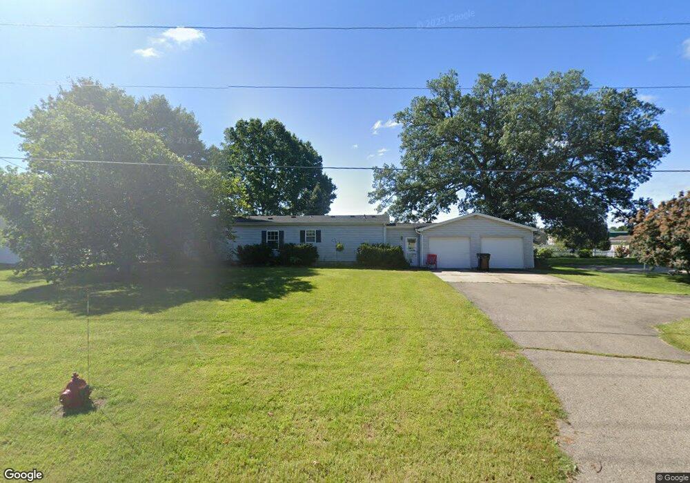
25671 Front Ave Mattawan, MI 49071
Estimated Value: $212,034 - $283,000
Studio
1
Bath
1,248
Sq Ft
$204/Sq Ft
Est. Value
About This Home
This home is located at 25671 Front Ave, Mattawan, MI 49071 and is currently estimated at $254,009, approximately $203 per square foot. 25671 Front Ave is a home located in Van Buren County with nearby schools including Mattawan Early Elementary School, Mattawan Early Childhood Education Center, and Mattawan Later Elementary School.
Ownership History
Date
Name
Owned For
Owner Type
Purchase Details
Closed on
Jan 26, 2021
Sold by
Markle Darryl J and Markle David R
Bought by
Markle Darryl J and Markle Frank Kimberly
Current Estimated Value
Home Financials for this Owner
Home Financials are based on the most recent Mortgage that was taken out on this home.
Original Mortgage
$108,000
Interest Rate
2.7%
Mortgage Type
New Conventional
Purchase Details
Closed on
Jul 15, 2009
Sold by
Markle David R and Markle Lesley
Bought by
Markle Darryl J and Markle David R
Home Financials for this Owner
Home Financials are based on the most recent Mortgage that was taken out on this home.
Original Mortgage
$100,000
Interest Rate
5.62%
Mortgage Type
Future Advance Clause Open End Mortgage
Purchase Details
Closed on
May 30, 2008
Sold by
Markle David R and Markle Lesley
Bought by
Markle David R and Markle Lesley
Create a Home Valuation Report for This Property
The Home Valuation Report is an in-depth analysis detailing your home's value as well as a comparison with similar homes in the area
Home Values in the Area
Average Home Value in this Area
Purchase History
| Date | Buyer | Sale Price | Title Company |
|---|---|---|---|
| Markle Darryl J | -- | Accommodation | |
| Markle Darryl J | -- | None Available | |
| Markle David R | -- | None Available |
Source: Public Records
Mortgage History
| Date | Status | Borrower | Loan Amount |
|---|---|---|---|
| Closed | Markle Darryl J | $108,000 | |
| Closed | Markle Darryl J | $100,000 |
Source: Public Records
Tax History
| Year | Tax Paid | Tax Assessment Tax Assessment Total Assessment is a certain percentage of the fair market value that is determined by local assessors to be the total taxable value of land and additions on the property. | Land | Improvement |
|---|---|---|---|---|
| 2025 | $2,277 | $101,600 | $0 | $0 |
| 2024 | $1,030 | $99,400 | $0 | $0 |
| 2023 | $982 | $89,600 | $0 | $0 |
| 2022 | $1,977 | $81,600 | $0 | $0 |
| 2021 | $1,902 | $69,100 | $10,800 | $58,300 |
| 2020 | $1,876 | $71,700 | $10,800 | $60,900 |
| 2019 | $1,802 | $67,000 | $67,000 | $0 |
| 2018 | $1,734 | $60,700 | $60,700 | $0 |
| 2017 | $1,690 | $56,100 | $0 | $0 |
| 2016 | $1,697 | $51,800 | $0 | $0 |
| 2015 | $1,228 | $51,800 | $0 | $0 |
| 2014 | $1,260 | $46,500 | $0 | $0 |
| 2013 | -- | $40,300 | $40,300 | $0 |
Source: Public Records
Map
Nearby Homes
- 57704 Rumshire Dr
- 58800 Silvergrass Dr
- 58478 Swenson St
- 59072 Swenson St
- 58640 Swenson St
- 58367 Swenson St
- 58370 Norton St
- 59075 Norton St
- 59018 Swenson St
- 59587 Silvergrass Dr
- 58884 Interlaken St
- 58994 Interlaken St
- 24340 Front St
- 10948 Mystic Heights Trail
- 10963 Mystic Heights Trail
- 10711 Mystic Heights Trail
- 24195 Third Ave
- 61121 Airpark Ln
- 26641 60th Ave
- Lot 1 Airpark Ln
- 25725 Front Ave
- 25615 Front Ave
- 25658 Front Ave
- 25614 Front Ave
- 58161 Silvergrass Ave
- 25730 Front Ave
- 58107 Silvergrass Ave
- 58219 Silvergrass Dr
- 58219 Silvergrass Ave
- 58279 Silvergrass Ave
- 57825 Kingdon Dr
- 57860 Hamilton Dr
- 58279 Silvergrass Dr
- 57880 Kingdon Dr
- 25790 Front Ave
- 25534 Front Ave
- 58373 Silvergrass Dr
- 57857 Rumshire Dr
- 57754 Hamilton Dr
- 57757 Kingdon Dr
Your Personal Tour Guide
Ask me questions while you tour the home.