
25675 Hiawatha Dr Sturgis, MI 49091
Estimated payment $305/month
Highlights
- Boat Ramp
- 0.93 Acre Lot
- Corner Lot: Yes
- Beach
About This Lot
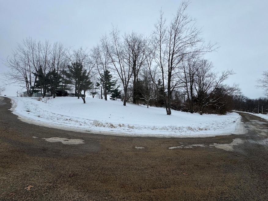
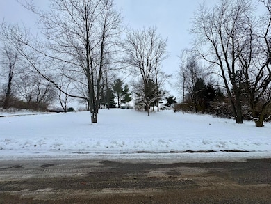
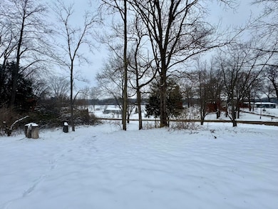
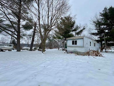
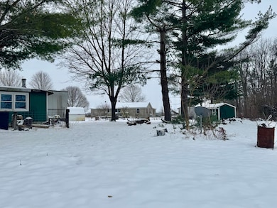
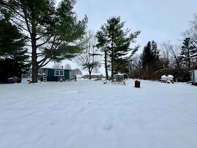
Discover the perfect place to start fresh with a beautiful elevated view overlooking the lake. Ideal for someone with vision, this property offers incredible potential for building your dream home. The existing trailer is condemned and will need to be removed, giving you a clean slate to create exactly what you want. This listing includes four lots, totaling 0.93 acres. Located within a small, well-maintained association, you'll enjoy exclusive access to a private boat launch and private beach, conveniently located directly across the street. A rare opportunity to secure lake privileges and build something truly special in a peaceful, scenic setting.
Property Details
Property Type
- Land
Est. Annual Taxes
- $498
Lot Details
- 0.93 Acre Lot
- Lot Dimensions are 300 x 300
- Corner Lot: Yes
Utilities
- Well
- Septic Tank
- Septic System
Community Details
Overview
- Property has a Home Owners Association
Recreation
- Boat Ramp
- Community Boat Launch
- Beach
Map
Home Values in the Area
Average Home Value in this Area
Tax History
| Year | Tax Paid | Tax Assessment Tax Assessment Total Assessment is a certain percentage of the fair market value that is determined by local assessors to be the total taxable value of land and additions on the property. | Land | Improvement |
|---|---|---|---|---|
| 2025 | $474 | $15,000 | $6,200 | $8,800 |
| 2024 | $103 | $14,200 | $5,400 | $8,800 |
| 2023 | $98 | $10,500 | $2,700 | $7,800 |
| 2022 | $0 | $9,400 | $2,500 | $6,900 |
| 2021 | $329 | $8,600 | $2,300 | $6,300 |
| 2020 | $91 | $8,600 | $2,300 | $6,300 |
| 2019 | $76 | $7,700 | $2,300 | $5,400 |
| 2018 | $323 | $7,600 | $2,300 | $5,300 |
| 2017 | $321 | $7,600 | $7,600 | $0 |
| 2016 | -- | $7,800 | $7,800 | $0 |
| 2015 | -- | $6,800 | $0 | $0 |
| 2014 | -- | $7,000 | $7,000 | $0 |
| 2012 | -- | $7,700 | $7,700 | $0 |
Property History
| Date | Event | Price | List to Sale | Price per Sq Ft |
|---|---|---|---|---|
| 12/07/2025 12/07/25 | For Sale | $50,000 | -- | -- |
Purchase History
| Date | Type | Sale Price | Title Company |
|---|---|---|---|
| Fiduciary Deed | -- | None Listed On Document | |
| Warranty Deed | $25,000 | Sbtc | |
| Deed | -- | -- |
Mortgage History
| Date | Status | Loan Amount | Loan Type |
|---|---|---|---|
| Previous Owner | $26,000 | Purchase Money Mortgage |
Source: MichRIC
MLS Number: 25061035
APN: 014-260-098-00
Disclaimer: Certain information contained herein is derived from information provided by parties other than Homes.com. All information provided is deemed reliable, but is not guaranteed to be accurate and should be independently verified.
![]() Information is deemed reliable but not guaranteed.
Information is deemed reliable but not guaranteed.
Copyright 2025 MichRIC, LLC. All rights reserved.
- 0 Vl Seneca Ct
- 67696 Thunderbird Dr
- 200 Broadus St
- 26865 Us Highway 12
- 708 N Centerville Rd
- 600 Saint Joseph St
- 501 W Ohio Ct
- 204 Merryview Dr
- 410 W Chicago Rd
- 805 N Nottawa St
- 210 Grove St
- 26137 Diana Dr
- 609 Sturgis St
- 501 Norwood St
- 607 George St
- 702 S Orange St
- 211 N Maple St
- 513 N Fourth St
- 69760 White School Rd
- 0 Deer Rd
- 69086 Texas Ave
- 155 Memorial Dr
- 104 W Michigan St Unit 3
- 835 Us-20 Unit 3
- 835 Us-20 Unit 6
- 610 Pine St
- 930 W 590 S
- 10139 Lucas Rd
- 9211 E Y Z Ave
- 1305 W Vistula St
- 412 S Main St Unit 1
- 16558 Donnell Lake St
- 400 N Terrace Blvd
- 245 Lynbrook Dr
- 1401 Park 33 Blvd
- 1408 Kentfield Way Unit 2
- 22538 Pine Arbor Dr
- 1306 Cedarbrook Ct
- 3530 E Lake Dr N
- 199 Northcrest Rd
