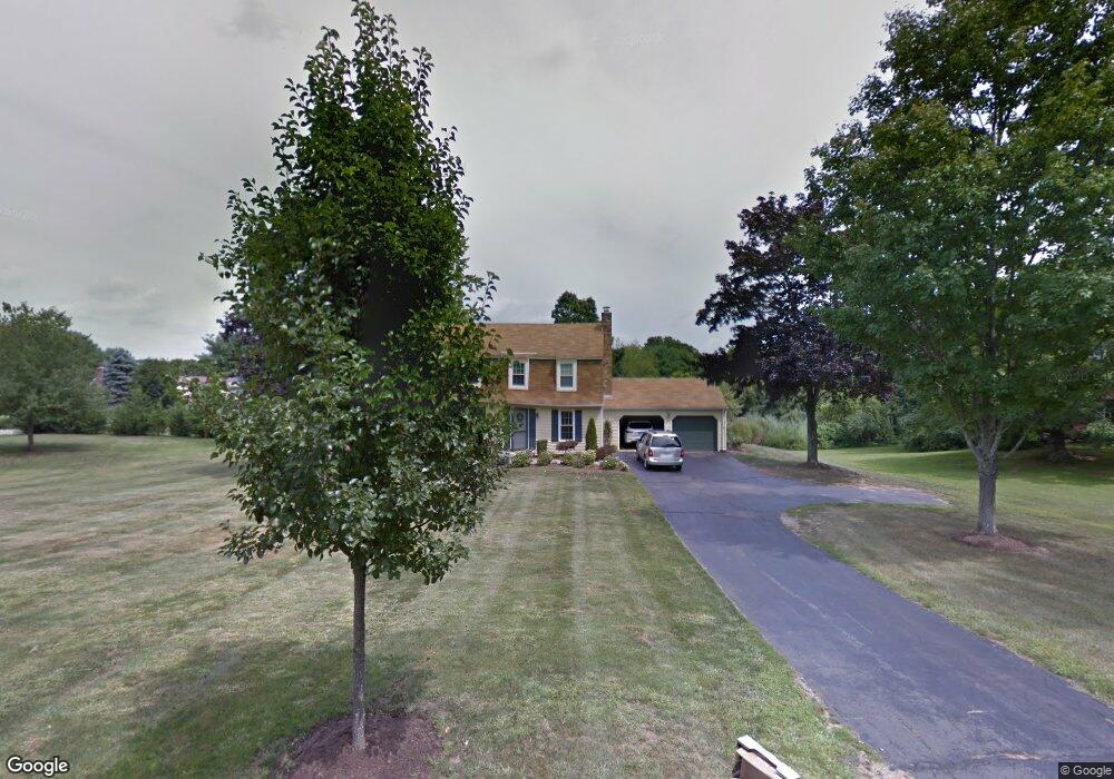
257 E River Rd Guilford, CT 06437
Estimated Value: $531,000 - $772,000
5
Beds
3
Baths
2,280
Sq Ft
$302/Sq Ft
Est. Value
About This Home
This home is located at 257 E River Rd, Guilford, CT 06437 and is currently estimated at $688,597, approximately $302 per square foot. 257 E River Rd is a home located in New Haven County with nearby schools including E.C. Adams Middle School, A. Baldwin Middle School, and Guilford High School.
Ownership History
Date
Name
Owned For
Owner Type
Purchase Details
Closed on
Aug 1, 2008
Sold by
Manfield Traci A
Bought by
Avallone Michelle
Current Estimated Value
Home Financials for this Owner
Home Financials are based on the most recent Mortgage that was taken out on this home.
Original Mortgage
$372,060
Interest Rate
6.47%
Purchase Details
Closed on
Dec 29, 2000
Sold by
Paukstys Mary
Bought by
Mansfield Traci A
Create a Home Valuation Report for This Property
The Home Valuation Report is an in-depth analysis detailing your home's value as well as a comparison with similar homes in the area
Home Values in the Area
Average Home Value in this Area
Purchase History
| Date | Buyer | Sale Price | Title Company |
|---|---|---|---|
| Avallone Michelle | $375,000 | -- | |
| Mansfield Traci A | $290,000 | -- |
Source: Public Records
Mortgage History
| Date | Status | Borrower | Loan Amount |
|---|---|---|---|
| Open | Mansfield Traci A | $357,115 | |
| Closed | Mansfield Traci A | $377,640 | |
| Closed | Mansfield Traci A | $372,060 | |
| Previous Owner | Mansfield Traci A | $130,000 |
Source: Public Records
Tax History
| Year | Tax Paid | Tax Assessment Tax Assessment Total Assessment is a certain percentage of the fair market value that is determined by local assessors to be the total taxable value of land and additions on the property. | Land | Improvement |
|---|---|---|---|---|
| 2025 | $10,529 | $380,800 | $200,970 | $179,830 |
| 2024 | $10,122 | $380,800 | $200,970 | $179,830 |
| 2023 | $9,855 | $380,800 | $200,970 | $179,830 |
| 2022 | $8,293 | $249,420 | $135,140 | $114,280 |
| 2021 | $8,136 | $249,420 | $135,140 | $114,280 |
| 2020 | $8,059 | $249,420 | $135,140 | $114,280 |
| 2019 | $7,821 | $244,170 | $135,140 | $109,030 |
| 2018 | $7,638 | $244,170 | $135,140 | $109,030 |
| 2017 | $7,665 | $261,060 | $137,220 | $123,840 |
| 2016 | $7,485 | $261,060 | $137,220 | $123,840 |
| 2015 | $7,372 | $261,060 | $137,220 | $123,840 |
| 2014 | $7,158 | $261,060 | $137,220 | $123,840 |
Source: Public Records
Map
Nearby Homes
- 4 Boston Post Rd
- 23 Sheep Pasture Rd
- 67 Boston Post Rd Unit 8
- 70 Wildwood Ave
- 409 Boston St
- 402 Boston St
- 173 Wildwood Ave
- 22 Nathans Ln
- 22 Village Cir Unit 22
- 35 Village Walk Unit 35
- 33 Village Walk Unit 33
- 178 Mungertown Rd
- 2 Esterly Farms Rd
- 26 Opening Hill Rd
- 80 Seaview Terrace Unit 31
- 38 Opening Hill Rd
- 147 Boston St
- 42 Neck Rd
- 7 Village Cir Unit 7
- 24 Village Cir Unit 24
- 33 Riverview Dr
- 245 E River Rd
- 271 E River Rd
- 51 Riverview Dr
- 260 E River Rd
- 85 Riverview Dr
- 293 E River Rd
- 270 E River Rd
- 38 Riverview Dr
- 20 Trailwood Dr
- 46 Riverview Dr
- 301 E River Rd
- 58 Riverview Dr
- 50 Trailwood Dr
- 58 Trailwood Dr
- 66 Riverview Dr
- 186 E River Rd
- 133 Riverview Dr
- 96 Riverview Dr
- 25 Trailwood Dr
Your Personal Tour Guide
Ask me questions while you tour the home.