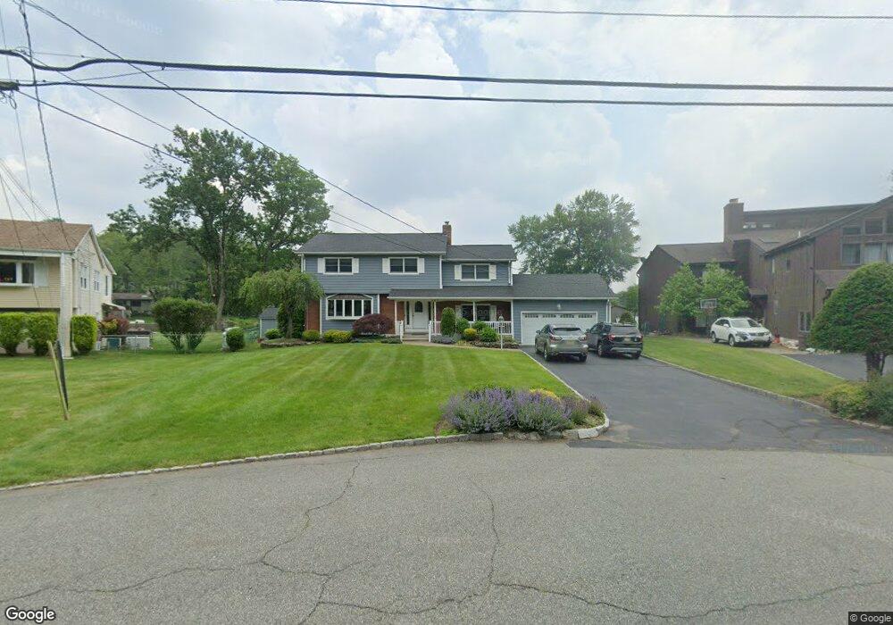
257 High Crest Dr West Milford, NJ 07480
Estimated Value: $676,655 - $832,000
--
Bed
--
Bath
2,352
Sq Ft
$313/Sq Ft
Est. Value
About This Home
This home is located at 257 High Crest Dr, West Milford, NJ 07480 and is currently estimated at $735,164, approximately $312 per square foot. 257 High Crest Dr is a home located in Passaic County with nearby schools including Macopin Middle School, West Milford High School, and Apple Montessori Schools and Camps - Kinnelon.
Ownership History
Date
Name
Owned For
Owner Type
Purchase Details
Closed on
Mar 30, 2015
Sold by
Hardt William and Hardt Mary Lu
Bought by
Farmer John F and Farmer Linda M
Current Estimated Value
Home Financials for this Owner
Home Financials are based on the most recent Mortgage that was taken out on this home.
Original Mortgage
$280,000
Outstanding Balance
$215,392
Interest Rate
3.72%
Mortgage Type
New Conventional
Estimated Equity
$519,772
Purchase Details
Closed on
Sep 30, 1997
Sold by
Logan Robert and Logan Doreen
Bought by
Hardt William and Hardt Mary Lu
Home Financials for this Owner
Home Financials are based on the most recent Mortgage that was taken out on this home.
Original Mortgage
$175,000
Interest Rate
6.92%
Create a Home Valuation Report for This Property
The Home Valuation Report is an in-depth analysis detailing your home's value as well as a comparison with similar homes in the area
Home Values in the Area
Average Home Value in this Area
Purchase History
| Date | Buyer | Sale Price | Title Company |
|---|---|---|---|
| Farmer John F | $527,000 | Agent For Westcor Land Title | |
| Hardt William | $235,000 | Chicago Title Insurance Co |
Source: Public Records
Mortgage History
| Date | Status | Borrower | Loan Amount |
|---|---|---|---|
| Open | Farmer John F | $280,000 | |
| Previous Owner | Hardt William | $175,000 |
Source: Public Records
Tax History Compared to Growth
Tax History
| Year | Tax Paid | Tax Assessment Tax Assessment Total Assessment is a certain percentage of the fair market value that is determined by local assessors to be the total taxable value of land and additions on the property. | Land | Improvement |
|---|---|---|---|---|
| 2025 | $18,644 | $459,900 | $229,500 | $230,400 |
| 2024 | $18,741 | $459,900 | $229,500 | $230,400 |
| 2022 | $17,789 | $459,900 | $229,500 | $230,400 |
| 2021 | $17,407 | $459,900 | $229,500 | $230,400 |
| 2020 | $17,223 | $459,900 | $229,500 | $230,400 |
| 2019 | $16,993 | $459,900 | $229,500 | $230,400 |
| 2018 | $16,952 | $459,900 | $229,500 | $230,400 |
| 2017 | $17,030 | $459,900 | $229,500 | $230,400 |
| 2016 | $17,058 | $459,900 | $229,500 | $230,400 |
| 2015 | $16,860 | $458,200 | $229,500 | $228,700 |
| 2014 | $16,390 | $458,200 | $229,500 | $228,700 |
Source: Public Records
Map
Nearby Homes
- 13 Upper High Crest Dr
- 18 Upper High Crest Dr
- 351 High Crest Dr
- 94 Upper High Crest Dr
- 94 Up High Crest Rd
- 15 Longview Rd
- 128 Upper High Crest Dr
- 128 Up High Crest Rd
- 1858 New Jersey 23
- 1858 State Rt 23
- 577 MacOpin Rd
- 6 Mohawk Trail
- 16 Berry Ln
- 402 Cambridge Dr
- 474 Cambridge Dr
- 130 Barrister Dr
- 265 Winthrop Dr Unit 54
- 271 Winthrop Dr Unit 57
- 34 North Rd
- 2 Holly Ct
- 259 High Crest Dr
- 255 High Crest Dr
- 263 High Crest Dr
- 253 High Crest Dr
- 260 High Crest Dr
- 267 High Crest Dr
- 269 High Crest Dr
- 250 High Crest Dr
- 195 High Crest Dr
- 199 High Crest Dr
- 203 High Crest Dr
- 191 High Crest Dr
- 273 High Crest Dr
- 207 High Crest Dr
- 187 High Crest Dr
- 211 High Crest Dr
- 244 High Crest Dr
- 274 High Crest Dr
- 277 High Crest Dr
- 200 High Crest Dr