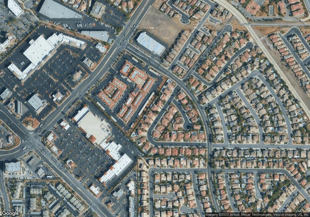
2570 Mizzoni Cir Henderson, NV 89052
MacDonald Ranch NeighborhoodEstimated Value: $618,000 - $720,000
3
Beds
2
Baths
2,316
Sq Ft
$286/Sq Ft
Est. Value
About This Home
This home is located at 2570 Mizzoni Cir, Henderson, NV 89052 and is currently estimated at $661,379, approximately $285 per square foot. 2570 Mizzoni Cir is a home located in Clark County with nearby schools including Glen C. Taylor Elementary School, Bob Miller Middle School, and Coronado High School.
Ownership History
Date
Name
Owned For
Owner Type
Purchase Details
Closed on
Mar 21, 2024
Sold by
Mcdaniel Phillip R
Bought by
Mcdaniel Trust and Mcdaniel
Current Estimated Value
Purchase Details
Closed on
Mar 7, 2003
Sold by
Hacsi Michael A and Hacsi Barbara A
Bought by
Mcdaniel Phillip R and Mcdaniel Patricia J
Home Financials for this Owner
Home Financials are based on the most recent Mortgage that was taken out on this home.
Original Mortgage
$60,000
Interest Rate
5.83%
Purchase Details
Closed on
Feb 2, 1999
Sold by
Great Western Homes Llc
Bought by
Hacsi Michael A and Hacsi Barbara A
Home Financials for this Owner
Home Financials are based on the most recent Mortgage that was taken out on this home.
Original Mortgage
$180,000
Interest Rate
6.73%
Create a Home Valuation Report for This Property
The Home Valuation Report is an in-depth analysis detailing your home's value as well as a comparison with similar homes in the area
Home Values in the Area
Average Home Value in this Area
Purchase History
| Date | Buyer | Sale Price | Title Company |
|---|---|---|---|
| Mcdaniel Trust | -- | None Listed On Document | |
| Mcdaniel Phillip R | $285,000 | Equity Title Of Nevada | |
| Hacsi Michael A | $192,500 | Fidelity Natl Title Agency I |
Source: Public Records
Mortgage History
| Date | Status | Borrower | Loan Amount |
|---|---|---|---|
| Previous Owner | Mcdaniel Phillip R | $60,000 | |
| Previous Owner | Hacsi Michael A | $180,000 |
Source: Public Records
Tax History Compared to Growth
Tax History
| Year | Tax Paid | Tax Assessment Tax Assessment Total Assessment is a certain percentage of the fair market value that is determined by local assessors to be the total taxable value of land and additions on the property. | Land | Improvement |
|---|---|---|---|---|
| 2025 | $3,141 | $155,985 | $47,950 | $108,035 |
| 2024 | $3,050 | $155,985 | $47,950 | $108,035 |
| 2023 | $3,050 | $153,937 | $51,800 | $102,137 |
| 2022 | $2,966 | $139,301 | $45,500 | $93,801 |
| 2021 | $2,882 | $133,310 | $44,100 | $89,210 |
| 2020 | $2,794 | $132,557 | $44,100 | $88,457 |
| 2019 | $2,714 | $120,679 | $33,600 | $87,079 |
| 2018 | $2,635 | $111,807 | $27,650 | $84,157 |
| 2017 | $3,204 | $113,182 | $27,650 | $85,532 |
| 2016 | $2,494 | $106,879 | $21,700 | $85,179 |
| 2015 | $2,564 | $100,757 | $18,900 | $81,857 |
| 2014 | $2,490 | $86,844 | $12,250 | $74,594 |
Source: Public Records
Map
Nearby Homes
- 2587 Mizzoni Cir
- 741 Wildwood Beach Ave
- 2579 Anchorgate Dr
- 2556 Prince Edward Dr
- 818 Sandhill Sage St
- 820 Sandhill Sage St
- 648 Doubleshot Ln
- 2566 Wiltshire Ave
- 848 Sandhill Sage St
- 700 Carnegie St Unit 1311
- 700 Carnegie St Unit 1111
- 700 Carnegie St Unit 1423
- 700 Carnegie St Unit 2621
- 700 Carnegie St Unit 2022
- 700 Carnegie St Unit 3214
- 700 Carnegie St Unit 4113
- 700 Carnegie St Unit 3913
- 700 Carnegie St Unit 1512
- 967 Cardelina Ln
- 2656 Bad Rock Cir
- 2572 Mizzoni Cir
- 2568 Mizzoni Cir
- 2574 Mizzoni Cir
- 2566 Mizzoni Cir
- 2569 Mizzoni Cir
- 2571 Mizzoni Cir
- 2571 Mizzoni Cir Unit n/a
- 2567 Mizzoni Cir
- 2573 Mizzoni Cir
- 2564 Mizzoni Cir
- 747 Aldo Rae Ct
- 2583 Mizzoni Cir
- 749 Aldo Rae Ct
- 2562 Mizzoni Cir
- 740 Aldo Rae Ct
- 2578 Mizzoni Cir
- 742 Aldo Rae Ct
- 2589 Mizzoni Cir
- 744 Aldo Rae Ct
- 2580 Mizzoni Cir
