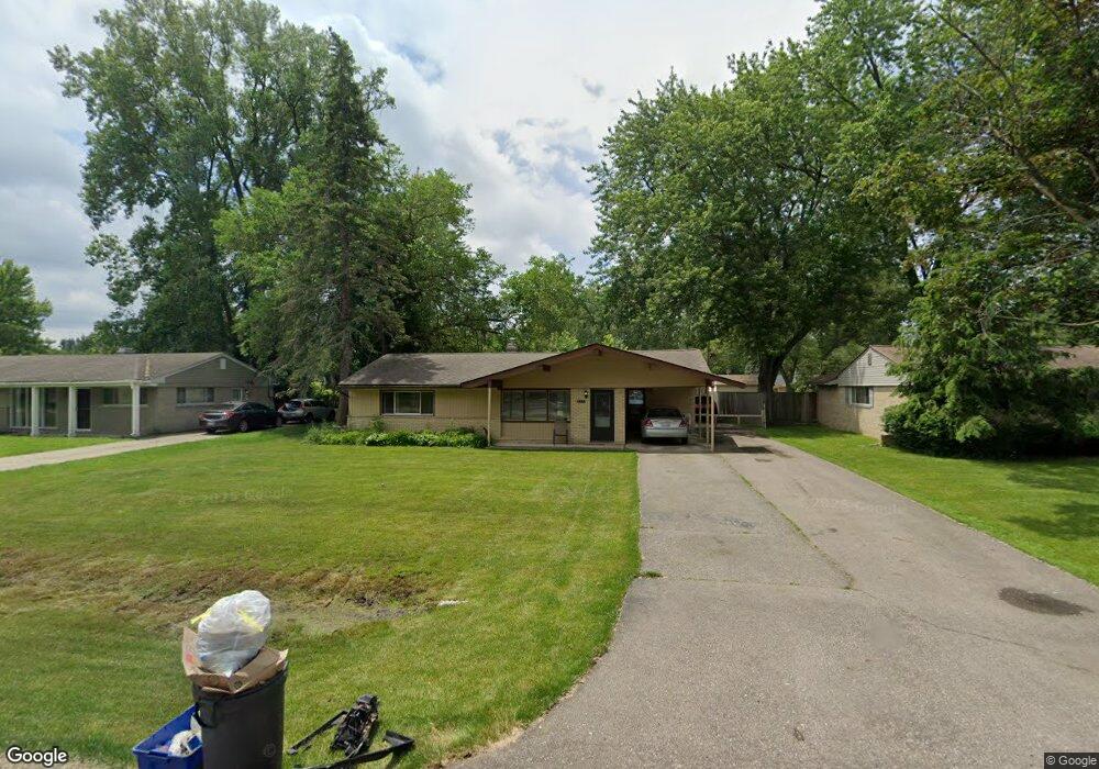
2571 Depew Dr West Bloomfield, MI 48324
Estimated Value: $259,153 - $288,000
3
Beds
2
Baths
1,330
Sq Ft
$208/Sq Ft
Est. Value
About This Home
This home is located at 2571 Depew Dr, West Bloomfield, MI 48324 and is currently estimated at $277,288, approximately $208 per square foot. 2571 Depew Dr is a home located in Oakland County with nearby schools including Walt Whitman Elementary School, Pontiac Middle School, and Pontiac High School.
Ownership History
Date
Name
Owned For
Owner Type
Purchase Details
Closed on
Jul 16, 2008
Sold by
Citimortgage Inc
Bought by
Mann Michael
Current Estimated Value
Purchase Details
Closed on
Feb 13, 2007
Sold by
Smiles Unrina
Bought by
Citimortgage Inc
Purchase Details
Closed on
Jan 26, 2004
Sold by
Little Eric R and Little Elsie I
Bought by
Smiles Unrina
Home Financials for this Owner
Home Financials are based on the most recent Mortgage that was taken out on this home.
Original Mortgage
$144,900
Interest Rate
8.15%
Mortgage Type
Purchase Money Mortgage
Create a Home Valuation Report for This Property
The Home Valuation Report is an in-depth analysis detailing your home's value as well as a comparison with similar homes in the area
Home Values in the Area
Average Home Value in this Area
Purchase History
| Date | Buyer | Sale Price | Title Company |
|---|---|---|---|
| Mann Michael | $42,000 | Attorneys Title Agency Inc | |
| Citimortgage Inc | $138,900 | None Available | |
| Smiles Unrina | $161,000 | Philip R Seaver Title Co Inc |
Source: Public Records
Mortgage History
| Date | Status | Borrower | Loan Amount |
|---|---|---|---|
| Previous Owner | Smiles Unrina | $144,900 |
Source: Public Records
Tax History Compared to Growth
Tax History
| Year | Tax Paid | Tax Assessment Tax Assessment Total Assessment is a certain percentage of the fair market value that is determined by local assessors to be the total taxable value of land and additions on the property. | Land | Improvement |
|---|---|---|---|---|
| 2024 | $1,973 | $108,120 | $0 | $0 |
| 2022 | $1,881 | $89,910 | $24,700 | $65,210 |
| 2021 | $2,402 | $80,520 | $0 | $0 |
| 2020 | $1,721 | $73,640 | $24,700 | $48,940 |
| 2018 | $2,288 | $63,470 | $17,900 | $45,570 |
| 2015 | -- | $50,720 | $0 | $0 |
| 2014 | -- | $46,570 | $0 | $0 |
| 2011 | -- | $53,220 | $0 | $0 |
Source: Public Records
Map
Nearby Homes
- 2630 Depew Dr
- 2622 Pine Ridge Rd
- 2918 Nagle Ct
- 2411 Pine Lake Ave
- 2468 Walce Dr
- 2084 Woodrow Wilson Blvd Unit A6
- 2230 Middlebelt Rd
- 2216 Middlebelt Rd
- 2329 Fordham St
- 2952 Prynne St
- 2665 Middlebelt Rd
- 3076 Pridham St
- 2360 Pineview
- 2428 Willow Beach St
- 1970 Beechmont St
- 3087 Brock St
- 2825 Wall St
- 3170 Orchard Lake Rd Unit 6
- 3170 Orchard Lake Rd Unit 84
- 2030 Pine Lake Trail
- 2583 Depew Dr
- 2559 Depew Dr
- 2614 Penna Dr
- 2541 Depew Dr
- 2595 Depew Dr
- 2607 Depew Dr
- 2624 Penna Dr
- 2614 Littletell Ave Unit Bldg-Unit
- 2614 Littletell Ave
- 2570 Depew Dr
- 2582 Depew Dr Unit Bldg-Unit
- 2582 Depew Dr
- 2588 Littletell Ave
- 2634 Penna Dr
- 2572 Littletell Ave
- 2558 Depew Dr
- 2594 Depew Dr
- 2546 Depew Dr
- 2619 Depew Dr
- 2644 Penna Dr