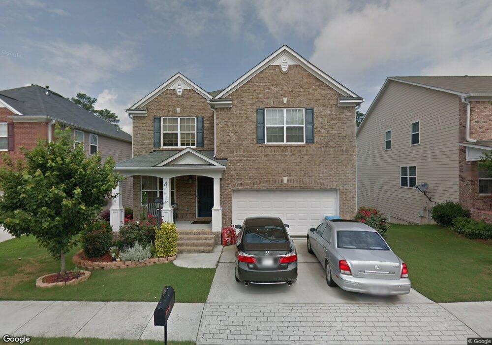
2571 Farmstead Ct Grayson, GA 30017
Estimated Value: $403,000 - $437,808
4
Beds
3
Baths
3,102
Sq Ft
$133/Sq Ft
Est. Value
About This Home
This home is located at 2571 Farmstead Ct, Grayson, GA 30017 and is currently estimated at $412,202, approximately $132 per square foot. 2571 Farmstead Ct is a home located in Gwinnett County with nearby schools including Trip Elementary School, Bay Creek Middle School, and Grayson High School.
Ownership History
Date
Name
Owned For
Owner Type
Purchase Details
Closed on
Mar 27, 2018
Sold by
Brown Leonie
Bought by
Blackwood Jacqueline and Blackwood Alexandria
Current Estimated Value
Home Financials for this Owner
Home Financials are based on the most recent Mortgage that was taken out on this home.
Original Mortgage
$98,000
Outstanding Balance
$56,641
Interest Rate
4.5%
Mortgage Type
New Conventional
Estimated Equity
$355,561
Purchase Details
Closed on
Feb 9, 2007
Sold by
Brown Leonie
Bought by
Brown Leonie and Blackwood Peter
Purchase Details
Closed on
Sep 25, 2006
Sold by
Colony Homes Llc
Bought by
Brown Leonie
Home Financials for this Owner
Home Financials are based on the most recent Mortgage that was taken out on this home.
Original Mortgage
$181,073
Interest Rate
6.48%
Mortgage Type
New Conventional
Create a Home Valuation Report for This Property
The Home Valuation Report is an in-depth analysis detailing your home's value as well as a comparison with similar homes in the area
Home Values in the Area
Average Home Value in this Area
Purchase History
| Date | Buyer | Sale Price | Title Company |
|---|---|---|---|
| Blackwood Jacqueline | -- | -- | |
| Brown Leonie | -- | -- | |
| Brown Leonie | $226,400 | -- |
Source: Public Records
Mortgage History
| Date | Status | Borrower | Loan Amount |
|---|---|---|---|
| Open | Blackwood Jacqueline | $98,000 | |
| Previous Owner | Brown Leonie | $181,073 |
Source: Public Records
Tax History Compared to Growth
Tax History
| Year | Tax Paid | Tax Assessment Tax Assessment Total Assessment is a certain percentage of the fair market value that is determined by local assessors to be the total taxable value of land and additions on the property. | Land | Improvement |
|---|---|---|---|---|
| 2025 | $6,227 | $208,760 | $30,000 | $178,760 |
| 2024 | $6,376 | $199,240 | $30,000 | $169,240 |
| 2023 | $6,376 | $193,000 | $30,400 | $162,600 |
| 2022 | $5,185 | $161,520 | $22,000 | $139,520 |
| 2021 | $3,814 | $116,280 | $16,800 | $99,480 |
| 2020 | $4,420 | $116,280 | $16,800 | $99,480 |
| 2019 | $3,847 | $101,320 | $15,200 | $86,120 |
| 2018 | $3,249 | $90,440 | $12,000 | $78,440 |
| 2016 | $2,836 | $79,480 | $12,000 | $67,480 |
| 2015 | $2,603 | $72,920 | $9,600 | $63,320 |
| 2014 | -- | $72,920 | $9,600 | $63,320 |
Source: Public Records
Map
Nearby Homes
- 1205 Pebble Bend Dr
- 706 Hawthorn Ln Unit 3
- 1135 Pebble Bend Dr
- 181 Camry Ln
- 958 Bramble Way
- 1028 Bramble Way
- 2542 Haynes Meadow Ct
- 314 Gable Brook Dr SW
- 2797 Nathaniel Way
- 2228 Roseberry Ln
- 2238 Roseberry Ln
- 1335 Tullifenney Ct SW
- 2687 Pointcrest Way
- 2810 Cooper Brook Dr
- 2639 Cooper Brook Dr
- 2629 Cooper Brook Dr
- 2880 Cooper Brook Dr
- 1134 Stony Point
- 2561 Farmstead Ct
- 2581 Farmstead Ct
- 2551 Farmstead Ct
- 2591 Farmstead Ct
- 2541 Farmstead Ct
- 2578 Farmstead Ct
- 2601 Farmstead Ct
- 2601 Farmstead Ct Unit 35
- 2568 Farmstead Ct Unit 47
- 2568 Farmstead Ct
- 2588 Farmstead Ct
- 2558 Farmstead Ct
- 2598 Farmstead Ct
- 2531 Farmstead Ct
- 2611 Farmstead Ct
- 2548 Farmstead Ct
- 2618 Farmstead Ct
- 2652 Meadow Trace Dr
- 2642 Meadow Trace Dr
- 2621 Farmstead Ct