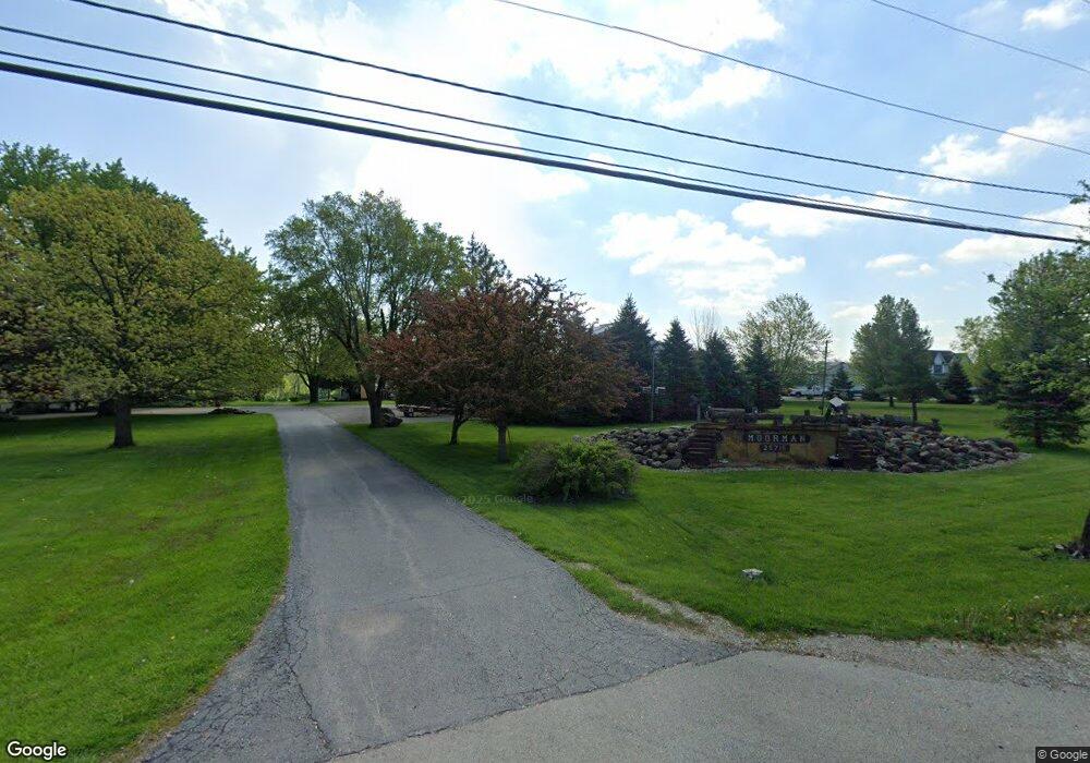
25715 S Blackberry Ln Channahon, IL 60410
South DuPage River NeighborhoodEstimated Value: $459,000
--
Bed
2
Baths
3,185
Sq Ft
$144/Sq Ft
Est. Value
About This Home
This home is located at 25715 S Blackberry Ln, Channahon, IL 60410 and is currently priced at $459,000, approximately $144 per square foot. 25715 S Blackberry Ln is a home located in Will County with nearby schools including N B Galloway Elementary School, Pioneer Path School, and Three Rivers School.
Ownership History
Date
Name
Owned For
Owner Type
Purchase Details
Closed on
Jul 27, 2022
Sold by
Lawrence T Moorman Revocable Living Trus
Bought by
White Eli and White Aubry
Current Estimated Value
Purchase Details
Closed on
Nov 24, 2014
Sold by
Moorman Lawrence T and Moorman Janet M
Bought by
Moorman Lawrence T and Moorman Revocable L Lawrence T
Purchase Details
Closed on
Aug 18, 2008
Sold by
Rittof Stephen M and Moorman Lawrence T
Bought by
Moorman Lawrence T and Moorman Janet M
Create a Home Valuation Report for This Property
The Home Valuation Report is an in-depth analysis detailing your home's value as well as a comparison with similar homes in the area
Home Values in the Area
Average Home Value in this Area
Purchase History
| Date | Buyer | Sale Price | Title Company |
|---|---|---|---|
| White Eli | -- | None Listed On Document | |
| Moorman Lawrence T | -- | None Available | |
| Moorman Lawrence T | -- | None Available |
Source: Public Records
Tax History Compared to Growth
Tax History
| Year | Tax Paid | Tax Assessment Tax Assessment Total Assessment is a certain percentage of the fair market value that is determined by local assessors to be the total taxable value of land and additions on the property. | Land | Improvement |
|---|---|---|---|---|
| 2022 | $14,434 | $178,805 | $25,311 | $153,494 |
| 2021 | $13,534 | $169,373 | $23,870 | $145,503 |
| 2020 | $13,130 | $165,807 | $23,270 | $142,537 |
| 2019 | $12,527 | $158,582 | $22,158 | $136,424 |
| 2018 | $12,006 | $151,761 | $21,467 | $130,294 |
| 2017 | $11,742 | $145,772 | $20,531 | $125,241 |
| 2016 | $11,401 | $140,161 | $19,657 | $120,504 |
| 2015 | $9,107 | $132,713 | $19,589 | $113,124 |
| 2014 | $9,107 | $131,164 | $19,540 | $111,624 |
| 2013 | $9,107 | $131,115 | $19,491 | $111,624 |
Source: Public Records
Map
Nearby Homes
- 25540 S Canal St
- 25610 S Parkside Dr
- 25710 S Parkside Dr
- 26020 W Ravine Woods Dr
- 26201 W Winding Oak Ct Unit 11
- 25815 S Bell Rd
- 25624 S Fieldstone Ct
- 24758 S Tryon St
- 26124 S Bell Rd
- 26210 W Bayberry Ct Unit 12
- 24639 S Howard Ct
- 26518 W Deer Path
- 26314 W Silver Stream Dr
- 24605 S River Trail
- 25225 W Saint Elizabeth Dr Unit B32
- 25221 W Saint Elizabeth Dr Unit B33
- 25215 W Saint Elizabeth Dr Unit B34
- 25211 W Saint Elizabeth Dr Unit B35
- 25205 W Saint Elizabeth Dr Unit B36
- 26330 S Settlers Dr
- 25624 S Blackberry Ln
- 25706 S Blackberry Ln
- 25823 S Blackberry Ln
- 22345 S Cedar Dr
- 70 lots Old Kerry Rd
- Lot 7 Old Kerry Ln
- 26601 Route 6
- 26601 W Eames St
- 0 NW Route 6 & Navajo Dr Unit 10050118
- 0 W Eames St Unit 10042583
- 0 Rt 6 Unit 10042572
- Lot 4 S Ford Rd
- Lot 3 S Ford Rd
- Lot 2 S Ford Rd
- Lot 1 S Ford Rd
- tbd Red Wing Ln High Ridge Dr
- 68 Lots Ravine Woods Dr
- 32 Lots Copper Leaf Dr
- 1000 Keating and Deer Hollow
- 67 Lots Ravine Woods Dr
