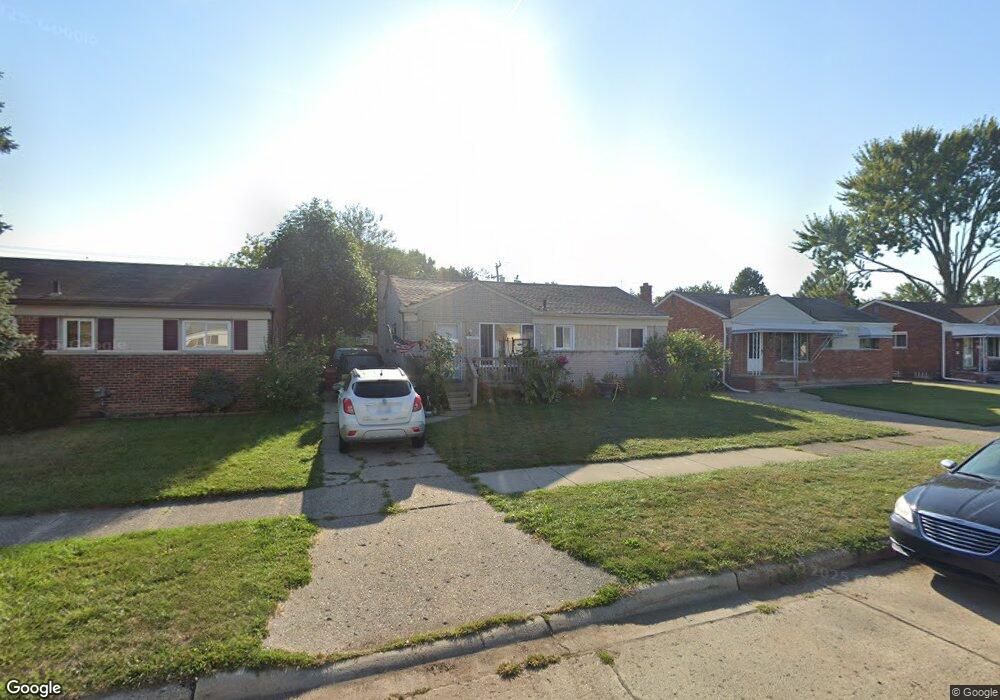
25724 Dale St Roseville, MI 48066
Estimated Value: $147,000 - $211,000
3
Beds
1
Bath
972
Sq Ft
$180/Sq Ft
Est. Value
About This Home
This home is located at 25724 Dale St, Roseville, MI 48066 and is currently estimated at $175,373, approximately $180 per square foot. 25724 Dale St is a home located in Macomb County with nearby schools including Dort Elementary School, Joseph G. Steenland Elementary School, and Fountain Elementary School.
Ownership History
Date
Name
Owned For
Owner Type
Purchase Details
Closed on
Jan 24, 2013
Sold by
25724 Dale Llc
Bought by
Wilson David M
Current Estimated Value
Purchase Details
Closed on
Oct 30, 2009
Sold by
Cornerstone Community Federal Credit Uni
Bought by
Wilson David M
Purchase Details
Closed on
May 12, 2009
Sold by
Hunter Brownstown Llc
Bought by
Sperry Tina
Purchase Details
Closed on
Feb 13, 2009
Sold by
Williams Janice S
Bought by
Cornerstone Community Federal Credit Uni
Purchase Details
Closed on
Jun 14, 2006
Sold by
Williams Janice and Williams Janice S
Bought by
Hunter Brownstown Llc
Purchase Details
Closed on
Aug 31, 1995
Sold by
Shirley A Chapman
Bought by
Futukis Beatrice L and Futukis James G
Create a Home Valuation Report for This Property
The Home Valuation Report is an in-depth analysis detailing your home's value as well as a comparison with similar homes in the area
Home Values in the Area
Average Home Value in this Area
Purchase History
| Date | Buyer | Sale Price | Title Company |
|---|---|---|---|
| Wilson David M | -- | None Available | |
| Wilson David M | $28,000 | Title One Inc | |
| Sperry Tina | -- | None Available | |
| Cornerstone Community Federal Credit Uni | $90,937 | None Available | |
| Hunter Brownstown Llc | $91,167 | Colonial Title Company | |
| Futukis Beatrice L | $53,000 | -- |
Source: Public Records
Tax History Compared to Growth
Tax History
| Year | Tax Paid | Tax Assessment Tax Assessment Total Assessment is a certain percentage of the fair market value that is determined by local assessors to be the total taxable value of land and additions on the property. | Land | Improvement |
|---|---|---|---|---|
| 2025 | $2,290 | $86,300 | $0 | $0 |
| 2024 | $1,199 | $74,100 | $0 | $0 |
| 2023 | $1,148 | $67,400 | $0 | $0 |
| 2022 | $2,053 | $58,000 | $0 | $0 |
| 2021 | $1,992 | $52,700 | $0 | $0 |
| 2020 | $1,100 | $46,300 | $0 | $0 |
| 2019 | $1,791 | $41,300 | $0 | $0 |
| 2018 | $1,755 | $0 | $0 | $0 |
| 2017 | $1,658 | $28,564 | $5,695 | $22,869 |
| 2016 | $1,647 | $28,564 | $0 | $0 |
| 2015 | $996 | $24,382 | $0 | $0 |
| 2013 | -- | $23,777 | $0 | $0 |
| 2011 | -- | $30,775 | $0 | $0 |
Source: Public Records
Map
Nearby Homes
- 25280 Dale St
- 25239 Lehner St
- 25294 Wiseman St
- 25323 Fern St
- 25297 Fortuna St
- 25152 Leach St
- 25135 Dale St
- 25246 Hayes Rd
- 25216 Hayes Rd
- 15676 Frazho Rd
- 25111 Leach St
- 25143 Fern St
- 15738 Frazho Rd
- 26070 Bryan St
- 26211 Clancy St
- 24933 Grove Ave
- 26204 Belanger St
- 25173 Rosenbusch Blvd
- 25184 Tecla Ave
- 25673 Ford St