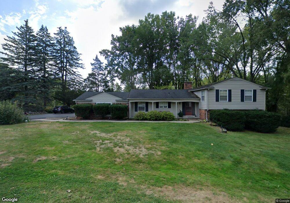
2573 Worcester Rd West Bloomfield, MI 48323
Estimated Value: $512,000 - $592,000
5
Beds
5
Baths
2,379
Sq Ft
$227/Sq Ft
Est. Value
About This Home
This home is located at 2573 Worcester Rd, West Bloomfield, MI 48323 and is currently estimated at $539,253, approximately $226 per square foot. 2573 Worcester Rd is a home located in Oakland County with nearby schools including West Hills Middle School, Bloomfield Hills High School, and Brookfield Academy - West Bloomfield Campus.
Ownership History
Date
Name
Owned For
Owner Type
Purchase Details
Closed on
Jul 16, 2021
Sold by
Fishman Bonnie S and Icetai Robert S
Bought by
Jaffe Hallie and Jaffe Ryan
Current Estimated Value
Home Financials for this Owner
Home Financials are based on the most recent Mortgage that was taken out on this home.
Original Mortgage
$337,565
Outstanding Balance
$306,428
Interest Rate
2.93%
Mortgage Type
FHA
Estimated Equity
$232,825
Purchase Details
Closed on
May 21, 2002
Sold by
Ketai Robert S
Bought by
Robert S Ketai Tr
Create a Home Valuation Report for This Property
The Home Valuation Report is an in-depth analysis detailing your home's value as well as a comparison with similar homes in the area
Home Values in the Area
Average Home Value in this Area
Purchase History
| Date | Buyer | Sale Price | Title Company |
|---|---|---|---|
| Jaffe Hallie | $408,000 | None Available | |
| Jaffe Hallie | $408,000 | None Listed On Document | |
| Robert S Ketai Tr | -- | -- |
Source: Public Records
Mortgage History
| Date | Status | Borrower | Loan Amount |
|---|---|---|---|
| Open | Jaffe Hallie | $337,565 | |
| Closed | Jaffe Hallie | $337,565 |
Source: Public Records
Tax History Compared to Growth
Tax History
| Year | Tax Paid | Tax Assessment Tax Assessment Total Assessment is a certain percentage of the fair market value that is determined by local assessors to be the total taxable value of land and additions on the property. | Land | Improvement |
|---|---|---|---|---|
| 2024 | $3,634 | $209,670 | $0 | $0 |
| 2022 | $3,517 | $177,100 | $62,280 | $114,820 |
| 2021 | $3,266 | $179,260 | $0 | $0 |
| 2020 | $1,620 | $180,710 | $62,280 | $118,430 |
| 2018 | $3,070 | $147,690 | $37,840 | $109,850 |
| 2015 | -- | $92,180 | $0 | $0 |
| 2014 | -- | $84,610 | $0 | $0 |
| 2011 | -- | $78,760 | $0 | $0 |
Source: Public Records
Map
Nearby Homes
- 2460 Turner St
- 2433 Wickfield Rd
- 4641 Cove Rd
- 4274 Wendell Rd
- 4670 Cove Rd
- 4710 Cove Rd
- 0 Wendell Rd Unit 20250033815
- 4724 Tara Ct
- 4768 Wendrick Dr
- 3075 Bloomfield Park Dr
- 3142 Bloomfield Shore Dr
- 0000 Middlebelt Rd
- 1992 Bent Tree Trail
- 4297 Wabeek Lake Dr S Unit 26
- 4033 Fox Lake Dr
- 3367 Lone Pine Rd
- 4174 Prescott Park Cir
- 4170 Prescott Park Cir
- 3440 Lone Pine Rd
- 4941 Fairway Ridge Cir
- 2603 Worcester Rd
- 2545 Worcester Rd
- 2584 Worcester Rd
- 2558 Worcester Rd
- 2623 Worcester Rd
- 2611 Ogden Dr
- 2513 Worcester Rd
- 2530 Worcester Rd
- 2565 Ogden Dr
- 2543 Ogden Dr
- 2521 Ogden Dr
- 2532 Wickfield Ct
- 2485 Worcester Rd
- 2508 Worcester Rd
- 2628 Ogden Dr
- 2503 Ogden Dr
- 2558 Wickfield Rd
- 2526 Wickfield Ct
- 2572 Wickfield Rd
- 2662 Ogden Dr