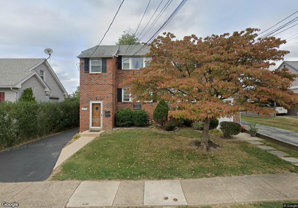
2579 Radcliffe Rd Broomall, PA 19008
Estimated Value: $431,000 - $546,000
4
Beds
2
Baths
1,760
Sq Ft
$272/Sq Ft
Est. Value
About This Home
This home is located at 2579 Radcliffe Rd, Broomall, PA 19008 and is currently estimated at $479,328, approximately $272 per square foot. 2579 Radcliffe Rd is a home located in Delaware County with nearby schools including Russell Elementary School, Paxon Hollow Middle School, and Marple Newtown Senior High School.
Ownership History
Date
Name
Owned For
Owner Type
Purchase Details
Closed on
Jan 14, 2012
Sold by
Fokas Spiro and Fokas Angie
Bought by
Kligos Argyris N and Fokas Kligos Sophia
Current Estimated Value
Purchase Details
Closed on
Jan 30, 1995
Sold by
Blatt Natalie A
Bought by
Fokas Spiro and Fokas Angie
Home Financials for this Owner
Home Financials are based on the most recent Mortgage that was taken out on this home.
Original Mortgage
$84,000
Interest Rate
9.13%
Mortgage Type
Purchase Money Mortgage
Create a Home Valuation Report for This Property
The Home Valuation Report is an in-depth analysis detailing your home's value as well as a comparison with similar homes in the area
Home Values in the Area
Average Home Value in this Area
Purchase History
| Date | Buyer | Sale Price | Title Company |
|---|---|---|---|
| Kligos Argyris N | -- | None Available | |
| Fokas Spiro | $120,000 | T A Title Insurance Company |
Source: Public Records
Mortgage History
| Date | Status | Borrower | Loan Amount |
|---|---|---|---|
| Previous Owner | Fokas Spiro | $84,000 |
Source: Public Records
Tax History Compared to Growth
Tax History
| Year | Tax Paid | Tax Assessment Tax Assessment Total Assessment is a certain percentage of the fair market value that is determined by local assessors to be the total taxable value of land and additions on the property. | Land | Improvement |
|---|---|---|---|---|
| 2025 | $4,730 | $273,710 | $77,820 | $195,890 |
| 2024 | $4,730 | $273,710 | $77,820 | $195,890 |
| 2023 | $4,580 | $273,710 | $77,820 | $195,890 |
| 2022 | $4,493 | $273,710 | $77,820 | $195,890 |
| 2021 | $6,781 | $273,710 | $77,820 | $195,890 |
| 2020 | $3,552 | $123,420 | $36,890 | $86,530 |
| 2019 | $3,509 | $123,420 | $36,890 | $86,530 |
| 2018 | $3,472 | $123,420 | $0 | $0 |
| 2017 | $3,474 | $123,420 | $0 | $0 |
| 2016 | $691 | $123,420 | $0 | $0 |
| 2015 | $691 | $123,420 | $0 | $0 |
| 2014 | $691 | $123,420 | $0 | $0 |
Source: Public Records
Map
Nearby Homes
- 2025 S Sproul Rd
- 2606 Springfield Rd
- 301 S New Ardmore Ave
- 15 Oakland Rd
- Lot 1 Cynwyd
- Lot 2 Cynwyd
- 50 Schoolhouse Ln
- 0 Cedar Grove Rd Unit PADE2105298
- 0 CED Cedar Grove Rd
- 2500 Grant Rd
- 404 Rock Run Cir
- 217 Bramber Dr
- 209 James Rd
- 106 Gibson Ct
- 104 Gibson Ct
- 370 Marple Rd
- 1 Brighton Village Dr
- 106 Eagle Dr
- 7 Brighton Village Dr
- 107 Eagle Dr
- 2577 Radcliffe Rd
- 2581 Radcliffe Rd
- 2575 Radcliffe Rd
- 2583 Radcliffe Rd
- 142 2nd Ave
- 133 1st Ave
- 200 Rolling Rd
- 2573 Radcliffe Rd
- 2585 Radcliffe Rd
- 138 2nd Ave
- 201 1st Ave
- 201 Rolling Rd
- 131 1st Ave
- 131 1st Ave Unit LOWER LEVEL
- 203 1st Ave
- 132 2nd Ave
- 204 Rolling Rd
- 203 Rolling Rd
- 129 1st Ave
- 2587 Radcliffe Rd