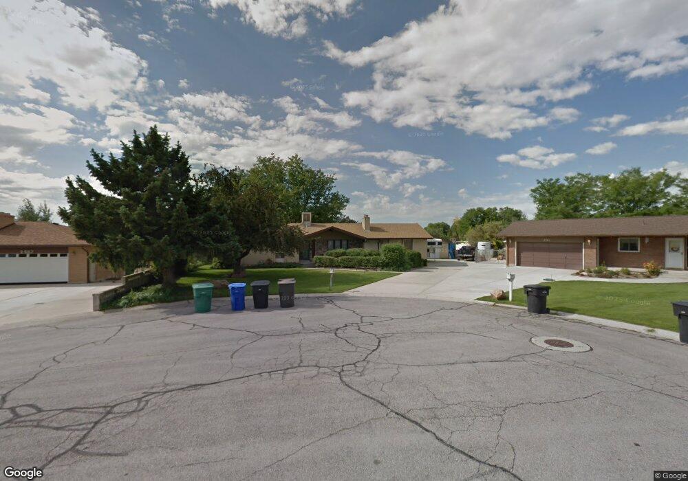
2579 W Cassidy Cir West Jordan, UT 84084
Estimated Value: $646,000 - $692,000
5
Beds
3
Baths
3,734
Sq Ft
$180/Sq Ft
Est. Value
About This Home
This home is located at 2579 W Cassidy Cir, West Jordan, UT 84084 and is currently estimated at $672,415, approximately $180 per square foot. 2579 W Cassidy Cir is a home located in Salt Lake County with nearby schools including West Jordan School, Majestic Elementary Arts Academy, and West Jordan Middle School.
Ownership History
Date
Name
Owned For
Owner Type
Purchase Details
Closed on
Oct 11, 2005
Sold by
Graves Phillip M and Graves Kathryn D
Bought by
Graves Phillip M and Graves Kathryn D
Current Estimated Value
Home Financials for this Owner
Home Financials are based on the most recent Mortgage that was taken out on this home.
Original Mortgage
$204,200
Outstanding Balance
$108,400
Interest Rate
5.63%
Mortgage Type
New Conventional
Estimated Equity
$564,015
Purchase Details
Closed on
Dec 1, 2003
Sold by
Graves Phillip M
Bought by
Graves Phillip M and Montoya Kathryn
Home Financials for this Owner
Home Financials are based on the most recent Mortgage that was taken out on this home.
Original Mortgage
$26,400
Interest Rate
6%
Mortgage Type
Credit Line Revolving
Purchase Details
Closed on
Jan 2, 2003
Sold by
Graves Phillip M
Bought by
Graves Phillip M and Montoya Kathryn
Home Financials for this Owner
Home Financials are based on the most recent Mortgage that was taken out on this home.
Original Mortgage
$184,000
Interest Rate
5.96%
Purchase Details
Closed on
Nov 13, 2000
Sold by
Graves Phillip M and Montoya Kathryn
Bought by
Graves Phillip M and Montoya Kathryn
Home Financials for this Owner
Home Financials are based on the most recent Mortgage that was taken out on this home.
Original Mortgage
$30,000
Interest Rate
7.82%
Mortgage Type
Credit Line Revolving
Purchase Details
Closed on
Sep 28, 1998
Sold by
Graves Phillip M and Montoya Kathryn D
Bought by
Graves Phillip M and Montoya Kathryn
Home Financials for this Owner
Home Financials are based on the most recent Mortgage that was taken out on this home.
Original Mortgage
$159,000
Interest Rate
6.88%
Purchase Details
Closed on
Sep 24, 1997
Sold by
Helgesen Harold I and Helgesen Darlene K
Bought by
Graves Phillip M and Montoya Kathryn D
Home Financials for this Owner
Home Financials are based on the most recent Mortgage that was taken out on this home.
Original Mortgage
$159,375
Interest Rate
7.54%
Purchase Details
Closed on
May 6, 1997
Sold by
Woods Reed D and Woods Iia Mae S
Bought by
Helgesen Harold I and Helgesen Darlene K
Home Financials for this Owner
Home Financials are based on the most recent Mortgage that was taken out on this home.
Original Mortgage
$142,089
Interest Rate
7.98%
Create a Home Valuation Report for This Property
The Home Valuation Report is an in-depth analysis detailing your home's value as well as a comparison with similar homes in the area
Home Values in the Area
Average Home Value in this Area
Purchase History
| Date | Buyer | Sale Price | Title Company |
|---|---|---|---|
| Graves Phillip M | -- | Backman Title Services | |
| Graves Phillip M | -- | -- | |
| Graves Phillip M | -- | Backman Stewart Title Svcs | |
| Graves Phillip M | -- | Superior Title | |
| Graves Phillip M | -- | Superior Title | |
| Graves Phillip M | -- | -- | |
| Graves Phillip M | -- | -- | |
| Graves Phillip M | -- | -- | |
| Helgesen Harold I | -- | Paramount Title Corp |
Source: Public Records
Mortgage History
| Date | Status | Borrower | Loan Amount |
|---|---|---|---|
| Open | Graves Phillip M | $204,200 | |
| Closed | Graves Phillip M | $26,400 | |
| Previous Owner | Graves Phillip M | $184,000 | |
| Previous Owner | Graves Phillip M | $30,000 | |
| Previous Owner | Graves Phillip M | $159,000 | |
| Previous Owner | Graves Phillip M | $159,375 | |
| Previous Owner | Helgesen Harold I | $142,089 |
Source: Public Records
Tax History Compared to Growth
Tax History
| Year | Tax Paid | Tax Assessment Tax Assessment Total Assessment is a certain percentage of the fair market value that is determined by local assessors to be the total taxable value of land and additions on the property. | Land | Improvement |
|---|---|---|---|---|
| 2025 | $3,245 | $648,400 | $174,200 | $474,200 |
| 2024 | $3,245 | $624,300 | $168,400 | $455,900 |
| 2023 | $3,245 | $554,400 | $161,900 | $392,500 |
| 2022 | $3,164 | $564,400 | $158,700 | $405,700 |
| 2021 | $2,680 | $435,300 | $125,600 | $309,700 |
| 2020 | $2,508 | $382,300 | $117,300 | $265,000 |
| 2019 | $2,535 | $378,800 | $117,300 | $261,500 |
| 2018 | $2,284 | $338,600 | $110,800 | $227,800 |
| 2017 | $2,137 | $315,400 | $110,800 | $204,600 |
| 2016 | $2,105 | $291,800 | $110,800 | $181,000 |
| 2015 | $2,027 | $274,000 | $113,000 | $161,000 |
| 2014 | $1,933 | $257,300 | $107,700 | $149,600 |
Source: Public Records
Map
Nearby Homes
- 2683 W Carson Ln
- 6918 S Harvest Cir
- 2421 W 6900 S
- 2333 W Ledgewood Dr
- 2332 Broderick Dr
- 6512 Timpanogos Way
- 6924 S 2160 W
- 8524 S Michele River Ave W Unit 109
- 2312 W Hidden Bend Cove Unit 107
- 6453 Fremont Peak Cir
- 6925 S Lexington Dr
- 2126 W Happiness Dr
- 3052 W Matterhorn Dr
- 6683 Alice Susanna Ln
- 6893 S 3200 W
- 2342 W 6200 S
- 3226 Tysonbrook Ct
- 2045 W 6200 S
- 1951 W 7125 S
- 6672 S 3335 W
- 2579 Cassidy Cir
- 2581 W Cassidy Cir
- 2557 W Cassidy Cir
- 2557 Cassidy Cir
- 2581 Cassidy Cir
- 6714 Cassidy Ln
- 2578 W Cassidy Cir
- 6714 S Cassidy Ln
- 2580 Carson Ln
- 2582 Cassidy Cir
- 2560 Carson Ln
- 2558 Cassidy Cir
- 2610 W Carson Ln
- 2610 Carson Ln
- 6750 Cassidy Ln
- 6701 S Cody Ln
- 6719 Cody Ln
- 6701 Cody Ln
- 6676 Cassidy Ln
- 6737 Cody Ln