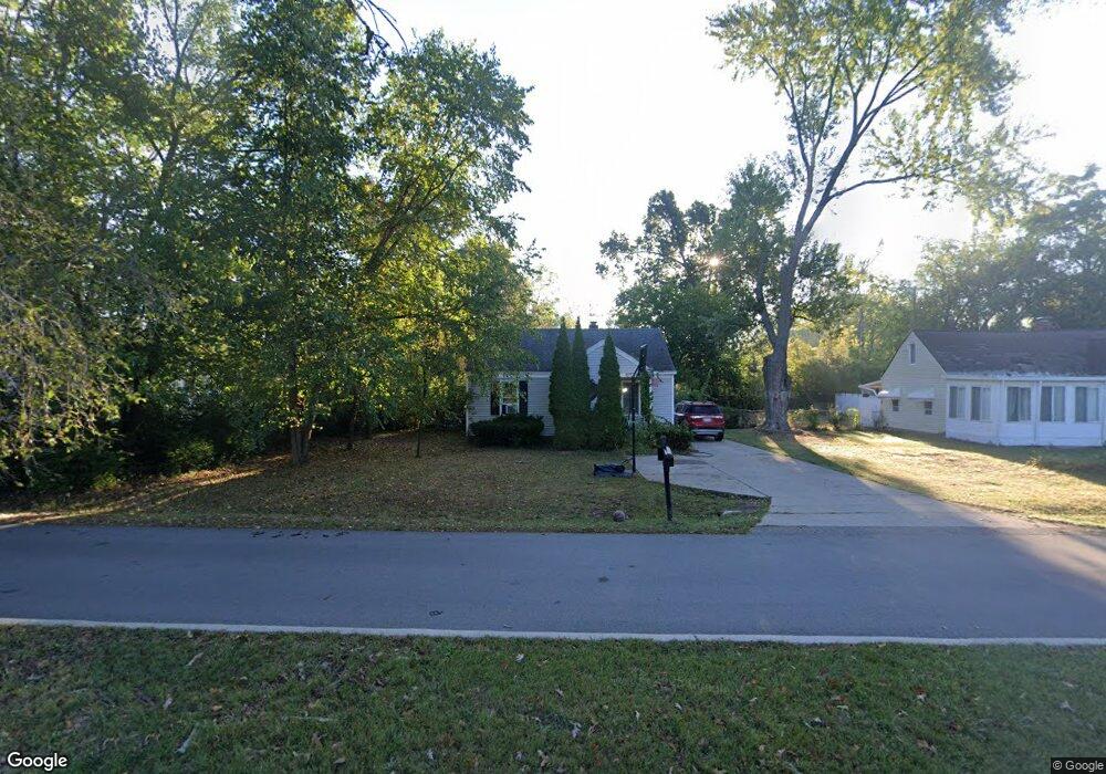
25820 Code Rd Southfield, MI 48033
Estimated Value: $133,595 - $259,000
2
Beds
2
Baths
1,029
Sq Ft
$173/Sq Ft
Est. Value
About This Home
This home is located at 25820 Code Rd, Southfield, MI 48033 and is currently estimated at $177,899, approximately $172 per square foot. 25820 Code Rd is a home located in Oakland County with nearby schools including Morris Adler Elementary School, Glenn W. Levey Middle School, and Faxon Academy.
Ownership History
Date
Name
Owned For
Owner Type
Purchase Details
Closed on
Jul 16, 2021
Sold by
Faranso Fatih
Bought by
Ffif Investment Llc
Current Estimated Value
Purchase Details
Closed on
Jun 25, 2021
Sold by
Stewart Phyllis and Estate Of Robert Zink
Bought by
Faranso Fatih
Purchase Details
Closed on
Nov 27, 2012
Sold by
Zink Robert and Zink Elna
Bought by
Zink Robert and Zink Elna
Purchase Details
Closed on
Aug 25, 1995
Sold by
Robbins Michael A
Bought by
Markowitz Melvin A
Home Financials for this Owner
Home Financials are based on the most recent Mortgage that was taken out on this home.
Original Mortgage
$68,400
Interest Rate
8%
Mortgage Type
Purchase Money Mortgage
Create a Home Valuation Report for This Property
The Home Valuation Report is an in-depth analysis detailing your home's value as well as a comparison with similar homes in the area
Home Values in the Area
Average Home Value in this Area
Purchase History
| Date | Buyer | Sale Price | Title Company |
|---|---|---|---|
| Ffif Investment Llc | -- | None Available | |
| Faranso Fatih | $75,000 | None Available | |
| Faranso Fatih | $75,000 | Casselman Liz | |
| Zink Robert | -- | None Available | |
| Markowitz Melvin A | $72,000 | -- |
Source: Public Records
Mortgage History
| Date | Status | Borrower | Loan Amount |
|---|---|---|---|
| Previous Owner | Markowitz Melvin A | $68,400 |
Source: Public Records
Tax History
| Year | Tax Paid | Tax Assessment Tax Assessment Total Assessment is a certain percentage of the fair market value that is determined by local assessors to be the total taxable value of land and additions on the property. | Land | Improvement |
|---|---|---|---|---|
| 2025 | $6,107 | $66,340 | $15,620 | $50,720 |
| 2022 | $5,218 | $58,760 | $8,980 | $49,780 |
| 2021 | $1,632 | $54,140 | $8,980 | $45,160 |
| 2020 | $1,433 | $48,320 | $7,810 | $40,510 |
| 2018 | $1,690 | $33,050 | $7,000 | $26,050 |
| 2015 | -- | $23,710 | $0 | $0 |
| 2014 | -- | $22,930 | $0 | $0 |
| 2011 | -- | $23,210 | $0 | $0 |
Source: Public Records
Map
Nearby Homes
- 25835 Lahser Rd Unit 5
- 25555 Lahser Rd Unit 15
- 25150 Briarbank Ave
- 25160 Lahser Rd
- 22664 W 11 Mile Rd Unit 10
- 24818 Lois Ln
- 22465 Kenwyck Dr
- 23409 Ranch Hill Dr W
- 21821 Concord St
- 22903 N Bellwood Dr
- 23223 Bellwood Dr
- 20940 Andover Rd
- 22430 Chatsford Circuit St
- 23500 Coventry Woods Ln
- 23460 Coventry Woods Ln
- 5000 Town Center Unit 2305
- 5000 Town Center Unit 801
- 5000 Town Center Unit 2205
- 5000 Town Center Unit 1704
- 5000 Town Center Unit 306
- 25800 Code Rd
- 22491 Civic Center Dr
- 22455 Civic Center Dr
- 25790 Code Rd
- 25821 Briarbank Ave
- 22351 Civic Center Dr
- 22445 Civic Center Dr
- 25785 Code Rd
- 25789 Code Rd
- 25760 Code Rd
- 25755 Code Rd
- 22700 Civic Center Dr
- 22700 Civic Center Dr
- 25822 Briarbank Ave
- 22263 Civic Center Dr
- 25720 Code Rd
- 25801 Briarbank Ave
- 25735 Code Rd
- 25821 Dunbar St
- 25802 Briarbank Ave
Your Personal Tour Guide
Ask me questions while you tour the home.