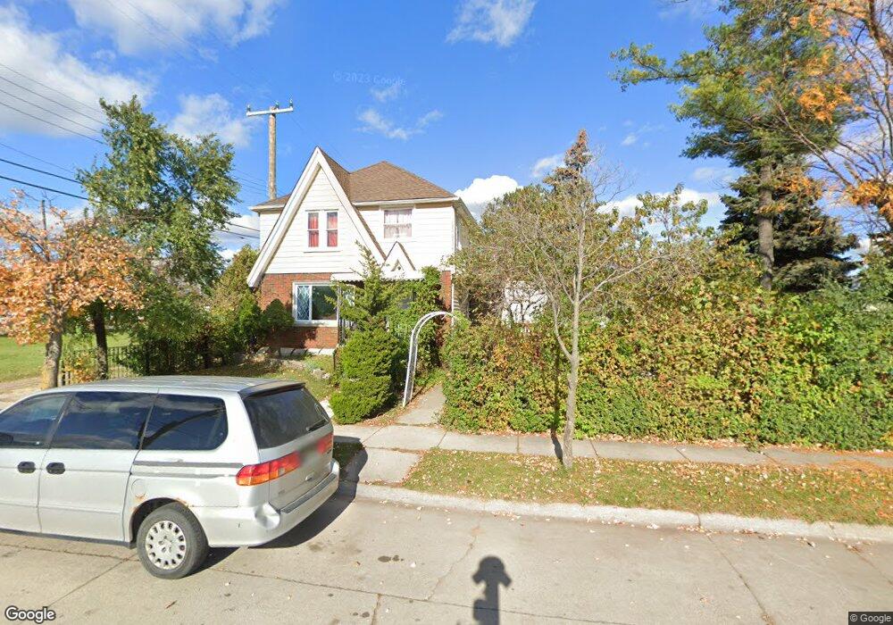
2584 Emily St Melvindale, MI 48122
Estimated Value: $189,000 - $223,000
4
Beds
2
Baths
1,728
Sq Ft
$119/Sq Ft
Est. Value
About This Home
This home is located at 2584 Emily St, Melvindale, MI 48122 and is currently estimated at $206,173, approximately $119 per square foot. 2584 Emily St is a home located in Wayne County with nearby schools including Rogers Early Elementary School, Allendale Elementary School, and Julian O. Strong Middle School.
Ownership History
Date
Name
Owned For
Owner Type
Purchase Details
Closed on
Apr 16, 2022
Sold by
Asadi Musleh Naji and Asadi Fawzieh T
Bought by
Sadi Fawzieh T Al and Asadi Naji Musleh
Current Estimated Value
Purchase Details
Closed on
Dec 9, 2015
Sold by
Asadi Hizam
Bought by
Asadi Musleh Naji
Purchase Details
Closed on
Sep 2, 2010
Sold by
Ferrin Lewis W and Ferrin Pamela S
Bought by
Federal Home Loan Mortgage Corp
Create a Home Valuation Report for This Property
The Home Valuation Report is an in-depth analysis detailing your home's value as well as a comparison with similar homes in the area
Home Values in the Area
Average Home Value in this Area
Purchase History
| Date | Buyer | Sale Price | Title Company |
|---|---|---|---|
| Sadi Fawzieh T Al | -- | None Listed On Document | |
| Asadi Musleh Naji | -- | Attorney | |
| Federal Home Loan Mortgage Corp | $148,047 | None Available |
Source: Public Records
Tax History Compared to Growth
Tax History
| Year | Tax Paid | Tax Assessment Tax Assessment Total Assessment is a certain percentage of the fair market value that is determined by local assessors to be the total taxable value of land and additions on the property. | Land | Improvement |
|---|---|---|---|---|
| 2025 | $2,290 | $113,000 | $0 | $0 |
| 2024 | $2,290 | $95,100 | $0 | $0 |
| 2023 | $1,991 | $91,600 | $0 | $0 |
| 2022 | $3,870 | $83,100 | $0 | $0 |
| 2021 | $3,750 | $72,700 | $0 | $0 |
| 2020 | $3,737 | $58,000 | $0 | $0 |
| 2019 | $3,464 | $55,600 | $0 | $0 |
| 2018 | $2,071 | $53,300 | $0 | $0 |
| 2017 | $2,571 | $54,100 | $0 | $0 |
| 2016 | $3,284 | $52,100 | $0 | $0 |
| 2015 | $4,765 | $47,800 | $0 | $0 |
| 2013 | $4,680 | $49,200 | $0 | $0 |
| 2012 | $3,208 | $48,000 | $4,700 | $43,300 |
Source: Public Records
Map
Nearby Homes
- 19120 Dix Rd
- 2573 Grace St
- 2790 Blanche St
- 2523 David St
- 819 Frank Ave
- 2800 David St
- 19211 Wall St
- 1862 Montie Rd
- 000 Harlow St
- 3603 Harlow Ave
- 2527 Corbin St
- 2064 Morris Ave
- 1840 Morris Ave
- 1826 Morris Ave
- 2190 Morris Ave
- 4020 Wall Ave
- 1807 Morris Ave
- 24558 Outer Dr
- 14545 College Ave
- 2105 Paris Ave
- 2572 Emily St
- 2573 Emogene St
- 2565 Emogene St
- 2550 Emily St
- 19300 Dix Rd
- 2557 Emogene St
- 2544 Emily St
- 2551 Emogene St
- 2543 Emily St
- 2545 Emogene St
- 2528 Emily St
- 2531 Emogene St
- 2580 Emogene St
- 2584 Emogene St
- 2574 Emogene St
- 2564 Emogene St
- 2522 Emily St
- 25051 Outer Dr
- 25051 Outer Dr
- 2531 Emily St