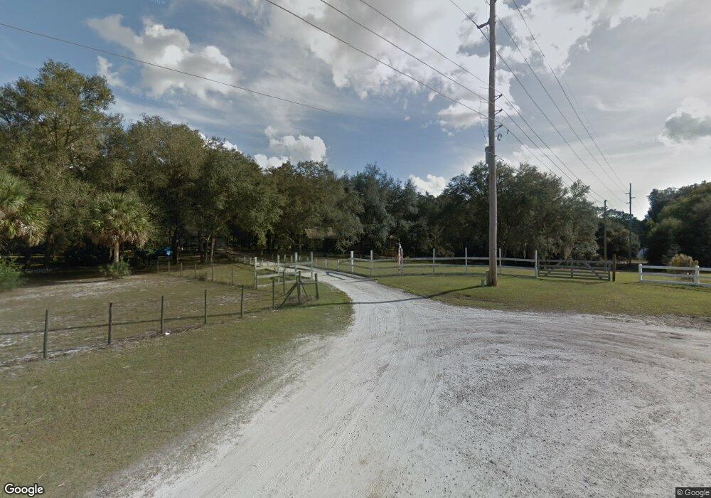
2585 Barren Oak Ct Deland, FL 32720
Estimated Value: $565,000 - $837,000
4
Beds
3
Baths
3,713
Sq Ft
$193/Sq Ft
Est. Value
About This Home
This home is located at 2585 Barren Oak Ct, Deland, FL 32720 and is currently estimated at $716,535, approximately $192 per square foot. 2585 Barren Oak Ct is a home located in Volusia County with nearby schools including Woodward Avenue Elementary School, Deland High School, and Deland Middle School.
Ownership History
Date
Name
Owned For
Owner Type
Purchase Details
Closed on
Aug 19, 2002
Sold by
Stevenson Walter R and Stevenson Christine
Bought by
Stevenson George and Stevenson Kim
Current Estimated Value
Purchase Details
Closed on
Mar 11, 1997
Sold by
Bowers Robert W and Bowers Wanda
Bought by
Stevenson Walter R and Stevenson Christine
Home Financials for this Owner
Home Financials are based on the most recent Mortgage that was taken out on this home.
Original Mortgage
$13,000
Interest Rate
7.88%
Purchase Details
Closed on
Oct 15, 1981
Bought by
Stevenson George and Stevenson Kim
Create a Home Valuation Report for This Property
The Home Valuation Report is an in-depth analysis detailing your home's value as well as a comparison with similar homes in the area
Home Values in the Area
Average Home Value in this Area
Purchase History
| Date | Buyer | Sale Price | Title Company |
|---|---|---|---|
| Stevenson George | -- | -- | |
| Stevenson Walter R | $28,000 | -- | |
| Stevenson George | $14,000 | -- |
Source: Public Records
Mortgage History
| Date | Status | Borrower | Loan Amount |
|---|---|---|---|
| Previous Owner | Stevenson Walter R | $13,000 |
Source: Public Records
Tax History Compared to Growth
Tax History
| Year | Tax Paid | Tax Assessment Tax Assessment Total Assessment is a certain percentage of the fair market value that is determined by local assessors to be the total taxable value of land and additions on the property. | Land | Improvement |
|---|---|---|---|---|
| 2025 | $4,810 | $309,993 | -- | -- |
| 2024 | $4,810 | $301,257 | -- | -- |
| 2023 | $4,810 | $292,483 | $0 | $0 |
| 2022 | $4,736 | $283,964 | $0 | $0 |
| 2021 | $4,927 | $275,693 | $0 | $0 |
| 2020 | $4,862 | $271,887 | $0 | $0 |
| 2019 | $5,037 | $265,774 | $0 | $0 |
| 2018 | $5,044 | $260,818 | $0 | $0 |
| 2017 | $5,081 | $255,453 | $0 | $0 |
| 2016 | $4,864 | $250,199 | $0 | $0 |
| 2015 | $4,965 | $248,460 | $0 | $0 |
| 2014 | $4,916 | $246,488 | $0 | $0 |
Source: Public Records
Map
Nearby Homes
- 2096 Chinaberry Ln
- 1268 Mcgregor Rd
- 129 Crystal Oak Dr
- 208 Crystal Ridge Rd
- 220 Blue Crystal Dr
- 0 No Street 5 637 Sf Unit MFRV4940765
- 1251 Pressly Cir
- 216 Blue Crystal Dr
- 2485 Blue Ridge Ave
- 0 Blue Ridge Ave
- 0 18th St Unit MFRV4933632
- 1344 18th St
- 0 No Street 12 Acres 5 404 Square
- 1160 19th St
- 1491 18th St
- 1554 19th St
- 1395 Deland Ave
- 1145 15th St
- 0 Lot 27 & 28 Unit MFRGC533475
- 849 Orange Oak Dr
- 2575 Barren Oak Ct
- 2570 Barren Oak Ct
- 715 Mcgregor Rd
- 2555 Barren Oak Ct
- 870 Stardust Way
- 2540 Barren Oak Ct
- 2210 W Dale Cir
- 890 Stardust Way
- 895 Mcgregor Rd
- 2160 W Dale Cir
- 721 Mcgregor Rd
- 2535 Barren Oak Ct
- 2220 W Dale Cir
- 2530 Barren Oak Ct
- 2150 W Dale Cir
- 895 Stardust Way
- 901 Mcgregor Rd
- 2195 W Dale Cir
- 970 Stardust Way
- 2155 W Dale Cir
