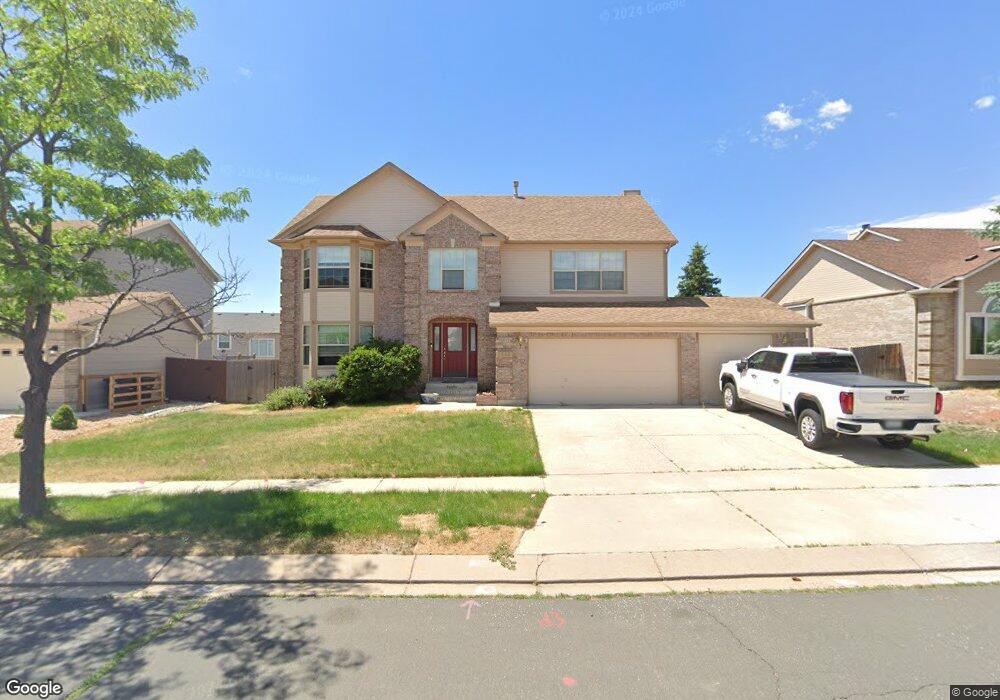
2585 Heathrow Dr Colorado Springs, CO 80920
Briargate NeighborhoodEstimated Value: $623,670 - $667,000
5
Beds
4
Baths
2,426
Sq Ft
$267/Sq Ft
Est. Value
About This Home
This home is located at 2585 Heathrow Dr, Colorado Springs, CO 80920 and is currently estimated at $648,418, approximately $267 per square foot. 2585 Heathrow Dr is a home located in El Paso County with nearby schools including Academy International Elementary School, Mountain Ridge Middle School, and Rampart High School.
Ownership History
Date
Name
Owned For
Owner Type
Purchase Details
Closed on
Jan 8, 2022
Sold by
Edmonds Rosa A
Bought by
Edmonds Alfredo J
Current Estimated Value
Purchase Details
Closed on
Sep 21, 2004
Sold by
Wells Fargo Bank Minnesota Na
Bought by
Edmonds Alfredo J and Edmonds Rosa A
Home Financials for this Owner
Home Financials are based on the most recent Mortgage that was taken out on this home.
Original Mortgage
$212,000
Interest Rate
4.37%
Mortgage Type
Unknown
Purchase Details
Closed on
Apr 26, 2004
Sold by
Larkin Patrick M
Bought by
Wells Fargo Bank Minnesota Na and Stanley Dean Witter Capital I Inc
Purchase Details
Closed on
Mar 27, 2000
Sold by
Michael Larkin P and Michael Linda K
Bought by
Larkin Patrick M
Home Financials for this Owner
Home Financials are based on the most recent Mortgage that was taken out on this home.
Original Mortgage
$238,500
Interest Rate
9.49%
Purchase Details
Closed on
Jan 14, 1999
Sold by
Michael Larkin P
Bought by
Larkin P Michael and Larkin Linda K
Purchase Details
Closed on
Nov 9, 1998
Sold by
Michael Larkin P and Michael Linda K
Bought by
Larkin P Michael
Home Financials for this Owner
Home Financials are based on the most recent Mortgage that was taken out on this home.
Original Mortgage
$208,250
Interest Rate
10%
Purchase Details
Closed on
May 19, 1994
Sold by
Elite Properties Of America Inc
Bought by
Larkin P Michael and Larkin Linda K
Home Financials for this Owner
Home Financials are based on the most recent Mortgage that was taken out on this home.
Original Mortgage
$194,600
Interest Rate
8.4%
Purchase Details
Closed on
Feb 17, 1994
Sold by
Briargate Joint Venture
Bought by
Elite Properties Of America Inc
Home Financials for this Owner
Home Financials are based on the most recent Mortgage that was taken out on this home.
Original Mortgage
$143,294
Interest Rate
6.94%
Purchase Details
Closed on
Oct 16, 1992
Bought by
Edmonds Alfredo J
Create a Home Valuation Report for This Property
The Home Valuation Report is an in-depth analysis detailing your home's value as well as a comparison with similar homes in the area
Home Values in the Area
Average Home Value in this Area
Purchase History
| Date | Buyer | Sale Price | Title Company |
|---|---|---|---|
| Edmonds Alfredo J | -- | None Listed On Document | |
| Edmonds Alfredo J | $265,000 | -- | |
| Wells Fargo Bank Minnesota Na | $291,233 | -- | |
| Larkin Patrick M | -- | -- | |
| Larkin P Michael | -- | -- | |
| Larkin P Michael | -- | First American | |
| Larkin P Michael | $205,580 | Land Title | |
| Elite Properties Of America Inc | -- | Land Title | |
| Edmonds Alfredo J | -- | -- |
Source: Public Records
Mortgage History
| Date | Status | Borrower | Loan Amount |
|---|---|---|---|
| Previous Owner | Edmonds Alfredo J | $212,000 | |
| Previous Owner | Larkin Patrick M | $238,500 | |
| Previous Owner | Larkin P Michael | $208,250 | |
| Previous Owner | Larkin P Michael | $194,600 | |
| Previous Owner | Elite Properties Of America Inc | $143,294 | |
| Closed | Edmonds Alfredo J | $39,750 |
Source: Public Records
Tax History Compared to Growth
Tax History
| Year | Tax Paid | Tax Assessment Tax Assessment Total Assessment is a certain percentage of the fair market value that is determined by local assessors to be the total taxable value of land and additions on the property. | Land | Improvement |
|---|---|---|---|---|
| 2025 | $2,765 | $45,280 | -- | -- |
| 2024 | $2,747 | $46,680 | $6,700 | $39,980 |
| 2022 | $2,241 | $31,760 | $5,420 | $26,340 |
| 2021 | $2,479 | $32,680 | $5,580 | $27,100 |
| 2020 | $2,350 | $28,870 | $4,650 | $24,220 |
| 2019 | $2,326 | $28,870 | $4,650 | $24,220 |
| 2018 | $2,072 | $25,300 | $3,600 | $21,700 |
| 2017 | $2,065 | $25,300 | $3,600 | $21,700 |
| 2016 | $2,056 | $25,160 | $3,660 | $21,500 |
| 2015 | $2,052 | $25,160 | $3,660 | $21,500 |
| 2014 | $1,938 | $23,740 | $3,660 | $20,080 |
Source: Public Records
Map
Nearby Homes
- 2560 Wimbleton Ct
- 2715 Heathrow Dr
- 2430 Linenhall Ct
- 2130 Wimbleton Ct
- 8735 Chapel Square Ct
- 8935 Coberdale Ct
- 2730 Kenton Green Ct
- 9659 Carriage Creek Point
- 2644 Marston Heights
- 2656 Marston Heights
- 2340 Winstead View
- 2479 Pine Valley View
- 9506 Hollydale Ct
- 2360 Pine Valley View
- 2270 Cloverdale Dr
- 8335 Sutterfield Dr
- 9331 Stoneglen Dr
- 2512 Willow Glen Dr
- 1931 London Carriage Grove
- 3279 Greenmoor Ct
- 2575 Heathrow Dr
- 2595 Heathrow Dr
- 2550 Wimbleton Ct
- 2570 Wimbleton Ct
- 2538 Wimbleton Ct
- 9015 Clapham Ct
- 2565 Heathrow Dr
- 9010 Clapham Ct
- 9025 Clapham Ct
- 2605 Heathrow Dr
- 2555 Heathrow Dr
- 2520 Wimbleton Ct
- 9020 Clapham Ct
- 2540 Heathrow Dr
- 9010 Rutledge Dr
- 2545 Wimbleton Ct
- 2565 Wimbleton Ct
- 2510 Wimbleton Ct
- 2535 Wimbleton Ct
- 2575 Wimbleton Ct