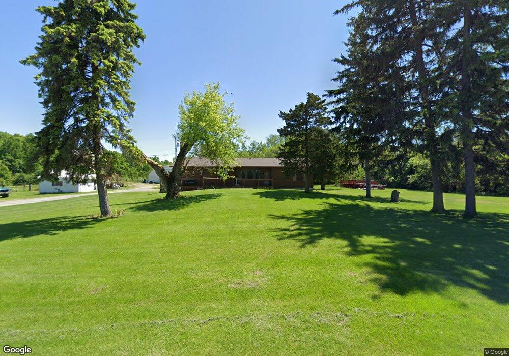
2585 Hubbard Rd Monroe, MI 48161
Estimated Value: $254,000 - $325,209
--
Bed
--
Bath
1,539
Sq Ft
$194/Sq Ft
Est. Value
About This Home
This home is located at 2585 Hubbard Rd, Monroe, MI 48161 and is currently estimated at $298,802, approximately $194 per square foot. 2585 Hubbard Rd is a home located in Monroe County with nearby schools including Monroe High School and Pathway Christian School - PERMANENTLY CLOSED.
Ownership History
Date
Name
Owned For
Owner Type
Purchase Details
Closed on
Jun 22, 2000
Sold by
Coolman Jerry
Bought by
Baker Johnny and Simpson Sara
Current Estimated Value
Home Financials for this Owner
Home Financials are based on the most recent Mortgage that was taken out on this home.
Original Mortgage
$150,500
Outstanding Balance
$54,341
Interest Rate
8.56%
Mortgage Type
New Conventional
Estimated Equity
$244,461
Purchase Details
Closed on
Nov 22, 1999
Sold by
Willingham Brian
Bought by
Kowalski James and Kowalski Tina
Home Financials for this Owner
Home Financials are based on the most recent Mortgage that was taken out on this home.
Original Mortgage
$182,400
Interest Rate
8.13%
Mortgage Type
New Conventional
Create a Home Valuation Report for This Property
The Home Valuation Report is an in-depth analysis detailing your home's value as well as a comparison with similar homes in the area
Home Values in the Area
Average Home Value in this Area
Purchase History
| Date | Buyer | Sale Price | Title Company |
|---|---|---|---|
| Baker Johnny | $158,500 | -- | |
| Kowalski James | $50,000 | -- |
Source: Public Records
Mortgage History
| Date | Status | Borrower | Loan Amount |
|---|---|---|---|
| Open | Baker Johnny | $150,500 | |
| Previous Owner | Kowalski James | $182,400 |
Source: Public Records
Tax History Compared to Growth
Tax History
| Year | Tax Paid | Tax Assessment Tax Assessment Total Assessment is a certain percentage of the fair market value that is determined by local assessors to be the total taxable value of land and additions on the property. | Land | Improvement |
|---|---|---|---|---|
| 2025 | $2,339 | $143,200 | $41,300 | $101,900 |
| 2024 | $1,022 | $137,400 | $0 | $0 |
| 2023 | $974 | $107,700 | $0 | $0 |
| 2022 | $2,118 | $107,700 | $0 | $0 |
| 2021 | $2,017 | $113,100 | $0 | $0 |
| 2020 | $1,988 | $101,600 | $0 | $0 |
| 2019 | $1,846 | $101,600 | $0 | $0 |
| 2018 | $1,775 | $95,300 | $0 | $0 |
| 2017 | $1,740 | $91,900 | $0 | $0 |
| 2016 | $1,720 | $91,900 | $0 | $0 |
| 2015 | $1,651 | $81,500 | $0 | $0 |
| 2014 | $1,630 | $81,500 | $0 | $0 |
| 2013 | -- | $72,500 | $0 | $0 |
Source: Public Records
Map
Nearby Homes
- 3298 W Albain Rd
- 13653 Dunlap Rd
- 00-80 Strasburg Rd
- 00-70 Strasburg Rd
- 00-60 Strasburg Rd
- 00-50 Strasburg Rd
- 00-40 Strasburg Rd
- 983 Tanners Landing
- 945 Tanners Landing
- 0000 Sullivan
- S Telegraph Rd Dunbar Rd
- 0 S Telegraph Rd
- 1052 S Otter Creek Rd
- 13171 S Dixie Hwy
- 4530 W Albain Rd
- 3012 1st St
- 0 W Albain Rd Unit 25035461
- 4899 Skylark Dr
- 4911 Skylark Dr
- 1042 Knightswood Ct
- 2533 Hubbard Rd
- 2603 Hubbard Rd
- 2505 Hubbard Rd
- 2477 Hubbard Rd
- 14665 Goutz Rd
- 14625 Goutz Rd
- 2665 Hubbard Rd
- 2431 Hubbard Rd
- 0 Goutz Rd Unit 4168932
- 0 Goutz Rd Unit 4169306
- 0 Goutz Rd Unit 4169368
- 0 Goutz Rd Unit 4373422
- 0 Goutz Rd Unit 4512781
- 0 Goutz Rd Unit 50082331
- 0 Goutz Rd Unit 901573
- 0 Goutz Rd Unit 907140
- 0 Goutz Rd Unit 943431
- 0 Goutz Rd Unit 20013638
- 0 Goutz Rd Unit 20354746
- 2383 Hubbard Rd