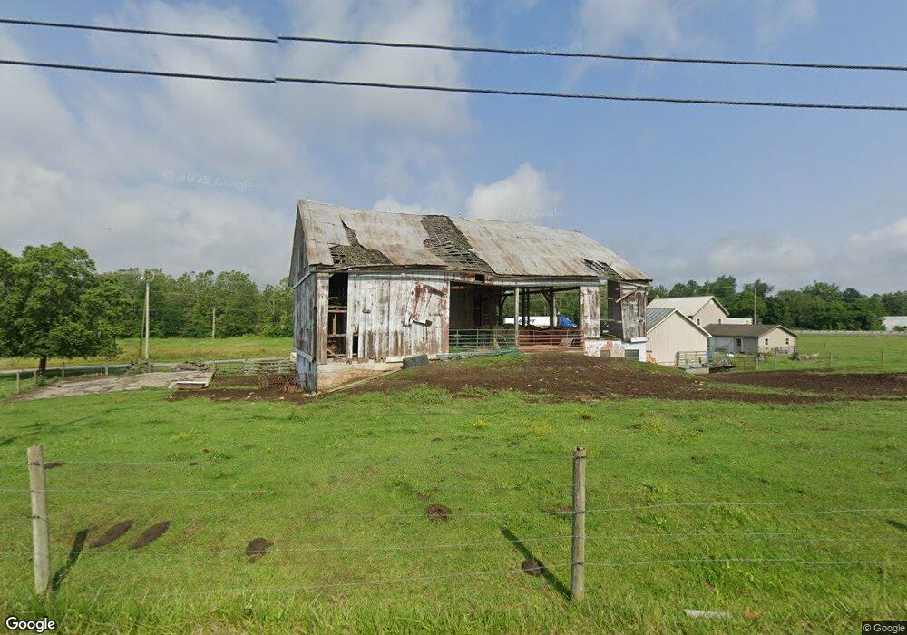
2585 Woodstock Rd Chambersburg, PA 17202
Estimated Value: $315,000 - $435,180
--
Bed
--
Bath
1,732
Sq Ft
$217/Sq Ft
Est. Value
About This Home
This home is located at 2585 Woodstock Rd, Chambersburg, PA 17202 and is currently estimated at $375,545, approximately $216 per square foot. 2585 Woodstock Rd is a home located in Franklin County with nearby schools including Chambersburg Area Middle School - North, Chambersburg Area Senior High School, and Montessori Academy of Chambersburg.
Ownership History
Date
Name
Owned For
Owner Type
Purchase Details
Closed on
May 1, 2007
Sold by
Martin Eugene R and Martin Lorene M
Bought by
Byers Fred J
Current Estimated Value
Home Financials for this Owner
Home Financials are based on the most recent Mortgage that was taken out on this home.
Original Mortgage
$192,000
Interest Rate
6.23%
Mortgage Type
Purchase Money Mortgage
Create a Home Valuation Report for This Property
The Home Valuation Report is an in-depth analysis detailing your home's value as well as a comparison with similar homes in the area
Home Values in the Area
Average Home Value in this Area
Purchase History
| Date | Buyer | Sale Price | Title Company |
|---|---|---|---|
| Byers Fred J | $240,000 | None Available |
Source: Public Records
Mortgage History
| Date | Status | Borrower | Loan Amount |
|---|---|---|---|
| Closed | Byers Fred J | $192,000 |
Source: Public Records
Tax History Compared to Growth
Tax History
| Year | Tax Paid | Tax Assessment Tax Assessment Total Assessment is a certain percentage of the fair market value that is determined by local assessors to be the total taxable value of land and additions on the property. | Land | Improvement |
|---|---|---|---|---|
| 2025 | $3,564 | $21,880 | $2,030 | $19,850 |
| 2024 | $3,453 | $21,880 | $2,030 | $19,850 |
| 2023 | $3,345 | $21,880 | $2,030 | $19,850 |
| 2022 | $3,267 | $21,880 | $2,030 | $19,850 |
| 2021 | $3,267 | $21,880 | $2,030 | $19,850 |
| 2020 | $3,182 | $21,880 | $2,030 | $19,850 |
| 2019 | $3,222 | $21,880 | $2,030 | $19,850 |
| 2018 | $2,945 | $21,880 | $2,030 | $19,850 |
| 2017 | $2,845 | $21,880 | $2,030 | $19,850 |
| 2016 | $627 | $21,880 | $2,030 | $19,850 |
| 2015 | $584 | $21,880 | $2,030 | $19,850 |
| 2014 | $584 | $21,880 | $2,030 | $19,850 |
Source: Public Records
Map
Nearby Homes
- 2103 Smoketown Rd
- 3280 Muirfield Dr
- 3576 Fox Hill Dr
- 3271 Saint Andrews Dr
- 3325 Muirfield Dr
- 3158 Saint Andrews Dr
- 3512 Fox Hill Dr
- 177 Granny Smith Ln
- 3398 Braemar Ct
- 1090 Ragged Edge Rd
- 3596A Eagle Dr
- 3526 Turnberry Dr
- 3534 Turnberry Dr
- 3581 Carnoustie Dr
- 3542 Turnberry Dr
- 3052 Sundown Dr
- 3056 Sundown Dr
- 2944 Constellation Dr
- 3243 Portrait Way
- 3546 White Church Rd
- 00000 Shaffer Rd
- 1711 Barnegat Light Dr
- 1719 Barnegat Light Dr
- 1675 Alligator Reef Ave
- 1683 Alligator Reef Ave
- 1724 Barnegat Light Dr
- 1727 Barnegat Light Dr
- 1676 Alligator Reef Ave
- 1683 Rock Rd
- 1691 Alligator Reef Ave
- 1732 Barnegat Light Dr
- 1690 Rock Rd
- 1735 Barnegat Light Dr
- 1699 Alligator Reef Ave
- 1684 Alligator Reef Ave
- 1740 Barnegat Light Dr
- 1698 Rock Rd
- 1692 Alligator Reef Ave
- 1707 Alligator Reef Ave
- 1743 Barnegat Light Dr