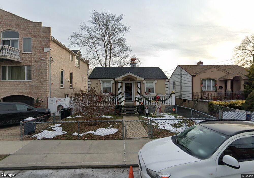
2586 Flint Ave Bronx, NY 10475
Eastchester NeighborhoodEstimated Value: $495,274 - $643,000
Studio
--
Bath
840
Sq Ft
$662/Sq Ft
Est. Value
About This Home
This home is located at 2586 Flint Ave, Bronx, NY 10475 and is currently estimated at $556,069, approximately $661 per square foot. 2586 Flint Ave is a home located in Bronx County with nearby schools including Cornerstone Academy For Social Action, Baychester Middle School, and One World Middle School At Edenwald.
Ownership History
Date
Name
Owned For
Owner Type
Purchase Details
Closed on
Oct 28, 2021
Sold by
Serret Jesus George and Serret William Omar
Bought by
Redding-Serret Jennifer and Serret Jesus George
Current Estimated Value
Purchase Details
Closed on
Nov 15, 2000
Sold by
Leo Thomas R and Leo Michelle A
Bought by
Serret Jesus George and Serret William Omar
Home Financials for this Owner
Home Financials are based on the most recent Mortgage that was taken out on this home.
Original Mortgage
$229,245
Interest Rate
7.52%
Create a Home Valuation Report for This Property
The Home Valuation Report is an in-depth analysis detailing your home's value as well as a comparison with similar homes in the area
Home Values in the Area
Average Home Value in this Area
Purchase History
| Date | Buyer | Sale Price | Title Company |
|---|---|---|---|
| Redding-Serret Jennifer | -- | -- | |
| Serret Jesus George | $304,000 | -- |
Source: Public Records
Mortgage History
| Date | Status | Borrower | Loan Amount |
|---|---|---|---|
| Previous Owner | Serret Jesus George | $229,245 |
Source: Public Records
Tax History
| Year | Tax Paid | Tax Assessment Tax Assessment Total Assessment is a certain percentage of the fair market value that is determined by local assessors to be the total taxable value of land and additions on the property. | Land | Improvement |
|---|---|---|---|---|
| 2025 | $3,814 | $21,613 | $5,218 | $16,395 |
| 2024 | $3,814 | $20,390 | $4,465 | $15,925 |
| 2023 | $3,857 | $20,390 | $5,119 | $15,271 |
| 2022 | $3,753 | $29,820 | $7,200 | $22,620 |
| 2021 | $3,715 | $26,280 | $7,200 | $19,080 |
| 2020 | $3,516 | $22,740 | $7,200 | $15,540 |
| 2019 | $3,262 | $21,060 | $7,200 | $13,860 |
| 2018 | $3,166 | $16,992 | $4,961 | $12,031 |
| 2017 | $3,138 | $16,863 | $6,058 | $10,805 |
| 2016 | $2,871 | $15,909 | $7,019 | $8,890 |
| 2015 | $1,869 | $15,009 | $7,648 | $7,361 |
| 2014 | $1,869 | $14,160 | $7,980 | $6,180 |
Source: Public Records
Map
Nearby Homes
- 2544 Hollers Ave
- 2542 Hollers Ave
- 982 Split Rock Rd
- 889 James St
- 808 Wolfs Ln
- 986 Plymouth St
- 677 James St
- 4 Lawrence Place
- 21 Lawrence Place
- 4610 Boston Post Rd
- 650 Ely Ave
- 1054 Clay Ave
- 15 Saint Pauls Place
- 15 Washington Blvd
- 1114 Washington Ave
- 62 Washington Blvd
- 490 Carol Place
- 3735 Rombouts Ave
- 6 Hazen St
- 622 Pelhamdale Ave Unit 45
- 2584 Flint Ave
- 2588 Flint Ave
- 2588 Flint Ave Unit 1A
- 2583 Hollers Ave
- 2582 Flint Ave
- 2581 Hollers Ave
- 2580 Flint Ave
- 2589 Flint Ave
- 2593 Flint Ave
- 2579 Hollers Ave
- 2579 Hollers Ave Unit 2-FLR
- 2578 Flint Ave
- 2583 Flint Ave
- 2577 Hollers Ave
- 2587 Flint Ave
- 2575 Hollers Ave
- 2576 Flint Ave
- 0 Flint Ave Unit 4735370
- 2585 Flint Ave
- 2573 Hollers Ave
Your Personal Tour Guide
Ask me questions while you tour the home.