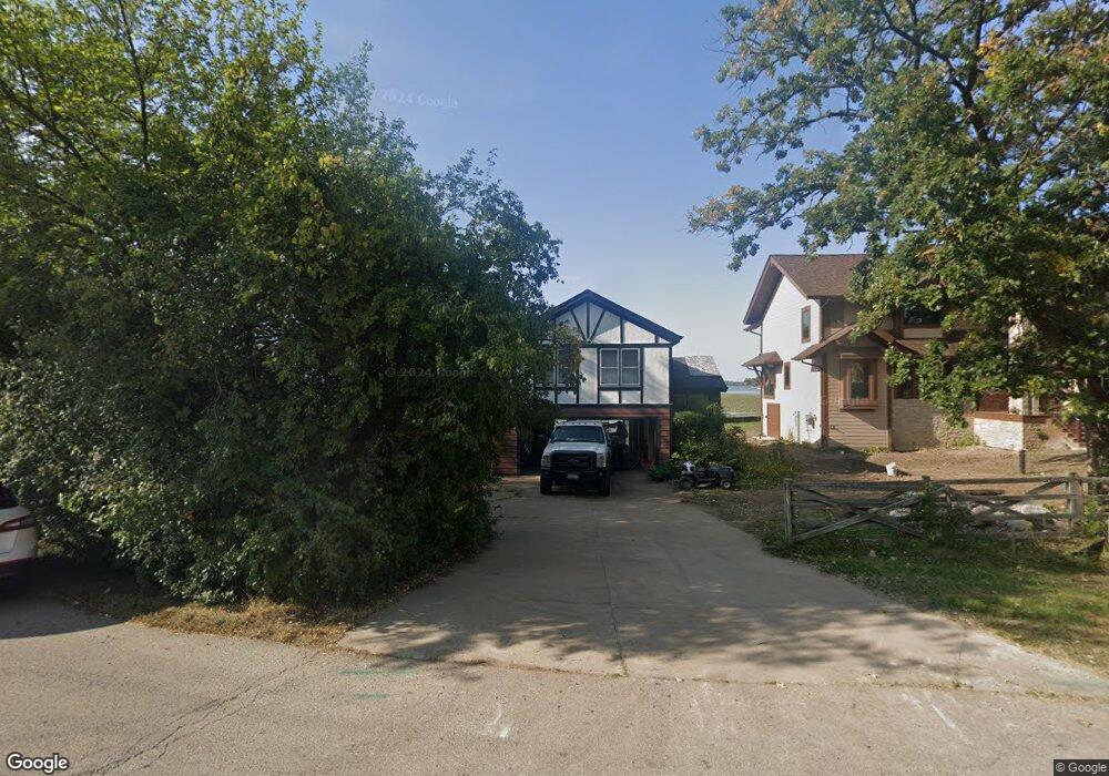
25880 W Brodie Dr Ingleside, IL 60041
Estimated Value: $217,000 - $282,000
--
Bed
1
Bath
1,326
Sq Ft
$195/Sq Ft
Est. Value
About This Home
This home is located at 25880 W Brodie Dr, Ingleside, IL 60041 and is currently estimated at $258,500, approximately $194 per square foot. 25880 W Brodie Dr is a home located in Lake County with nearby schools including Gavin Central Elementary School, Gavin South Middle School, and Grant Community High School.
Ownership History
Date
Name
Owned For
Owner Type
Purchase Details
Closed on
Dec 22, 1993
Sold by
Fedesna Dorothy
Bought by
Fedesna Kenneth J and Fedesna Brigitte M
Current Estimated Value
Home Financials for this Owner
Home Financials are based on the most recent Mortgage that was taken out on this home.
Original Mortgage
$100,000
Interest Rate
7.22%
Create a Home Valuation Report for This Property
The Home Valuation Report is an in-depth analysis detailing your home's value as well as a comparison with similar homes in the area
Home Values in the Area
Average Home Value in this Area
Purchase History
| Date | Buyer | Sale Price | Title Company |
|---|---|---|---|
| Fedesna Kenneth J | $84,666 | Republic Title Company |
Source: Public Records
Mortgage History
| Date | Status | Borrower | Loan Amount |
|---|---|---|---|
| Previous Owner | Fedesna Kenneth J | $100,000 |
Source: Public Records
Tax History Compared to Growth
Tax History
| Year | Tax Paid | Tax Assessment Tax Assessment Total Assessment is a certain percentage of the fair market value that is determined by local assessors to be the total taxable value of land and additions on the property. | Land | Improvement |
|---|---|---|---|---|
| 2024 | $3,067 | $63,847 | $20,593 | $43,254 |
| 2023 | $5,939 | $39,509 | $14,471 | $25,038 |
| 2022 | $5,939 | $74,789 | $14,608 | $60,181 |
| 2021 | $5,185 | $63,669 | $13,769 | $49,900 |
| 2020 | $5,223 | $62,759 | $13,572 | $49,187 |
| 2019 | $5,054 | $60,183 | $13,015 | $47,168 |
| 2018 | $5,265 | $62,274 | $20,411 | $41,863 |
| 2017 | $5,164 | $57,560 | $18,866 | $38,694 |
| 2016 | $5,472 | $52,643 | $17,254 | $35,389 |
| 2015 | $5,740 | $49,125 | $16,101 | $33,024 |
| 2014 | $6,407 | $55,018 | $15,837 | $39,181 |
| 2012 | $7,745 | $59,339 | $17,936 | $41,403 |
Source: Public Records
Map
Nearby Homes
- 36497 N Hawthorne Ln
- 36379 N Wesley Rd
- 35835 N Benjamin Ave
- 37322 N Stanton Point Rd
- 35720 N Laurel Ave
- 35729 N Watson Ave
- 35694 N Laurel Ave
- 69 Washington St
- 35663 N Helendale Rd
- 314 Mastodon Dr
- 37411 N Fairview Ln
- 35531 N Sunnyside Ave
- 605 Rollins Rd
- 42 Rushmore Rd
- 26177 W Lakeview Ave
- 24570 W Blackcherry Ln
- 35647 N Grove Ave
- 43 Lippincott Rd
- 35611 N Grove Ave
- 35105 N Ingleside Dr
- 25862 W Brodie Dr
- 25875 W Brodie Dr
- 25861 W Brodie Dr
- 25883 W Brodie Dr
- 25853 W Brodie Dr
- 25901 W Brodie Dr
- 25835 W Brodie Dr
- 25827 W Brodie Dr
- 36534 N Il Route 59
- 36526 N Il Route 59
- 36542 N Il Route 59
- 36534 N Illinois 59
- 25821 W Brodie Dr
- 25816 W Brodie Dr
- 36510 N Il Route 59
- 36558 N Il Route 59
- 36581 N Iola Ave
- 36615 N Iola Ave
- 36621 N Iola Ave
- 36575 N Iola Ave