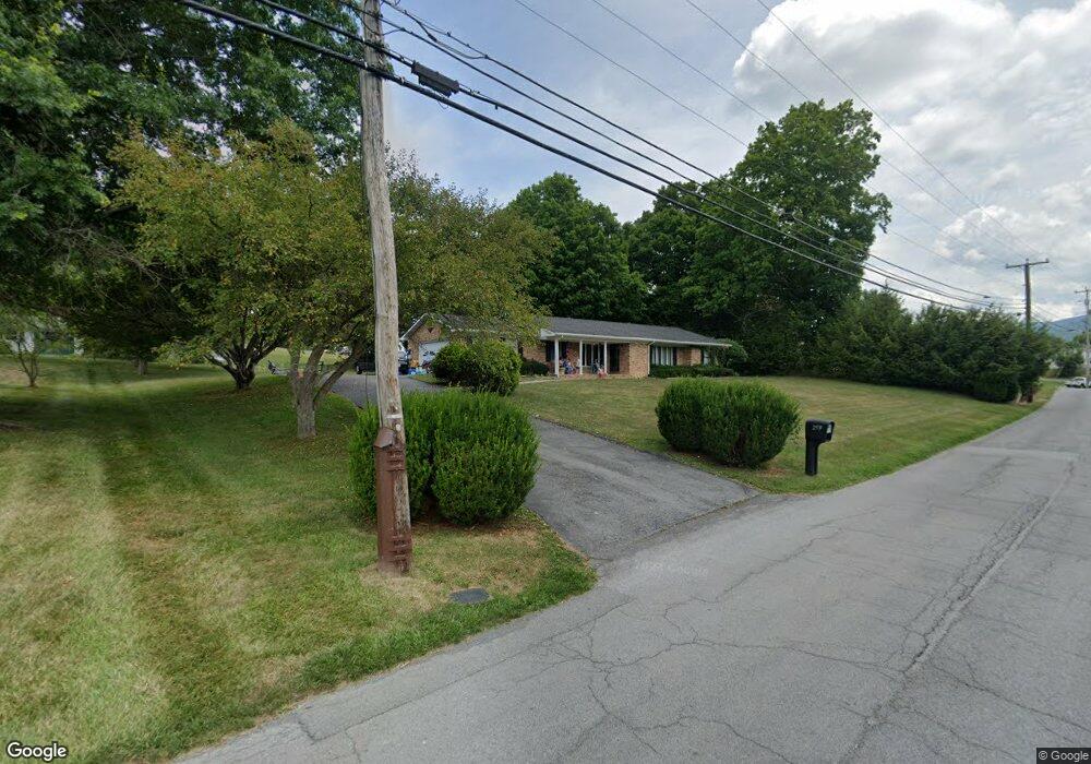
259 Dial Rock Rd North Tazewell, VA 24630
Estimated Value: $204,000 - $274,027
3
Beds
1
Bath
2,156
Sq Ft
$115/Sq Ft
Est. Value
About This Home
This home is located at 259 Dial Rock Rd, North Tazewell, VA 24630 and is currently estimated at $247,007, approximately $114 per square foot. 259 Dial Rock Rd is a home located in Tazewell County with nearby schools including Tazewell Christian Academy.
Ownership History
Date
Name
Owned For
Owner Type
Purchase Details
Closed on
Dec 8, 2015
Sold by
Palmer Rita Joyce Shrader and Shrader Arnold Thomas
Bought by
Johnson Samuel H and Johnson Chrisa L
Current Estimated Value
Home Financials for this Owner
Home Financials are based on the most recent Mortgage that was taken out on this home.
Original Mortgage
$154,415
Outstanding Balance
$121,707
Interest Rate
3.77%
Mortgage Type
Credit Line Revolving
Estimated Equity
$125,300
Create a Home Valuation Report for This Property
The Home Valuation Report is an in-depth analysis detailing your home's value as well as a comparison with similar homes in the area
Home Values in the Area
Average Home Value in this Area
Purchase History
| Date | Buyer | Sale Price | Title Company |
|---|---|---|---|
| Johnson Samuel H | $173,500 | None Available |
Source: Public Records
Mortgage History
| Date | Status | Borrower | Loan Amount |
|---|---|---|---|
| Open | Johnson Samuel H | $154,415 |
Source: Public Records
Tax History Compared to Growth
Tax History
| Year | Tax Paid | Tax Assessment Tax Assessment Total Assessment is a certain percentage of the fair market value that is determined by local assessors to be the total taxable value of land and additions on the property. | Land | Improvement |
|---|---|---|---|---|
| 2023 | $1,057 | $182,200 | $28,000 | $154,200 |
| 2022 | $1,057 | $182,200 | $28,000 | $154,200 |
| 2021 | $1,057 | $182,200 | $28,000 | $154,200 |
| 2020 | $1,057 | $182,200 | $28,000 | $154,200 |
| 2019 | $1,057 | $182,200 | $28,000 | $154,200 |
| 2018 | $1,115 | $182,200 | $28,000 | $154,200 |
| 2017 | $1,115 | $202,800 | $28,000 | $174,800 |
| 2016 | -- | $202,800 | $28,000 | $174,800 |
| 2015 | -- | $202,800 | $28,000 | $174,800 |
| 2014 | -- | $202,800 | $28,000 | $174,800 |
| 2013 | -- | $202,800 | $28,000 | $174,800 |
Source: Public Records
Map
Nearby Homes
- 209 Faith St
- 265 Buckhorn St
- 561 Hillsboro Dr
- 3398 Riverside Dr
- 379 Freedom Ave
- 31291 Gc Perry Hwy
- 1353 Fincastle Turnpike
- 175 Steeles Ln
- 156 Linda Ln
- 195 Kulchar Ln
- 0 Goose Creek Rd
- TBD Deer Ridge Trail
- 119 Deer Ridge Trail
- 799 Dogwood Rd
- 308 Division St
- 306 E Tower St
- 639 Tower St
- 509 Tazewell Ave
- 137 Carline Ave
- 210 Philos St
- 116 Dial Rock Rd
- 113 Dial Rock Rd
- 119 Dial Rock Rd
- 235 Dial Rock Rd
- 133 Bland St
- 282 Dial Rock Rd
- 264 Dial Rock Rd
- 118 Dial Rock Rd
- 157 Bland St
- 244 Dial Rock Rd
- 118 Watts St
- 294 Dial Rock Rd
- 114 Dial Rock Rd
- 167 Bland St
- 109 Dial Rock Rd
- 213 Dial Rock Rd
- 121 Dial Rock Rd
- 139 Watts St
- 108 Bland St
- 177 Bland St