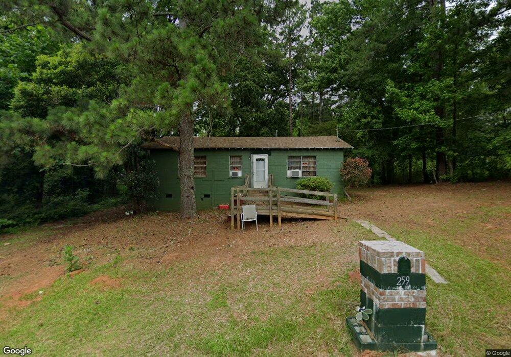
259 Maple St Batesburg, SC 29006
Estimated Value: $79,000 - $176,000
3
Beds
1
Bath
960
Sq Ft
$132/Sq Ft
Est. Value
About This Home
This home is located at 259 Maple St, Batesburg, SC 29006 and is currently estimated at $126,363, approximately $131 per square foot. 259 Maple St is a home with nearby schools including Batesburg-Leesville Primary School, Batesburg-Leesville Elementary School, and Batesburg-Leesville Middle School.
Ownership History
Date
Name
Owned For
Owner Type
Purchase Details
Closed on
Apr 27, 2020
Sold by
Mccarty Timothy
Bought by
Carter Edward
Current Estimated Value
Purchase Details
Closed on
May 3, 2017
Sold by
Mccarty Timothy
Bought by
Blocker Anthony
Home Financials for this Owner
Home Financials are based on the most recent Mortgage that was taken out on this home.
Original Mortgage
$9,300
Interest Rate
8%
Create a Home Valuation Report for This Property
The Home Valuation Report is an in-depth analysis detailing your home's value as well as a comparison with similar homes in the area
Home Values in the Area
Average Home Value in this Area
Purchase History
| Date | Buyer | Sale Price | Title Company |
|---|---|---|---|
| Carter Edward | $500 | None Available | |
| Blocker Anthony | $10,300 | None Available |
Source: Public Records
Mortgage History
| Date | Status | Borrower | Loan Amount |
|---|---|---|---|
| Previous Owner | Blocker Anthony | $9,300 |
Source: Public Records
Tax History Compared to Growth
Tax History
| Year | Tax Paid | Tax Assessment Tax Assessment Total Assessment is a certain percentage of the fair market value that is determined by local assessors to be the total taxable value of land and additions on the property. | Land | Improvement |
|---|---|---|---|---|
| 2024 | -- | $1,939 | $600 | $1,339 |
| 2023 | $992 | $1,293 | $400 | $893 |
| 2022 | $297 | $1,293 | $400 | $893 |
| 2020 | $265 | $1,293 | $400 | $893 |
| 2019 | $958 | $1,870 | $360 | $1,510 |
| 2018 | $948 | $1,870 | $360 | $1,510 |
| 2017 | $929 | $1,870 | $360 | $1,510 |
| 2016 | $880 | $1,869 | $360 | $1,509 |
| 2014 | -- | $2,309 | $360 | $1,949 |
| 2013 | -- | $2,310 | $360 | $1,950 |
Source: Public Records
Map
Nearby Homes
- 212 Eddie St
- 214 Magnolia St
- 00 Olive Branch Terrace
- 326 Nell St
- TBD Liberty St
- 303 Nell St
- 689 W Columbia Ave
- 695 W Columbia Ave
- 0 Russell
- 411 Wilson St
- 692 Russell St
- 697 Russell St
- 201 Fox St
- 305 S Bethlehem Rd
- 360 W Church St
- 0 Line St Unit 23634336
- 0 Bethlehem Rd
- 364 Rikard St
- 551 Park St
- 337 Mill St