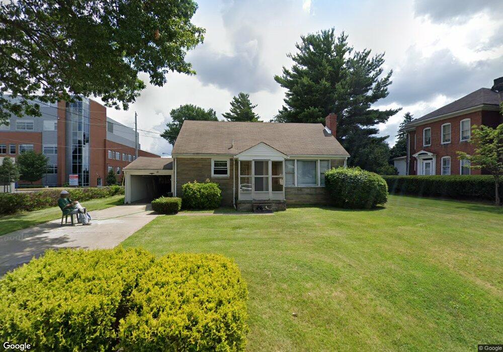
259 Poplar St Mansfield, OH 44903
Estimated Value: $80,000 - $153,000
2
Beds
1
Bath
1,142
Sq Ft
$103/Sq Ft
Est. Value
About This Home
This home is located at 259 Poplar St, Mansfield, OH 44903 and is currently estimated at $117,604, approximately $102 per square foot. 259 Poplar St is a home located in Richland County with nearby schools including St. Peter's High School/Junior High, St. Peter's Elementary/Montessori School, and Discovery School.
Ownership History
Date
Name
Owned For
Owner Type
Purchase Details
Closed on
Jun 29, 2022
Sold by
Shaw Richard L
Bought by
259 Poplar St Llc
Current Estimated Value
Purchase Details
Closed on
Jun 2, 2022
Sold by
Dansby James R
Bought by
Shaw Richard L
Purchase Details
Closed on
Feb 15, 2000
Sold by
Est Antoinette D Cunning
Bought by
Dansby James R
Home Financials for this Owner
Home Financials are based on the most recent Mortgage that was taken out on this home.
Original Mortgage
$56,850
Interest Rate
8.08%
Mortgage Type
New Conventional
Create a Home Valuation Report for This Property
The Home Valuation Report is an in-depth analysis detailing your home's value as well as a comparison with similar homes in the area
Home Values in the Area
Average Home Value in this Area
Purchase History
| Date | Buyer | Sale Price | Title Company |
|---|---|---|---|
| 259 Poplar St Llc | $125 | None Listed On Document | |
| Shaw Richard L | $70,000 | None Listed On Document | |
| Dansby James R | $63,200 | -- |
Source: Public Records
Mortgage History
| Date | Status | Borrower | Loan Amount |
|---|---|---|---|
| Previous Owner | Dansby James R | $56,850 |
Source: Public Records
Tax History Compared to Growth
Tax History
| Year | Tax Paid | Tax Assessment Tax Assessment Total Assessment is a certain percentage of the fair market value that is determined by local assessors to be the total taxable value of land and additions on the property. | Land | Improvement |
|---|---|---|---|---|
| 2024 | $991 | $19,720 | $3,910 | $15,810 |
| 2023 | $944 | $19,720 | $3,910 | $15,810 |
| 2022 | $255 | $13,320 | $3,170 | $10,150 |
| 2021 | $257 | $13,320 | $3,170 | $10,150 |
| 2020 | $263 | $13,320 | $3,170 | $10,150 |
| 2019 | $291 | $13,320 | $3,170 | $10,150 |
| 2018 | $287 | $13,320 | $3,170 | $10,150 |
| 2017 | $540 | $13,320 | $3,170 | $10,150 |
| 2016 | $800 | $21,420 | $4,220 | $17,200 |
| 2015 | $764 | $21,420 | $4,220 | $17,200 |
| 2014 | $754 | $21,420 | $4,220 | $17,200 |
| 2012 | $313 | $22,550 | $4,450 | $18,100 |
Source: Public Records
Map
Nearby Homes
- 257 Wood St
- 114 Vennum Ave
- 118 Lind Ave
- 119 Carpenter Rd
- 126 Dawson Ave
- 135 Wood St
- 133 Stewart Ave S
- 76 Bartley Ave
- 88 Sherman Ave
- 37 Baldwin Ave
- 538 Broadview Ave
- 353 Sturges Ave
- 131 Sturges Ave
- 71 Glenwood Blvd
- 375 Sturges Ave
- 0 Cline Ave Hedeen Abbeyfeale Unit 9066362
- 78 Glenwood Blvd
- 679 Coleman Rd
- 118 Parkwood Blvd
- 505 Wood St
- 401 Ohio St
- 271 Poplar St
- 420 Parkview St Unit 422
- 275 Poplar St
- 254 Poplar St
- 428 Parkview St
- 248 Poplar St
- 421 Parkview St Unit 423
- 272 Vennum Ave Unit 275
- 244 Poplar St
- 283 Poplar St
- 426 Parkview St
- 280 Vennum Ave
- 427 Parkview St Unit 429
- 258 Vennum Ave
- 266 Vennum Ave
- 289 Poplar St
- 433 Parkview St
- 282 Vennum Ave
- 255 Bartley Ave