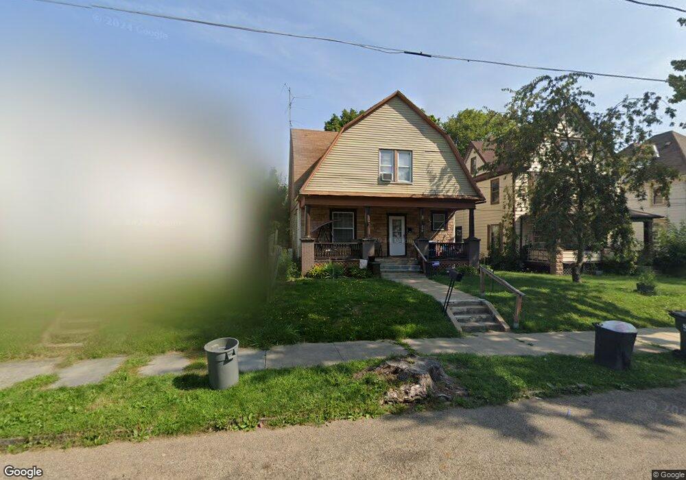
259 W Columbia St Alliance, OH 44601
Estimated Value: $64,000 - $102,000
3
Beds
2
Baths
1,568
Sq Ft
$58/Sq Ft
Est. Value
About This Home
This home is located at 259 W Columbia St, Alliance, OH 44601 and is currently estimated at $90,393, approximately $57 per square foot. 259 W Columbia St is a home located in Stark County with nearby schools including Alliance Early Learning School, Alliance Intermediate School at Northside, and Alliance Middle School.
Ownership History
Date
Name
Owned For
Owner Type
Purchase Details
Closed on
Oct 7, 2009
Sold by
Hsbc Bank Usa National Association
Bought by
Schroeder Herbert T and Schroeder Hong T
Current Estimated Value
Purchase Details
Closed on
Aug 11, 2009
Sold by
Neiswanger Dexter
Bought by
Hsbc Bank Usa National Association
Purchase Details
Closed on
Sep 20, 2005
Sold by
Investment Concept Group Ltd
Bought by
Neiswanger Dexter
Home Financials for this Owner
Home Financials are based on the most recent Mortgage that was taken out on this home.
Original Mortgage
$72,000
Interest Rate
8.47%
Mortgage Type
Fannie Mae Freddie Mac
Purchase Details
Closed on
Jul 14, 2005
Sold by
National City Bank Of Indiana
Bought by
Investment Concept Group Ltd
Purchase Details
Closed on
Mar 22, 2005
Sold by
Hud
Bought by
National City Bank Of Indiana
Purchase Details
Closed on
Feb 28, 2005
Sold by
Dennison Adam N
Bought by
Hud
Purchase Details
Closed on
Jun 15, 2001
Sold by
Skyland Hills Corp
Bought by
Dennison Adam N
Home Financials for this Owner
Home Financials are based on the most recent Mortgage that was taken out on this home.
Original Mortgage
$51,688
Interest Rate
7.2%
Mortgage Type
FHA
Purchase Details
Closed on
Aug 7, 2000
Sold by
Ellsworth Timothy P and Ellsworth Mary E
Bought by
Skyland Hills Corp
Purchase Details
Closed on
Mar 11, 1999
Sold by
Oblisk James W and Oblisk Cheryl A
Bought by
Ellsworth Timothy P and Ellsworth Mary E
Home Financials for this Owner
Home Financials are based on the most recent Mortgage that was taken out on this home.
Original Mortgage
$33,000
Interest Rate
6.78%
Mortgage Type
Purchase Money Mortgage
Purchase Details
Closed on
Feb 22, 1995
Sold by
Harton Charles E
Bought by
Oblisk James W and Oblisk Cheryl
Home Financials for this Owner
Home Financials are based on the most recent Mortgage that was taken out on this home.
Original Mortgage
$19,500
Interest Rate
10.75%
Mortgage Type
New Conventional
Create a Home Valuation Report for This Property
The Home Valuation Report is an in-depth analysis detailing your home's value as well as a comparison with similar homes in the area
Home Values in the Area
Average Home Value in this Area
Purchase History
| Date | Buyer | Sale Price | Title Company |
|---|---|---|---|
| Schroeder Herbert T | $13,500 | None Available | |
| Hsbc Bank Usa National Association | $36,000 | None Available | |
| Neiswanger Dexter | $80,000 | Union Title Co | |
| Investment Concept Group Ltd | $22,000 | Nova Title Agency Inc | |
| National City Bank Of Indiana | -- | -- | |
| Hud | $30,000 | -- | |
| Dennison Adam N | $52,500 | -- | |
| Skyland Hills Corp | -- | Americas Choice Title Agency | |
| Ellsworth Timothy P | $32,500 | -- | |
| Oblisk James W | $23,000 | -- |
Source: Public Records
Mortgage History
| Date | Status | Borrower | Loan Amount |
|---|---|---|---|
| Previous Owner | Neiswanger Dexter | $72,000 | |
| Previous Owner | Dennison Adam N | $51,688 | |
| Previous Owner | Ellsworth Timothy P | $33,000 | |
| Previous Owner | Oblisk James W | $19,500 |
Source: Public Records
Tax History Compared to Growth
Tax History
| Year | Tax Paid | Tax Assessment Tax Assessment Total Assessment is a certain percentage of the fair market value that is determined by local assessors to be the total taxable value of land and additions on the property. | Land | Improvement |
|---|---|---|---|---|
| 2025 | -- | $25,800 | $5,850 | $19,950 |
| 2024 | -- | $25,800 | $5,850 | $19,950 |
| 2023 | $677 | $16,450 | $4,550 | $11,900 |
| 2022 | $341 | $16,450 | $4,550 | $11,900 |
| 2021 | $684 | $16,450 | $4,550 | $11,900 |
| 2020 | $664 | $14,920 | $3,960 | $10,960 |
| 2019 | $655 | $14,920 | $3,960 | $10,960 |
| 2018 | $658 | $14,920 | $3,960 | $10,960 |
| 2017 | $544 | $12,120 | $2,840 | $9,280 |
| 2016 | $548 | $12,120 | $2,840 | $9,280 |
| 2015 | $553 | $12,120 | $2,840 | $9,280 |
| 2014 | $702 | $14,630 | $3,430 | $11,200 |
| 2013 | $350 | $14,630 | $3,430 | $11,200 |
Source: Public Records
Map
Nearby Homes
- 132 S Haines Ave
- 163 W Market St
- 345 W Market St
- 329 1/2 W Main St
- 427 S Union Ave
- 511 W Ely St
- 645 W Summit St
- 140 W Summit St
- 725 W Summit St
- 734 Parkway Blvd
- 807 S Union Ave
- 356 E Broadway St
- 361 E Main St
- 710 N Freedom Ave
- 124 E Wayne St
- 432 S Linden Ave
- 896 Parkway Blvd
- V/L S Fredeom Ave
- 738 Kingsway St
- 452 E Summit St
- 255 W Columbia St
- 267 W Columbia St
- 245 W Columbia St
- 273 W Columbia St
- 235 W Columbia St
- 283 W Columbia St
- 254 W Market St
- 264 W Market St
- 240 W Market St
- 272 W Market St
- 287 W Columbia St
- 219 W Columbia St
- 258 W Columbia St
- 252 W Columbia St
- 266 W Columbia St
- 232 W Market St
- 120 S Lincoln Ave
- 284 W Market St
- 244 W Columbia St
- 272 W Columbia St