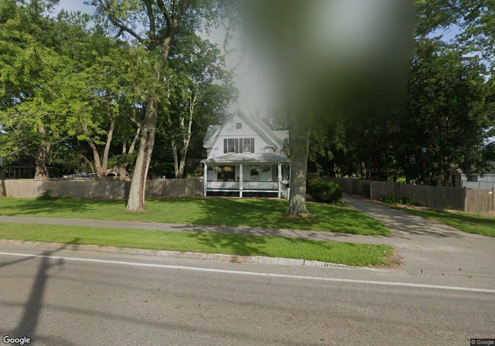
259 W Main St Norton, MA 02766
Estimated Value: $491,966
3
Beds
1
Bath
1,556
Sq Ft
$316/Sq Ft
Est. Value
About This Home
This home is located at 259 W Main St, Norton, MA 02766 and is currently estimated at $491,966, approximately $316 per square foot. 259 W Main St is a home located in Bristol County with nearby schools including J.C. Solmonese Elementary School, Henri A. Yelle Elementary School, and Norton Middle School.
Ownership History
Date
Name
Owned For
Owner Type
Purchase Details
Closed on
May 23, 2020
Sold by
Gouveia Virginia G
Bought by
Brown Fan Z and Brown Ian S
Current Estimated Value
Purchase Details
Closed on
Dec 20, 2019
Sold by
259 West Main Street T
Bought by
Gouveia Virginia G
Purchase Details
Closed on
Oct 27, 2009
Sold by
Fonseca Irene V and Grace Maryellen
Bought by
259 West Main Street T and Fonseca Irene V
Purchase Details
Closed on
Jul 1, 1980
Bought by
259 W Main St Rt
Create a Home Valuation Report for This Property
The Home Valuation Report is an in-depth analysis detailing your home's value as well as a comparison with similar homes in the area
Home Values in the Area
Average Home Value in this Area
Purchase History
| Date | Buyer | Sale Price | Title Company |
|---|---|---|---|
| Brown Fan Z | $315,000 | None Available | |
| Gouveia Virginia G | -- | None Available | |
| 259 West Main Street T | -- | -- | |
| 259 W Main St Rt | $70,000 | -- |
Source: Public Records
Tax History Compared to Growth
Tax History
| Year | Tax Paid | Tax Assessment Tax Assessment Total Assessment is a certain percentage of the fair market value that is determined by local assessors to be the total taxable value of land and additions on the property. | Land | Improvement |
|---|---|---|---|---|
| 2025 | $0 | $347,100 | $179,400 | $167,700 |
| 2024 | $4,459 | $331,800 | $170,900 | $160,900 |
| 2023 | $0 | $313,600 | $161,100 | $152,500 |
| 2022 | $4,459 | $312,700 | $146,500 | $166,200 |
| 2021 | $4,469 | $299,300 | $139,500 | $159,800 |
| 2020 | $4,307 | $291,000 | $135,400 | $155,600 |
| 2019 | $4,394 | $294,900 | $144,600 | $150,300 |
| 2018 | $4,310 | $284,300 | $144,600 | $139,700 |
| 2017 | $4,236 | $275,600 | $144,600 | $131,000 |
| 2016 | $4,144 | $265,500 | $144,600 | $120,900 |
| 2015 | $3,944 | $256,300 | $138,400 | $117,900 |
| 2014 | $3,574 | $232,500 | $119,100 | $113,400 |
Source: Public Records
Map
Nearby Homes
- 16 Park Ln
- 108 S Worcester St
- 53 Sturdy St
- 55 Sturdy St
- 145 S Worcester St
- 170 S Worcester St Unit 3
- 178 S Worcester St
- 225 S Worcester St Unit 1
- 225 S Worcester St Unit 2
- 182 John Scott Blvd
- 75 Barrows St
- 19 Precourt Ln
- 4 Village Way Unit F
- 48 Dean St
- 180 Pike Ave
- 14 Country Club Way
- 38 Danielle St
- 127 John Scott Blvd
- 125 John Scott Blvd
- 64 Ridgehill Rd
- 259 W Main St
- 263 W Main St
- 260 W Main St
- 265 W Main St
- 0 Woodlark Dr Unit A
- 2 A Woodlark Dr Unit A
- 2 Woodlark Dr Unit D
- 2 Woodlark Dr Unit C
- 2 Woodlark Dr Unit B
- 2 Woodlark Dr Unit A
- 2 Woodlark Dr Unit 2C
- 2 Woodlark Dr Unit 3
- 251 W Main St
- 251 W Main St Unit 1
- 267 W Main St
- 267 W Main St Unit HOUSE
- 6 Cottage St
- 8 Cottage St
- 1 A Woodlark Dr Unit A
- 1 D Woodlark Dr Unit 1D