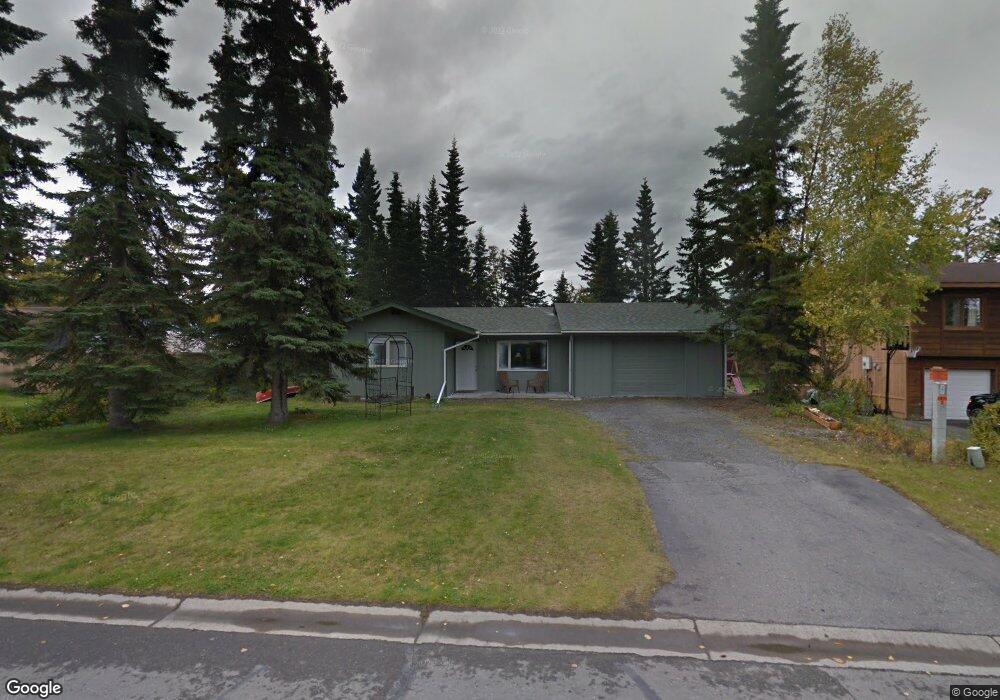
259 W Rockwell Ave Soldotna, AK 99669
Estimated Value: $166,000 - $265,000
3
Beds
1
Bath
890
Sq Ft
$259/Sq Ft
Est. Value
About This Home
This home is located at 259 W Rockwell Ave, Soldotna, AK 99669 and is currently estimated at $230,242, approximately $258 per square foot. 259 W Rockwell Ave is a home located in Kenai Peninsula Borough with nearby schools including Redoubt Elementary School, Skyview Middle School, and Soldotna High School.
Ownership History
Date
Name
Owned For
Owner Type
Purchase Details
Closed on
Jul 14, 2025
Sold by
Hardy Joseph E and Hardy Billie E
Bought by
Cameron Brian C and Munson Tami L
Current Estimated Value
Purchase Details
Closed on
Apr 11, 2023
Sold by
Billie B Hardy Revocable Trust
Bought by
Hardy Joseph E and Hardy Billie E
Purchase Details
Closed on
Nov 20, 2001
Sold by
Hardy Joseph E and Hardy Billie B
Bought by
The Billie B Hardy Revocable Trust
Purchase Details
Closed on
Nov 14, 2001
Sold by
Munger Michael L
Bought by
Hardy Joseph E and Hardy Billie B
Create a Home Valuation Report for This Property
The Home Valuation Report is an in-depth analysis detailing your home's value as well as a comparison with similar homes in the area
Home Values in the Area
Average Home Value in this Area
Purchase History
| Date | Buyer | Sale Price | Title Company |
|---|---|---|---|
| Cameron Brian C | -- | First American Title Insurance | |
| Hardy Joseph E | -- | None Listed On Document | |
| The Billie B Hardy Revocable Trust | -- | -- | |
| Hardy Joseph E | -- | -- |
Source: Public Records
Tax History Compared to Growth
Tax History
| Year | Tax Paid | Tax Assessment Tax Assessment Total Assessment is a certain percentage of the fair market value that is determined by local assessors to be the total taxable value of land and additions on the property. | Land | Improvement |
|---|---|---|---|---|
| 2025 | $1,395 | $189,900 | $31,900 | $158,000 |
| 2024 | $698 | $174,000 | $31,100 | $142,900 |
| 2023 | $1,270 | $158,300 | $28,300 | $130,000 |
| 2022 | $1,205 | $153,300 | $26,900 | $126,400 |
| 2021 | $1,139 | $143,300 | $21,600 | $121,700 |
| 2020 | $1,107 | $137,300 | $21,600 | $115,700 |
| 2019 | $1,127 | $139,800 | $19,600 | $120,200 |
| 2018 | $1,139 | $141,300 | $19,600 | $121,700 |
| 2017 | $1,035 | $136,000 | $19,600 | $116,400 |
| 2016 | $998 | $129,100 | $19,600 | $109,500 |
| 2015 | $970 | $125,900 | $19,600 | $106,300 |
| 2014 | $970 | $121,200 | $19,600 | $101,600 |
Source: Public Records
Map
Nearby Homes
- 265 Charity Cir
- 169 N Brentwood St
- 386 W Corral Ave
- 256 Upper Rosian Dr
- 327 Knight Dr
- 253 Upper Rosian Dr
- L42 N Aspen Dr
- 235 N Aspen Dr
- 35839 Irons Ave
- 35841 Irons Ave
- 35868 Everwell Place
- 35856 Everwell Place
- 35840 Everwell Place
- 000 Ridgewood Dr
- 35870 Glory St
- 150 S Leibrock St
- 190 Trumpeter Ave
- 366 Diane Ln
- L1 Kenai Spur Hwy
- 228 Stacy Dr
- 253 W Rockwell Ave
- 267 W Rockwell Ave
- 260 W Katmai Ave
- 254 W Katmai Ave
- 268 W Katmai Ave
- 247 W Rockwell Ave
- 273 W Rockwell Ave
- 248 W Katmai Ave
- 274 W Katmai Ave
- 279 W Rockwell Ave
- 280 W Katmai Ave
- 285 W Rockwell Ave
- 256 Charity Cir
- L7 B6 W Rockwell Ave
- 259 W Katmai Ave
- 253 W Katmai Ave
- 286 W Katmai Ave
- 265 W Katmai Ave
- 247 W Katmai Ave
- 262 Charity Cir