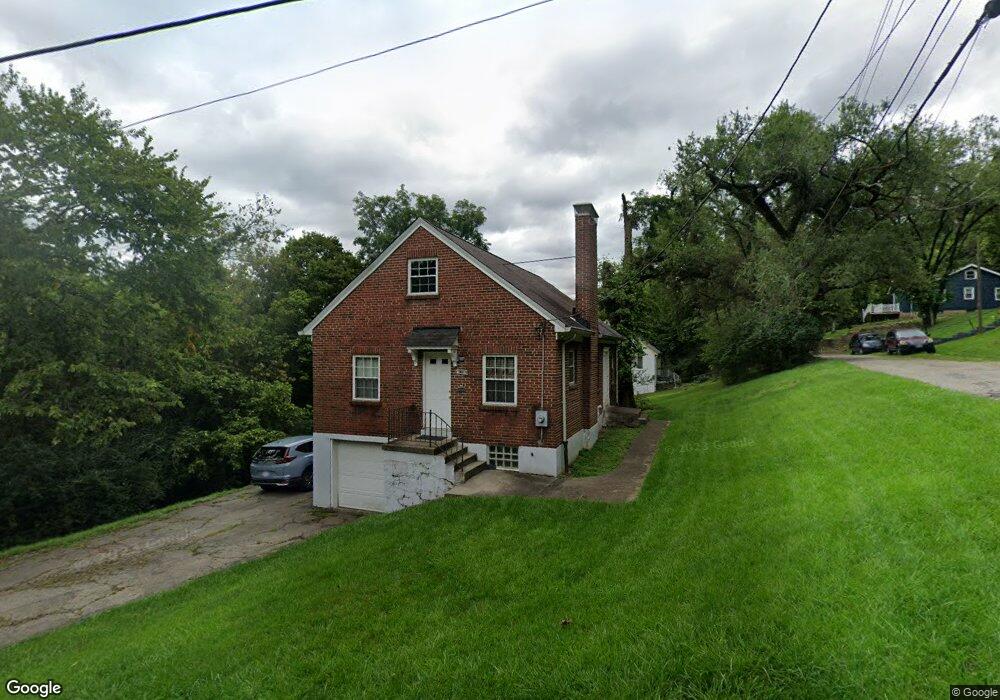
2590 Brestel Rd Cincinnati, OH 45225
North Fairmount NeighborhoodEstimated Value: $79,000 - $108,000
2
Beds
1
Bath
1,350
Sq Ft
$66/Sq Ft
Est. Value
About This Home
This home is located at 2590 Brestel Rd, Cincinnati, OH 45225 and is currently estimated at $89,489, approximately $66 per square foot. 2590 Brestel Rd is a home located in Hamilton County with nearby schools including Ethel M. Taylor Academy, Robert A. Taft Information Technology High School, and Western Hills High School.
Ownership History
Date
Name
Owned For
Owner Type
Purchase Details
Closed on
Aug 15, 2005
Sold by
Homesteading & Urban Redevelopment Corp
Bought by
Koehler Ii Randy S
Current Estimated Value
Purchase Details
Closed on
May 15, 2003
Sold by
Stanley Jimmie L and Stanley Dorothy
Bought by
Homesteading & Urban Redevelopment Corp
Create a Home Valuation Report for This Property
The Home Valuation Report is an in-depth analysis detailing your home's value as well as a comparison with similar homes in the area
Home Values in the Area
Average Home Value in this Area
Purchase History
| Date | Buyer | Sale Price | Title Company |
|---|---|---|---|
| Koehler Ii Randy S | -- | None Available | |
| Homesteading & Urban Redevelopment Corp | $24,000 | -- |
Source: Public Records
Tax History
| Year | Tax Paid | Tax Assessment Tax Assessment Total Assessment is a certain percentage of the fair market value that is determined by local assessors to be the total taxable value of land and additions on the property. | Land | Improvement |
|---|---|---|---|---|
| 2025 | $1,079 | $17,017 | $2,765 | $14,252 |
| 2023 | $1,070 | $17,017 | $2,765 | $14,252 |
| 2022 | $1,243 | $17,823 | $2,748 | $15,075 |
| 2021 | $1,188 | $17,823 | $2,748 | $15,075 |
| 2020 | $1,222 | $17,823 | $2,748 | $15,075 |
| 2019 | $1,219 | $16,202 | $2,499 | $13,703 |
| 2018 | $1,220 | $16,202 | $2,499 | $13,703 |
| 2017 | $1,158 | $16,202 | $2,499 | $13,703 |
| 2016 | $1,807 | $25,061 | $3,119 | $21,942 |
| 2015 | $1,631 | $25,061 | $3,119 | $21,942 |
| 2014 | $1,031 | $25,061 | $3,119 | $21,942 |
| 2013 | $1,038 | $24,812 | $3,087 | $21,725 |
Source: Public Records
Map
Nearby Homes
- 1859 Baltimore Ave
- 1965 Baltimore Ave
- 1808 Carll St
- 1797 Denham St
- 1793 Baltimore Ave
- 1781 Baltimore Ave
- 2594 Seegar Ave
- 2043 E Teralta Cir
- 2060 Bickel Ave
- 2065 Harrison Ave
- 2114 Saint Leo Place
- 2568 Trevor Place
- 2085 N Teralta Cir
- 2082 Harrison Ave
- 1854 Knox St
- 2109 Harrison Ave
- 1642 Sutter Ave
- 1646 Pulte St
- 1879 Biegler St
- 1875 Biegler St
- 1924 Arthur Place
- 1909 Baltimore Ave
- 1911 Arthur Place
- 1906 Arthur Place
- 1905 Baltimore Ave
- 1911 Baltimore Ave
- 1903 Baltimore Ave
- 1895 Baltimore Ave
- 1907 Arthur Place
- 1919 Arthur Place
- 1891 Baltimore Ave
- 1929 Arthur Place
- 1917 Baltimore Ave
- 1933 Arthur Place
- 1921 Baltimore Ave
- 1889 Baltimore Ave
- 1887 Baltimore Ave
- 1903 Arthur Place
- 1925 Baltimore Ave
- 1932 Arthur Place
Your Personal Tour Guide
Ask me questions while you tour the home.