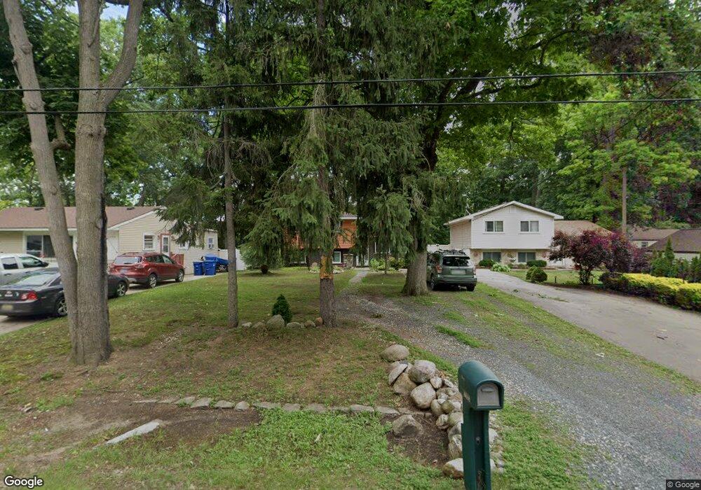
2590 Maplecrest Dr Waterford, MI 48329
Waterford Township NeighborhoodEstimated Value: $228,691 - $275,000
3
Beds
2
Baths
1,384
Sq Ft
$177/Sq Ft
Est. Value
About This Home
This home is located at 2590 Maplecrest Dr, Waterford, MI 48329 and is currently estimated at $245,423, approximately $177 per square foot. 2590 Maplecrest Dr is a home located in Oakland County with nearby schools including Riverside Elementary School, Pierce Middle School, and Waterford Kettering High School.
Ownership History
Date
Name
Owned For
Owner Type
Purchase Details
Closed on
Dec 11, 2020
Sold by
Boyd Robert J
Bought by
Alessi Diane and Boyd Aaron
Current Estimated Value
Purchase Details
Closed on
Feb 13, 2013
Sold by
Boyd Robert J
Bought by
Boyd Robert J and Boyd Aaron J
Purchase Details
Closed on
Nov 15, 2011
Sold by
Green Tree Servicing Llc
Bought by
Boyd Robert J
Purchase Details
Closed on
Aug 17, 2010
Sold by
Stepp Gary R and Stepp Kimberlee Ann
Bought by
Green Tree Servicing Llc
Purchase Details
Closed on
Mar 27, 1996
Sold by
Ccb Associates Inc
Bought by
Stepp Gary R
Create a Home Valuation Report for This Property
The Home Valuation Report is an in-depth analysis detailing your home's value as well as a comparison with similar homes in the area
Home Values in the Area
Average Home Value in this Area
Purchase History
| Date | Buyer | Sale Price | Title Company |
|---|---|---|---|
| Alessi Diane | -- | None Available | |
| Boyd Robert J | -- | None Available | |
| Boyd Robert J | $24,000 | Great Lakes Title Agency | |
| Green Tree Servicing Llc | $57,800 | None Available | |
| Stepp Gary R | $55,000 | -- |
Source: Public Records
Tax History Compared to Growth
Tax History
| Year | Tax Paid | Tax Assessment Tax Assessment Total Assessment is a certain percentage of the fair market value that is determined by local assessors to be the total taxable value of land and additions on the property. | Land | Improvement |
|---|---|---|---|---|
| 2024 | $2,063 | $89,070 | $0 | $0 |
| 2023 | $1,946 | $85,030 | $0 | $0 |
| 2022 | $2,564 | $73,280 | $0 | $0 |
| 2021 | $2,452 | $69,970 | $0 | $0 |
| 2020 | $1,795 | $67,360 | $0 | $0 |
| 2019 | $2,378 | $60,880 | $0 | $0 |
| 2018 | $2,347 | $57,420 | $0 | $0 |
| 2017 | $2,205 | $57,420 | $0 | $0 |
| 2016 | $2,196 | $53,090 | $0 | $0 |
| 2015 | -- | $46,320 | $0 | $0 |
| 2014 | -- | $41,270 | $0 | $0 |
| 2011 | -- | $43,010 | $0 | $0 |
Source: Public Records
Map
Nearby Homes
- 6350 Elmwood Dr
- 6175 Hatchery Rd
- 6441 Crest Dr
- 2610 Airport Rd
- 2615 Compton Dr
- 2262 Overridge Ave
- 2351 Overridge Ave
- 3077 Nanwich Dr
- 2739 Moosewood Dr Unit 50
- 5914 Pleasant Dr
- 6625 Lanman Dr
- 6376 Lanman Dr
- 6391 Rowley Blvd
- 6015 Rowley Blvd
- 7044 Desmond Rd
- 3194 Whitfield Dr
- 6275 Williams Lake Rd
- 2648 Bonita Dr
- 5502 Rowley Blvd
- 2606 Caterham Dr
- 2580 Maplecrest Dr
- 2596 Maplecrest Dr
- 2602 Maplecrest Dr
- 2570 Maplecrest Dr
- 2612 Maplecrest Dr
- 2560 Maplecrest Dr
- 2599 Campbellgate Cir
- 6304 Dellwood Dr
- 6313 Fortune Dr
- 2620 Maplecrest Dr
- 2625 Campbellgate Dr
- 2603 Campbellgate Cir
- 6310 Dellwood Dr
- 6327 Fortune Dr
- 6318 Fortune Dr
- 2550 Maplecrest Dr
- 2550 Maplecrest Dr
- 6311 Elmwood Dr
- 2591 Campbellgate Cir
- 2631 Campbellgate Dr