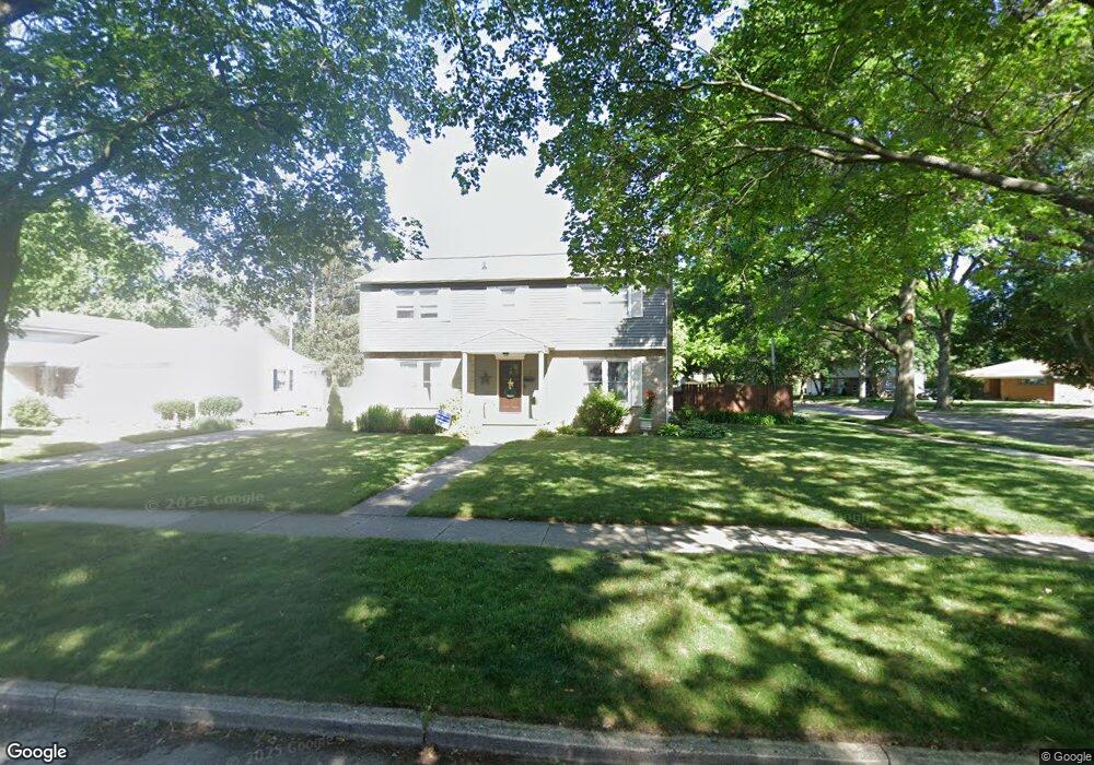
2591 Borglum Ave NE Grand Rapids, MI 49505
Creston NeighborhoodEstimated Value: $391,950 - $482,000
4
Beds
3
Baths
2,185
Sq Ft
$198/Sq Ft
Est. Value
About This Home
This home is located at 2591 Borglum Ave NE, Grand Rapids, MI 49505 and is currently estimated at $431,738, approximately $197 per square foot. 2591 Borglum Ave NE is a home located in Kent County with nearby schools including Riverside Middle School, Union High School, and All Saints Academy - Lower Campus.
Ownership History
Date
Name
Owned For
Owner Type
Purchase Details
Closed on
Sep 20, 2021
Sold by
Ables Kenneth A and Ables Deborah A
Bought by
Ables Kenneth and Ables Kenneth
Current Estimated Value
Purchase Details
Closed on
Sep 9, 2003
Sold by
Miller Robert J and Miller Lynn M
Bought by
Ables Kenneth and Ables Deborah A
Home Financials for this Owner
Home Financials are based on the most recent Mortgage that was taken out on this home.
Original Mortgage
$144,000
Interest Rate
6.33%
Mortgage Type
Purchase Money Mortgage
Purchase Details
Closed on
Sep 30, 1998
Sold by
Ts Pdl J and Ts J
Bought by
Miler Miler R and Miler L
Purchase Details
Closed on
Mar 31, 1998
Sold by
Pdll Pdll J J and Pdll J
Bought by
Ables Kenneth Deborah A
Create a Home Valuation Report for This Property
The Home Valuation Report is an in-depth analysis detailing your home's value as well as a comparison with similar homes in the area
Home Values in the Area
Average Home Value in this Area
Purchase History
| Date | Buyer | Sale Price | Title Company |
|---|---|---|---|
| Ables Kenneth | -- | None Listed On Document | |
| Ables Kenneth | $180,000 | -- | |
| Miler Miler R | $154,500 | -- | |
| Ables Kenneth Deborah A | -- | -- |
Source: Public Records
Mortgage History
| Date | Status | Borrower | Loan Amount |
|---|---|---|---|
| Previous Owner | Ables Kenneth | $144,000 |
Source: Public Records
Tax History Compared to Growth
Tax History
| Year | Tax Paid | Tax Assessment Tax Assessment Total Assessment is a certain percentage of the fair market value that is determined by local assessors to be the total taxable value of land and additions on the property. | Land | Improvement |
|---|---|---|---|---|
| 2025 | $2,971 | $192,500 | $0 | $0 |
| 2024 | $2,971 | $180,800 | $0 | $0 |
| 2023 | $3,014 | $155,300 | $0 | $0 |
| 2022 | $2,862 | $142,100 | $0 | $0 |
| 2021 | $2,798 | $133,100 | $0 | $0 |
| 2020 | $2,675 | $124,500 | $0 | $0 |
| 2019 | $2,802 | $116,400 | $0 | $0 |
| 2018 | $2,706 | $103,300 | $0 | $0 |
| 2017 | $2,634 | $93,000 | $0 | $0 |
| 2016 | $2,666 | $84,600 | $0 | $0 |
| 2015 | $2,479 | $84,600 | $0 | $0 |
| 2013 | -- | $75,800 | $0 | $0 |
Source: Public Records
Map
Nearby Homes
- 2550 Borglum Ave NE
- 661 Conger St NE
- 648 Russwood St NE
- 929 Ellsmere St NE
- 518 Russwood St NE
- 2905 Remy Ct NE Unit 1
- 838 Aberdeen St NE
- 2630 Oakwood Ave NE
- 753 Halena St NE
- 1116 Kelsey St NE
- 2480 Lafayette Ave NE
- 1110 Aberdeen St NE
- 1139 Arlington St NE
- 3151 Kendalwood Ct NE
- 3030 Plainfield Ave NE
- 483 Kenwood St NE
- 1115 Ecklund St NE
- 465 Kenwood St NE
- 2624 Monroe Ave NE
- 1313 Ellsmere St NE
- 2585 Borglum Ave NE
- 718 Conger St NE
- 727 Conger St NE
- 2573 Borglum Ave NE
- 2613 Borglum Ave NE
- 708 Conger St NE
- 2592 Borglum Ave NE
- 2584 Borglum Ave NE
- 2567 Borglum Ave NE
- 717 Conger St NE
- 2604 Borglum Ave NE
- 2578 Belknap Ave NE
- 707 Conger St NE
- 2578 Borglum Ave NE
- 2610 Borglum Ave NE
- 2627 Borglum Ave NE
- 2586 Belknap Ave NE
- 2555 Borglum Ave NE
- 705 Conger St NE
- 2568 Belknap Ave NE