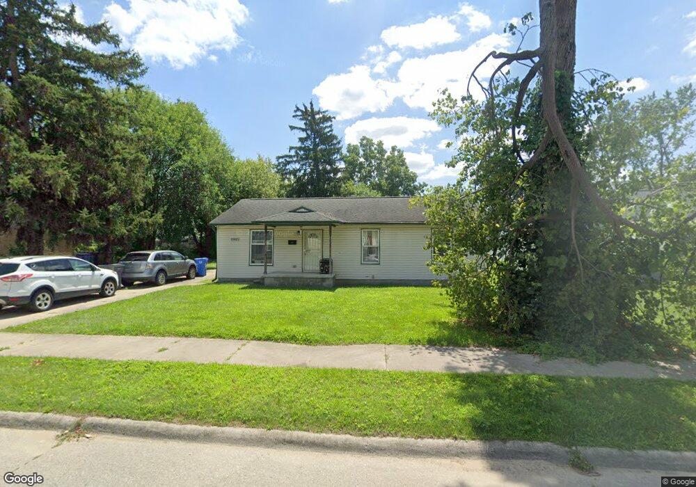
25925 Andover St Unit Bldg-Unit Inkster, MI 48141
Estimated Value: $86,000 - $139,635
3
Beds
1
Bath
1,008
Sq Ft
$123/Sq Ft
Est. Value
About This Home
This home is located at 25925 Andover St Unit Bldg-Unit, Inkster, MI 48141 and is currently estimated at $123,909, approximately $122 per square foot. 25925 Andover St Unit Bldg-Unit is a home located in Wayne County with nearby schools including West Village Academy and Peterson-Warren Academy.
Ownership History
Date
Name
Owned For
Owner Type
Purchase Details
Closed on
May 27, 2020
Sold by
Garner Lawrence M and Garner Brenda F
Bought by
Lawrence M Garner And Brenda F Garner Revocab and Garner
Current Estimated Value
Purchase Details
Closed on
Sep 16, 2009
Sold by
Myrick Glenn A
Bought by
Garner Lawrence M
Purchase Details
Closed on
Mar 20, 2008
Sold by
Garner Lawrence M and Garner Brenda F
Bought by
Garner Properties & Management Llc
Purchase Details
Closed on
Oct 1, 2002
Sold by
Barton Charles G
Bought by
Garner Lawrence M
Create a Home Valuation Report for This Property
The Home Valuation Report is an in-depth analysis detailing your home's value as well as a comparison with similar homes in the area
Home Values in the Area
Average Home Value in this Area
Purchase History
| Date | Buyer | Sale Price | Title Company |
|---|---|---|---|
| Lawrence M Garner And Brenda F Garner Revocab | -- | None Listed On Document | |
| Garner Lawrence M | -- | None Available | |
| Garner Properties & Management Llc | -- | None Available | |
| Garner Lawrence M | $27,000 | Michigan Title Insurance Age |
Source: Public Records
Tax History Compared to Growth
Tax History
| Year | Tax Paid | Tax Assessment Tax Assessment Total Assessment is a certain percentage of the fair market value that is determined by local assessors to be the total taxable value of land and additions on the property. | Land | Improvement |
|---|---|---|---|---|
| 2025 | $1,525 | $67,500 | $0 | $0 |
| 2024 | $1,525 | $55,100 | $0 | $0 |
| 2023 | $1,472 | $44,400 | $0 | $0 |
| 2022 | $2,022 | $35,900 | $0 | $0 |
| 2021 | $2,106 | $32,500 | $0 | $0 |
| 2020 | $2,058 | $27,800 | $0 | $0 |
| 2019 | $1,980 | $24,000 | $0 | $0 |
| 2018 | $1,336 | $22,100 | $0 | $0 |
| 2017 | $1,053 | $21,200 | $0 | $0 |
| 2016 | $1,926 | $21,900 | $0 | $0 |
| 2015 | $2,070 | $20,700 | $0 | $0 |
| 2013 | $2,600 | $26,000 | $0 | $0 |
| 2012 | $1,376 | $28,600 | $3,900 | $24,700 |
Source: Public Records
Map
Nearby Homes
- 25866 Andover St
- 25719 Colgate St
- 26202 Colgate St
- 26231 Andover St
- 26132 Kitch St
- 25895 Annapolis St
- 26419 Carlysle St
- 26225 McDonald St
- 25243 Lehigh St
- 26458 Hopkins St
- 25474 McDonald St
- 26439 Hopkins St
- 25212 Lehigh St
- 26645 Ross St
- 25716 Notre Dame St
- 25085 Colgate St
- 26653 Ross St
- 26773 Colgate St
- 25452 Notre Dame St
- 26106 Powers Ave
- 25925 Andover St
- 25909 Andover St
- 25863 Andover St
- VACANT LAN Harrison & Andover
- VACANT LAND Harrison & Andover
- 25950 Andover St
- 25912 Andover St
- 25924 Andover St
- 25949 Andover St
- 25900 Andover St
- 25936 Andover St
- 25841 Andover St
- 25920 Colgate St
- 25948 Andover St
- 25922 Colgate St
- 25948 Colgate St
- 25958 Colgate St
- 25910 Colgate St
- 25955 Andover St
- 25854 Colgate St