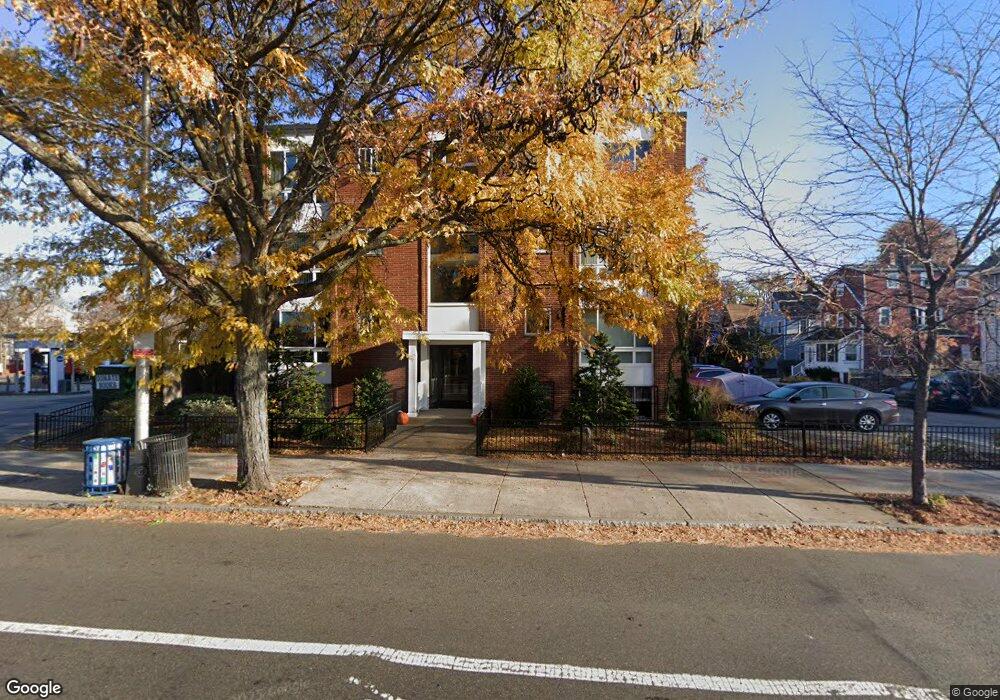
2595 Massachusetts Ave Unit 8 Cambridge, MA 02140
North Cambridge NeighborhoodEstimated Value: $362,000 - $570,000
1
Bed
1
Bath
555
Sq Ft
$830/Sq Ft
Est. Value
About This Home
This home is located at 2595 Massachusetts Ave Unit 8, Cambridge, MA 02140 and is currently estimated at $460,508, approximately $829 per square foot. 2595 Massachusetts Ave Unit 8 is a home located in Middlesex County with nearby schools including Benjamin Banneker Charter Public School, International School of Boston, and Lesley Ellis School.
Ownership History
Date
Name
Owned For
Owner Type
Purchase Details
Closed on
May 1, 2000
Sold by
Brown Earl K
Bought by
Cascap Rlty Inc
Current Estimated Value
Purchase Details
Closed on
Jun 15, 1988
Sold by
Mannarino Thomas P
Bought by
Brown Earl K
Home Financials for this Owner
Home Financials are based on the most recent Mortgage that was taken out on this home.
Original Mortgage
$45,000
Interest Rate
10.24%
Mortgage Type
Purchase Money Mortgage
Create a Home Valuation Report for This Property
The Home Valuation Report is an in-depth analysis detailing your home's value as well as a comparison with similar homes in the area
Home Values in the Area
Average Home Value in this Area
Purchase History
| Date | Buyer | Sale Price | Title Company |
|---|---|---|---|
| Cascap Rlty Inc | $112,000 | -- | |
| Brown Earl K | $95,000 | -- |
Source: Public Records
Mortgage History
| Date | Status | Borrower | Loan Amount |
|---|---|---|---|
| Previous Owner | Brown Earl K | $45,000 |
Source: Public Records
Tax History Compared to Growth
Tax History
| Year | Tax Paid | Tax Assessment Tax Assessment Total Assessment is a certain percentage of the fair market value that is determined by local assessors to be the total taxable value of land and additions on the property. | Land | Improvement |
|---|---|---|---|---|
| 2025 | $2,506 | $394,700 | $0 | $394,700 |
| 2024 | $2,242 | $378,700 | $0 | $378,700 |
| 2023 | $2,315 | $395,100 | $0 | $395,100 |
| 2022 | $2,331 | $393,700 | $0 | $393,700 |
| 2021 | $2,253 | $385,200 | $0 | $385,200 |
| 2020 | $2,226 | $387,200 | $0 | $387,200 |
| 2019 | $2,140 | $360,300 | $0 | $360,300 |
| 2018 | $2,089 | $332,100 | $0 | $332,100 |
| 2017 | $1,969 | $303,400 | $0 | $303,400 |
| 2016 | $1,861 | $266,200 | $0 | $266,200 |
| 2015 | $1,844 | $235,800 | $0 | $235,800 |
| 2014 | $1,827 | $218,000 | $0 | $218,000 |
Source: Public Records
Map
Nearby Homes
- 23 Brookford St
- 23 Brookford St Unit 2
- 23 Brookford St Unit 1
- 19 Cottage Park Ave
- 3 Seagrave Rd
- 97 Elmwood St Unit 313
- 97 Elmwood St Unit 110
- 97 Elmwood St Unit 310
- 127 Harvey St
- 127 Harvey St Unit 127
- 24 Washburn Ave Unit 1
- 57 Garrison Ave
- 69 Harvey St Unit 1
- 69 Clarendon Ave Unit A
- 39 Seven Pines Ave
- 112 Jackson St
- 67-69 Cameron Ave
- 124 Jackson St
- 32 Cameron Ave
- 22 Harrington Rd
- 2595 Massachusetts Ave Unit 18
- 2595 Massachusetts Ave Unit 17
- 2595 Massachusetts Ave Unit 16
- 2595 Massachusetts Ave Unit 15
- 2591 Massachusetts Ave Unit 14
- 2595 Massachusetts Ave Unit 13
- 2595 Massachusetts Ave Unit 12
- 2595 Massachusetts Ave Unit 11
- 2595 Massachusetts Ave Unit 10
- 2595 Massachusetts Ave Unit 9
- 2595 Massachusetts Ave Unit 7
- 2595 Massachusetts Ave Unit 6
- 2595 Massachusetts Ave Unit 5
- 2595 Massachusetts Ave Unit 4
- 2595 Massachusetts Ave Unit 3
- 2595 Massachusetts Ave Unit 2
- 2591 Massachusetts Ave Unit 1
- 2595 Massahusetts Ave Unit 2
- 2595 Massachusetts Ave Unit F
- 4 Gladstone St