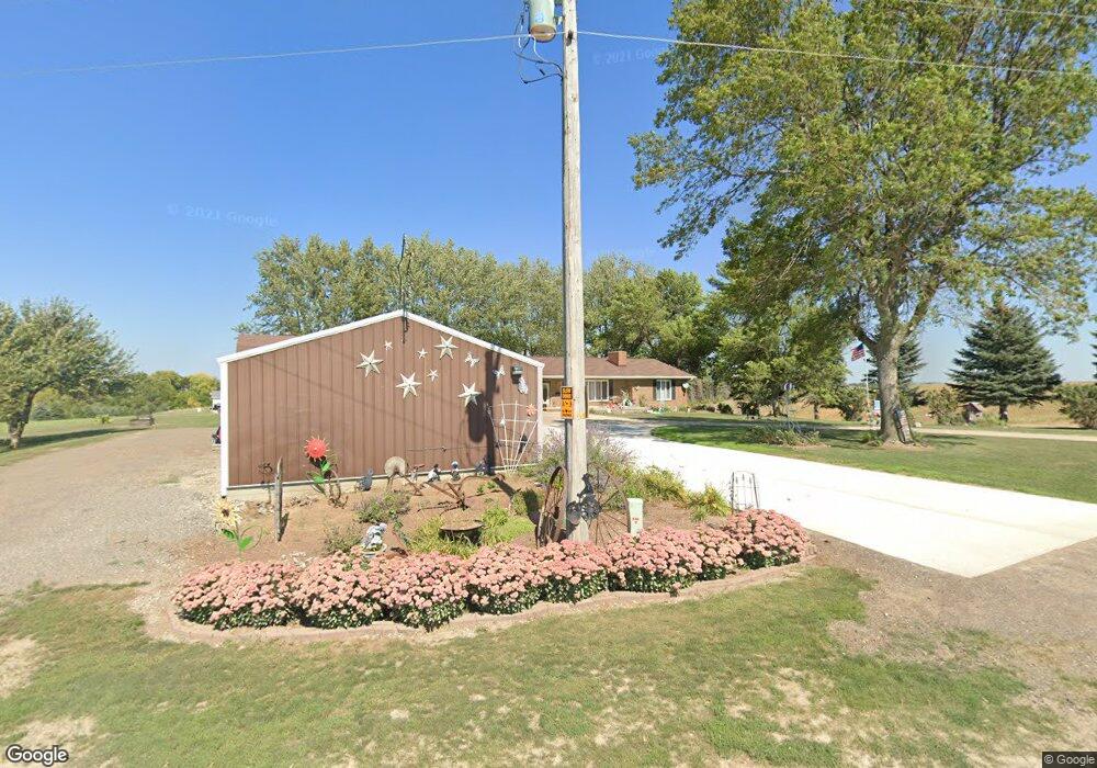
2596 S Main Loop Denison, IA 51442
Estimated Value: $381,000 - $415,488
3
Beds
2
Baths
1,881
Sq Ft
$210/Sq Ft
Est. Value
About This Home
This home is located at 2596 S Main Loop, Denison, IA 51442 and is currently estimated at $394,122, approximately $209 per square foot. 2596 S Main Loop is a home located in Crawford County with nearby schools including Denison Elementary School, Broadway Elementary School, and Denison Middle School.
Ownership History
Date
Name
Owned For
Owner Type
Purchase Details
Closed on
Nov 9, 2012
Sold by
Swason Elizabeth L
Bought by
Buria Jeffrey L and Stover La Vonne F
Current Estimated Value
Home Financials for this Owner
Home Financials are based on the most recent Mortgage that was taken out on this home.
Original Mortgage
$204,250
Outstanding Balance
$140,366
Interest Rate
3.35%
Mortgage Type
New Conventional
Estimated Equity
$253,756
Create a Home Valuation Report for This Property
The Home Valuation Report is an in-depth analysis detailing your home's value as well as a comparison with similar homes in the area
Purchase History
| Date | Buyer | Sale Price | Title Company |
|---|---|---|---|
| Buria Jeffrey L | $215,000 | None Available |
Source: Public Records
Mortgage History
| Date | Status | Borrower | Loan Amount |
|---|---|---|---|
| Open | Buria Jeffrey L | $204,250 |
Source: Public Records
Tax History
| Year | Tax Paid | Tax Assessment Tax Assessment Total Assessment is a certain percentage of the fair market value that is determined by local assessors to be the total taxable value of land and additions on the property. | Land | Improvement |
|---|---|---|---|---|
| 2025 | $3,996 | $381,440 | $56,780 | $324,660 |
| 2024 | $3,996 | $374,870 | $56,780 | $318,090 |
| 2023 | $4,060 | $374,870 | $56,780 | $318,090 |
| 2022 | $4,156 | $310,130 | $56,780 | $253,350 |
| 2021 | $4,062 | $307,230 | $56,780 | $250,450 |
| 2020 | $4,048 | $275,250 | $39,400 | $235,850 |
| 2019 | $3,962 | $258,350 | $29,400 | $228,950 |
| 2018 | $3,886 | $258,350 | $29,400 | $228,950 |
| 2017 | $3,886 | $258,350 | $29,400 | $228,950 |
| 2016 | $3,776 | $248,400 | $0 | $0 |
| 2015 | $3,776 | $237,730 | $0 | $0 |
| 2014 | $3,618 | $225,530 | $0 | $0 |
Source: Public Records
Map
Nearby Homes
- 2541 Donna Reed Rd
- Lot 9 Donna Reed Rd
- 1526 S Main St
- 1510 S Main St
- Lot 2 Donna Reed Rd
- 1200 S 15th St
- 1310 City View Dr
- 2910 Highway 30 E
- 102 S 27th St
- 714 S 25th St
- 702 S 25th St
- 712 S 25th St
- 718 S 25th St
- 706 S 25th St
- 113 Morningview St
- 222 S 15th St Unit A
- 120 N 24th St
- 206 S 14th St
- 116 N 19th St
- 1722 1st Ave N
- 2594 S Main Loop
- 2592 S Main Loop
- 2588 S Main Loop
- 2802 S Main Loop
- 2580 Donna Reed Rd
- 2535 Donna Reed Rd
- 2531 Donna Reed Rd
- 2582 S Main Loop
- 2530 Donna Reed Rd
- 2526 Donna Reed Rd
- 2519 Donna Reed Rd
- 2563 S Main Loop
- 2511 Donna Reed Rd
- 2503 Donna Reed Rd
- 2520 Donna Reed Rd
- 2501 Donna Reed Rd
- 1 S Main Loop
- 0 P Ave
- 0 Donna Reed Rd
- Lot 8 Donna Reed Rd
Your Personal Tour Guide
Ask me questions while you tour the home.