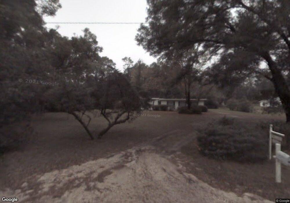
2596 Whitehurst Rd Deland, FL 32720
North DeLand NeighborhoodEstimated Value: $272,000 - $326,097
3
Beds
2
Baths
1,328
Sq Ft
$220/Sq Ft
Est. Value
About This Home
This home is located at 2596 Whitehurst Rd, Deland, FL 32720 and is currently estimated at $292,774, approximately $220 per square foot. 2596 Whitehurst Rd is a home located in Volusia County with nearby schools including Citrus Grove Elementary, Deland High School, and Southwestern Middle School.
Ownership History
Date
Name
Owned For
Owner Type
Purchase Details
Closed on
Apr 19, 2013
Sold by
Sargent Deborah G and Sargent Richard
Bought by
Armandi Conrad A and Armandi Glenda F
Current Estimated Value
Purchase Details
Closed on
Mar 22, 2007
Sold by
Armandi Conrad A and Armandi Glenda F
Bought by
Beaty Robert W and Beaty Donna E
Home Financials for this Owner
Home Financials are based on the most recent Mortgage that was taken out on this home.
Original Mortgage
$170,000
Interest Rate
6.27%
Mortgage Type
Purchase Money Mortgage
Purchase Details
Closed on
Aug 6, 2002
Sold by
Heaney Marjorie S
Bought by
Heaney Marjorie S
Create a Home Valuation Report for This Property
The Home Valuation Report is an in-depth analysis detailing your home's value as well as a comparison with similar homes in the area
Home Values in the Area
Average Home Value in this Area
Purchase History
| Date | Buyer | Sale Price | Title Company |
|---|---|---|---|
| Armandi Conrad A | $50,000 | Dba Volusia Title Services | |
| Beaty Robert W | $245,000 | Volusia Title Services | |
| Heaney Marjorie S | -- | -- |
Source: Public Records
Mortgage History
| Date | Status | Borrower | Loan Amount |
|---|---|---|---|
| Previous Owner | Beaty Robert W | $170,000 |
Source: Public Records
Tax History Compared to Growth
Tax History
| Year | Tax Paid | Tax Assessment Tax Assessment Total Assessment is a certain percentage of the fair market value that is determined by local assessors to be the total taxable value of land and additions on the property. | Land | Improvement |
|---|---|---|---|---|
| 2025 | $2,344 | $196,563 | -- | -- |
| 2024 | $2,344 | $191,024 | -- | -- |
| 2023 | $2,344 | $185,461 | $0 | $0 |
| 2022 | $2,270 | $180,059 | $0 | $0 |
| 2021 | $2,327 | $174,815 | $0 | $0 |
| 2020 | $2,290 | $172,401 | $0 | $0 |
| 2019 | $2,340 | $168,525 | $0 | $0 |
| 2018 | $2,324 | $165,383 | $32,670 | $132,713 |
| 2017 | $633 | $68,535 | $26,136 | $42,399 |
| 2016 | $1,761 | $69,405 | $0 | $0 |
| 2015 | -- | $67,193 | $0 | $0 |
| 2014 | -- | $55,374 | $0 | $0 |
Source: Public Records
Map
Nearby Homes
- 1149 Glenwood Trail
- 1130 Glenwood Trail
- 1460 Glenwood Rd
- 3221 Oaklea Dr
- 1480 Gaudrey St
- 1420 Trinidad St
- 1555 Mercers Fernery Rd
- 2680 Concord Rd
- 1580 Trinidad St
- 753 Glenwood Rd
- 1540 Ashley Oaks Dr
- 1105 Burgoyne Rd
- 2172 N Spring Garden Ave
- 2850 Green Mountain Rd
- 2836 Shenandoah Rd
- 1075 Burgoyne Rd
- 975 Rolling Acres Dr
- 2541 Parkway Dr
- 1751 Salvadore St
- 1830 Saint Charles Terrace
- 2584 Whitehurst Rd
- Whitehurst Rd
- 2616 Whitehurst Rd
- 1195 Heidi Ct
- 1187 Heidi Ct
- 2626 Whitehurst Rd
- 2578 Whitehurst Rd
- 2580 Whitehurst Rd
- 1198 Glenwood Trail
- 1214 Glenwood Rd
- 1190 Glenwood Trail
- 1171 Heidi Ct
- 1216 Glenwood Rd
- 1192 Heidi Ct
- 1192 Glenwood Rd
- 1192 Glenwood Rd Unit 2
- 2521 Whitehurst Rd
- 1182 Glenwood Trail
- 1184 Heidi Ct
- 2676 Whitehurst Rd