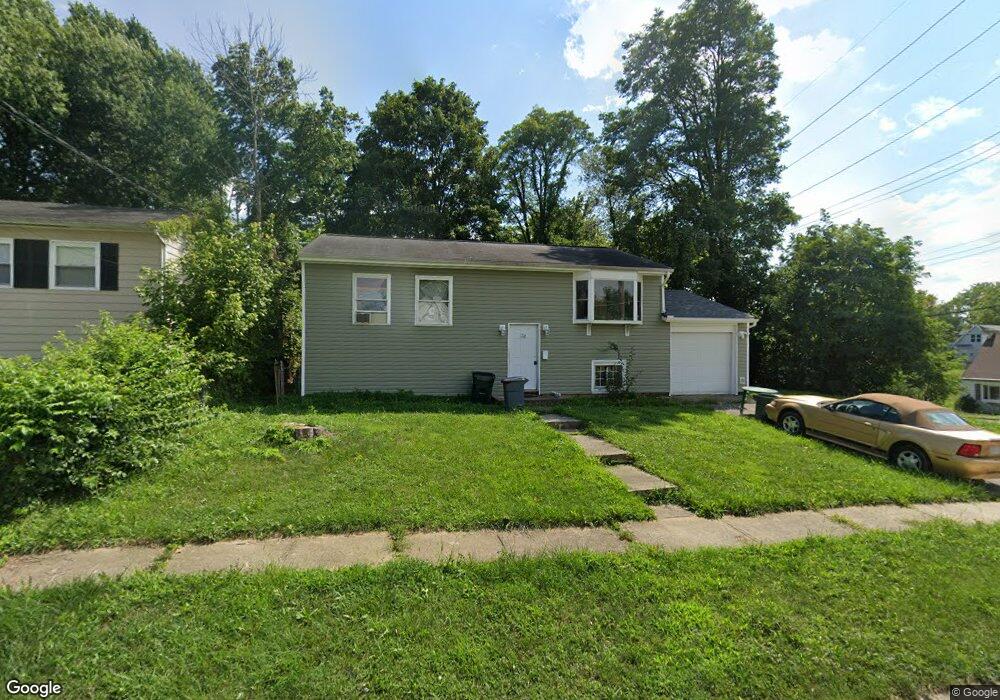
2597 Berthbrook Dr Cincinnati, OH 45231
New Burlington NeighborhoodEstimated Value: $190,560 - $232,000
3
Beds
1
Bath
1,908
Sq Ft
$109/Sq Ft
Est. Value
About This Home
This home is located at 2597 Berthbrook Dr, Cincinnati, OH 45231 and is currently estimated at $208,640, approximately $109 per square foot. 2597 Berthbrook Dr is a home located in Hamilton County with nearby schools including Mt Healthy High School, Hamilton County Mathematics and Science Academy, and Central Montessori Academy.
Ownership History
Date
Name
Owned For
Owner Type
Purchase Details
Closed on
Jun 15, 1995
Sold by
Va
Bought by
Bitter James L and Bitter Rhonda S
Current Estimated Value
Home Financials for this Owner
Home Financials are based on the most recent Mortgage that was taken out on this home.
Original Mortgage
$40,800
Interest Rate
7.9%
Purchase Details
Closed on
Oct 19, 1994
Sold by
Leis Simon L and Ellis Bobby R
Bought by
Va
Create a Home Valuation Report for This Property
The Home Valuation Report is an in-depth analysis detailing your home's value as well as a comparison with similar homes in the area
Home Values in the Area
Average Home Value in this Area
Purchase History
| Date | Buyer | Sale Price | Title Company |
|---|---|---|---|
| Bitter James L | -- | -- | |
| Va | $32,000 | -- |
Source: Public Records
Mortgage History
| Date | Status | Borrower | Loan Amount |
|---|---|---|---|
| Closed | Bitter James L | $40,800 |
Source: Public Records
Tax History
| Year | Tax Paid | Tax Assessment Tax Assessment Total Assessment is a certain percentage of the fair market value that is determined by local assessors to be the total taxable value of land and additions on the property. | Land | Improvement |
|---|---|---|---|---|
| 2025 | $2,110 | $49,431 | $7,952 | $41,479 |
| 2024 | $2,495 | $49,431 | $7,952 | $41,479 |
| 2023 | $2,518 | $49,431 | $7,952 | $41,479 |
| 2022 | $1,938 | $27,532 | $7,249 | $20,283 |
| 2021 | $1,891 | $27,532 | $7,249 | $20,283 |
| 2020 | $1,911 | $27,532 | $7,249 | $20,283 |
| 2019 | $1,760 | $23,332 | $6,143 | $17,189 |
| 2018 | $1,771 | $23,332 | $6,143 | $17,189 |
| 2017 | $1,680 | $23,332 | $6,143 | $17,189 |
| 2016 | $1,778 | $24,581 | $7,795 | $16,786 |
| 2015 | $1,790 | $24,581 | $7,795 | $16,786 |
| 2014 | $1,780 | $24,581 | $7,795 | $16,786 |
| 2013 | $1,857 | $26,720 | $8,474 | $18,246 |
Source: Public Records
Map
Nearby Homes
- 2792 Wheatfield Dr
- 10061 Sturgeon Ln
- 10073 Pippin Rd
- 9925 Grasscreek Ct
- 2752 Mancelona Ct
- 9846 Pinedale Dr
- 2528 Mariposa St
- 2610 Niagara St
- 9632 Sacramento St
- 2773 Grosvenor Dr
- 3013 Niagara St
- 9500 Ridgemoor Ave
- 9561 Trafalgar Ct
- 2317 Magdalena Dr
- 3099 Niagara St
- 2585 Fulbourne Dr
- 2005 Miles Rd
- 10287 Springlen Ct
- 2908 Libra Ln
- 9391 Jericho Dr
- 2589 Berthbrook Dr
- 2596 Berthbrook Dr
- 9880 Pippin Rd
- 2577 Berthbrook Dr
- 9891 Pippin Rd
- 9901 Pippin Rd
- 2590 Berthbrook Dr
- 2569 Berthbrook Dr
- 2499 Schon Dr
- 9881 Pippin Rd
- 2578 Berthbrook Dr
- 2497 Schon Dr
- 9870 Pippin Rd
- 2557 Berthbrook Dr
- 2570 Berthbrook Dr
- 2558 Berthbrook Dr
- 2549 Berthbrook Dr
- 9928 Pippin Rd
- 2498 Schon Dr
- 2493 Schon Dr
Your Personal Tour Guide
Ask me questions while you tour the home.