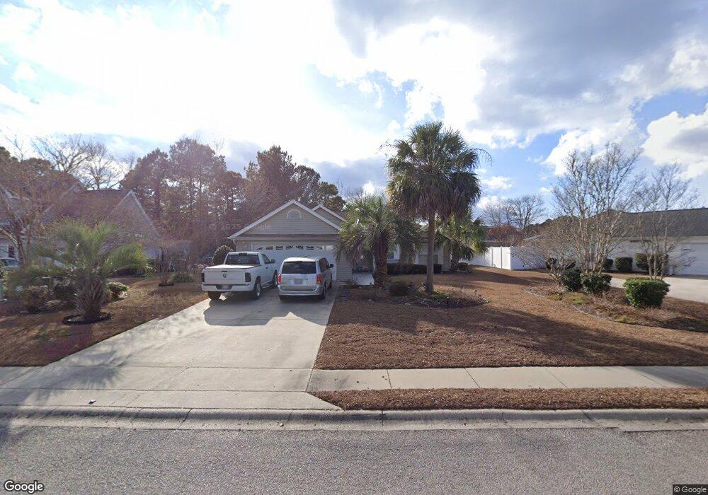
2597 Buck Scrape Rd Myrtle Beach, SC 29588
Estimated Value: $266,000 - $310,000
3
Beds
2
Baths
1,340
Sq Ft
$216/Sq Ft
Est. Value
About This Home
This home is located at 2597 Buck Scrape Rd, Myrtle Beach, SC 29588 and is currently estimated at $289,126, approximately $215 per square foot. 2597 Buck Scrape Rd is a home located in Horry County with nearby schools including Forestbrook Elementary School, Forestbrook Middle School, and Socastee High School.
Ownership History
Date
Name
Owned For
Owner Type
Purchase Details
Closed on
Aug 7, 2000
Sold by
Royal Oaks Construction Inc
Bought by
Dunning Colin and Dunning Barbara
Current Estimated Value
Home Financials for this Owner
Home Financials are based on the most recent Mortgage that was taken out on this home.
Original Mortgage
$103,900
Outstanding Balance
$34,909
Interest Rate
8.17%
Mortgage Type
Unknown
Estimated Equity
$254,217
Create a Home Valuation Report for This Property
The Home Valuation Report is an in-depth analysis detailing your home's value as well as a comparison with similar homes in the area
Home Values in the Area
Average Home Value in this Area
Purchase History
We collect this data history from publicly available records. To have your information removed, we recommend requesting removal directly through your county’s website.
| Date | Buyer | Sale Price | Title Company |
|---|---|---|---|
| Dunning Colin | $129,900 | -- |
Source: Public Records
Mortgage History
We collect this data history from publicly available records. To have your information removed, we recommend requesting removal directly through your county’s website.
| Date | Status | Borrower | Loan Amount |
|---|---|---|---|
| Open | Dunning Colin | $103,900 |
Source: Public Records
Tax History
| Year | Tax Paid | Tax Assessment Tax Assessment Total Assessment is a certain percentage of the fair market value that is determined by local assessors to be the total taxable value of land and additions on the property. | Land | Improvement |
|---|---|---|---|---|
| 2025 | $527 | $0 | $0 | $0 |
| 2024 | $527 | $11,006 | $4,000 | $7,006 |
| 2023 | $527 | $5,877 | $1,068 | $4,809 |
| 2021 | $456 | $6,613 | $1,221 | $5,392 |
| 2020 | $382 | $6,613 | $1,221 | $5,392 |
| 2019 | $382 | $6,613 | $1,221 | $5,392 |
| 2018 | $323 | $5,110 | $922 | $4,188 |
| 2017 | $308 | $5,110 | $922 | $4,188 |
| 2016 | -- | $5,110 | $922 | $4,188 |
| 2015 | $308 | $5,110 | $922 | $4,188 |
| 2014 | $286 | $5,110 | $922 | $4,188 |
Source: Public Records
Map
Nearby Homes
- 2729 Canvasback Trail
- 2611 Ringneck Trail
- 2540 Bearstand Trail
- 2560 Wild Game Trail Unit Hunters Ridge
- 281 La Patos Dr
- 425 Dog Pen Ct
- 6096 Zoe Way Unit 819
- 6108 Zoe Way Unit 822
- 6100 Zoe Way Unit 820
- 2023 Felicity Place
- 629 Cottontail Trail Unit Hunters Ridge Crossi
- 125 Black Bear Rd
- 2425 Hunters Trail
- 6232 Zoe Way Unit 853
- 6144 Zoe Way Unit 831
- 6160 Zoe Way Unit 835
- 6104 Zoe Way Unit 821
- 6152 Zoe Way Unit 833
- 6285 Zoe Way Unit 864
- 6316 Zoe Way Unit 829
- 2599 Buck Scrape Rd
- 2741 Canvasback Trail
- 2593 Buck Scrape Rd
- 2602 Corn Pile Rd
- 2600 Corn Pile Rd
- 2604 Corn Pile Rd
- 2800 Six Shot Ct
- 2740 Canvasback Trail
- 2743 Canvasback Trail
- 2745 Canvasback Trail
- 2738 Canvasback Trail
- 2736 Canvasback Trail
- 2744 Canvasback Trail
- 2601 Corn Pile Rd
- 2601 Corn Pile Rd
- 2747 Canvasback Trail
- 2802 Six Shot Ct
- 2605 Corn Pile Rd
- 2734 Canvasback Trail
- 2803 Six Shot Ct
Your Personal Tour Guide
Ask me questions while you tour the home.