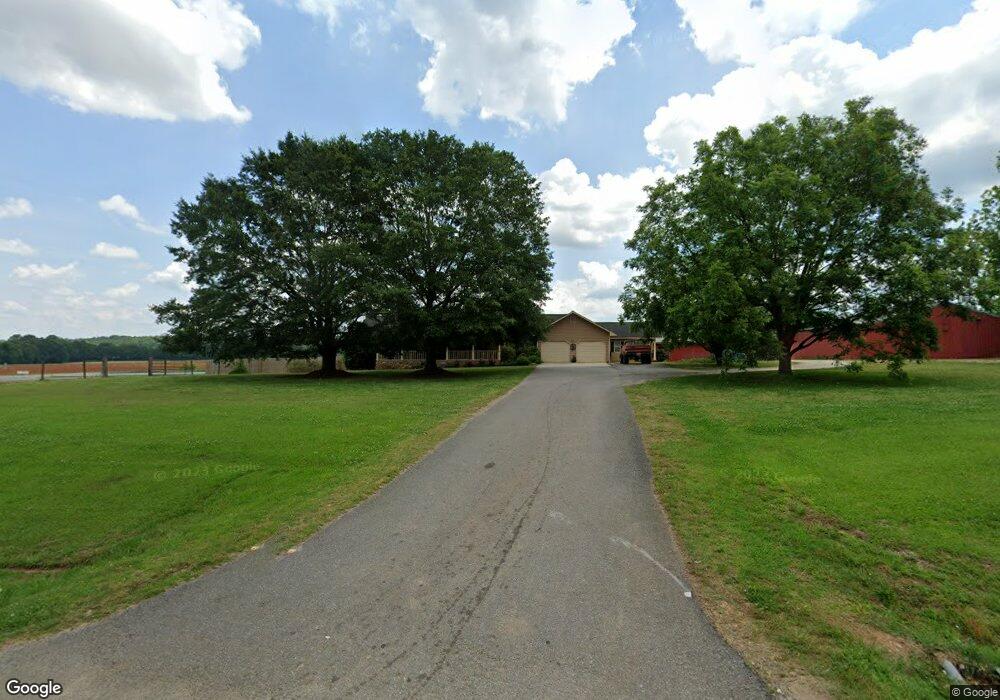
2597 Old State Highway 113 Taylorsville, GA 30178
Estimated Value: $340,273 - $591,000
3
Beds
4
Baths
2,646
Sq Ft
$186/Sq Ft
Est. Value
About This Home
This home is located at 2597 Old State Highway 113, Taylorsville, GA 30178 and is currently estimated at $492,068, approximately $185 per square foot. 2597 Old State Highway 113 is a home located in Bartow County with nearby schools including Taylorsville Elementary School, Woodland Middle School, and Woodland High School.
Ownership History
Date
Name
Owned For
Owner Type
Purchase Details
Closed on
Jan 12, 2024
Sold by
Gentry Bobby
Bought by
Gentry Bobby Lee and Gentry Lynne K
Current Estimated Value
Purchase Details
Closed on
Mar 3, 2020
Sold by
Gentry Bobby Lee
Bought by
Gentry Bobby Lee and Gentry Lynne K
Purchase Details
Closed on
Feb 28, 2017
Sold by
Gentry Lynne K
Bought by
Gentry Bobby Lee
Create a Home Valuation Report for This Property
The Home Valuation Report is an in-depth analysis detailing your home's value as well as a comparison with similar homes in the area
Home Values in the Area
Average Home Value in this Area
Purchase History
| Date | Buyer | Sale Price | Title Company |
|---|---|---|---|
| Gentry Bobby Lee | -- | -- | |
| Gentry Bobby Lee | -- | -- | |
| Gentry Bobby Lee | -- | -- |
Source: Public Records
Tax History Compared to Growth
Tax History
| Year | Tax Paid | Tax Assessment Tax Assessment Total Assessment is a certain percentage of the fair market value that is determined by local assessors to be the total taxable value of land and additions on the property. | Land | Improvement |
|---|---|---|---|---|
| 2024 | $2,539 | $110,883 | $5,776 | $105,107 |
| 2023 | $2,539 | $104,011 | $3,522 | $100,489 |
| 2022 | $2,441 | $102,701 | $3,453 | $99,248 |
| 2021 | $1,941 | $79,380 | $3,453 | $75,927 |
| 2020 | $2,043 | $79,380 | $3,453 | $75,927 |
| 2019 | $1,901 | $73,480 | $2,120 | $71,360 |
| 2018 | $1,908 | $73,480 | $2,120 | $71,360 |
| 2017 | $1,917 | $73,480 | $2,120 | $71,360 |
| 2016 | $1,932 | $73,480 | $2,120 | $71,360 |
| 2015 | $1,476 | $57,240 | $2,120 | $55,120 |
| 2014 | $1,423 | $53,760 | $5,040 | $48,720 |
| 2013 | -- | $41,920 | $5,040 | $36,880 |
Source: Public Records
Map
Nearby Homes
- 18 Adair Dr
- 1594 Old Alabama Rd
- 2822 Old State Highway 113
- 103 Main St
- 2 Two Gun Bailey Rd
- 0 Two Gun Bailey Rd Unit 7298610
- Tract1 Big Pond Rd
- 94 Church St
- 1801 Old Alabama Rd
- 2920 Cartersville Hwy
- 24 Applewood Ln
- 84 Popham Rd
- 37 Jackson Road South W
- 0 Popham Rd Unit 7661846
- 0 Popham Rd Unit 10587111
- 0 Popham Rd Unit 22620358
- 367 Big Pond Rd
- 2716 Taylorsville Rd
- 0 Big Pond Road South W
- 47 Taff Rd
- 2597 Old State Highway 113
- 2601 Old State Highway 113
- 19 Siniard Dr
- 19 Siniard Dr
- 17 Siniard Dr
- 2651 Old State Highway 113
- 16 Siniard Dr
- 2671 Old State Highway 113
- 18 Paige Dr
- 16 Paige Dr
- 16 Paige Dr
- 15 Siniard Dr
- 19 Paige Dr
- 14 Paige Dr
- 17 Paige Dr
- 17 Paige Dr
- 17 Paige Dr
- 17 Paige Dr
- 16 Adair Dr
- 12 Siniard Dr