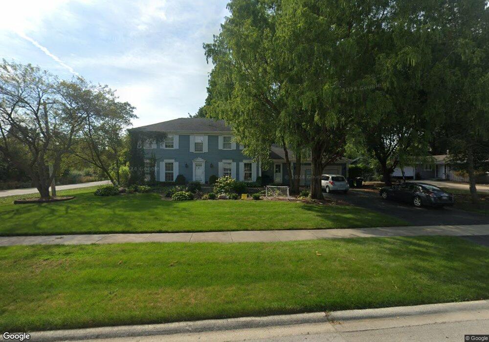
25W613 Red Maple Ln Unit 1 Wheaton, IL 60189
Arrowhead NeighborhoodEstimated Value: $811,051 - $1,110,000
4
Beds
4
Baths
3,142
Sq Ft
$291/Sq Ft
Est. Value
About This Home
This home is located at 25W613 Red Maple Ln Unit 1, Wheaton, IL 60189 and is currently estimated at $913,013, approximately $290 per square foot. 25W613 Red Maple Ln Unit 1 is a home located in DuPage County with nearby schools including Wiesbrook Elementary School, Hubble Middle School, and Wheaton Warrenville South High School.
Ownership History
Date
Name
Owned For
Owner Type
Purchase Details
Closed on
Apr 13, 2015
Sold by
Barg Thomas H and Barg Jennifer E
Bought by
Barg Thomas H and Barg Jennifer E
Current Estimated Value
Home Financials for this Owner
Home Financials are based on the most recent Mortgage that was taken out on this home.
Original Mortgage
$395,000
Outstanding Balance
$302,746
Interest Rate
3.62%
Mortgage Type
New Conventional
Estimated Equity
$610,267
Purchase Details
Closed on
Oct 28, 2011
Sold by
Armstrong Richard A and Armstrong Lynda S
Bought by
Barg Thomas H and Barg Jennifer E
Home Financials for this Owner
Home Financials are based on the most recent Mortgage that was taken out on this home.
Original Mortgage
$417,000
Interest Rate
4.09%
Mortgage Type
New Conventional
Purchase Details
Closed on
Dec 16, 1998
Sold by
Armstrong Richard A and Armstrong Miriam W
Bought by
Armstrong Richard A and Armstrong Lynda S
Home Financials for this Owner
Home Financials are based on the most recent Mortgage that was taken out on this home.
Original Mortgage
$240,000
Interest Rate
6.95%
Create a Home Valuation Report for This Property
The Home Valuation Report is an in-depth analysis detailing your home's value as well as a comparison with similar homes in the area
Home Values in the Area
Average Home Value in this Area
Purchase History
| Date | Buyer | Sale Price | Title Company |
|---|---|---|---|
| Barg Thomas H | -- | Carrington Title Partners Ll | |
| Barg Thomas H | $526,500 | Attorneys Title Guaranty Fun | |
| Armstrong Richard A | $350,000 | -- |
Source: Public Records
Mortgage History
| Date | Status | Borrower | Loan Amount |
|---|---|---|---|
| Open | Barg Thomas H | $395,000 | |
| Closed | Barg Thomas H | $417,000 | |
| Previous Owner | Armstrong Richard A | $240,000 |
Source: Public Records
Tax History
| Year | Tax Paid | Tax Assessment Tax Assessment Total Assessment is a certain percentage of the fair market value that is determined by local assessors to be the total taxable value of land and additions on the property. | Land | Improvement |
|---|---|---|---|---|
| 2024 | $13,231 | $234,652 | $36,123 | $198,529 |
| 2023 | $12,678 | $215,990 | $33,250 | $182,740 |
| 2022 | $12,268 | $204,120 | $31,420 | $172,700 |
| 2021 | $11,884 | $199,270 | $30,670 | $168,600 |
| 2020 | $11,778 | $197,410 | $30,380 | $167,030 |
| 2019 | $11,478 | $192,200 | $29,580 | $162,620 |
| 2018 | $11,311 | $190,550 | $27,880 | $162,670 |
| 2017 | $11,127 | $183,520 | $26,850 | $156,670 |
| 2016 | $10,988 | $176,190 | $25,780 | $150,410 |
| 2015 | $10,913 | $168,080 | $24,590 | $143,490 |
| 2014 | $10,616 | $160,640 | $29,600 | $131,040 |
| 2013 | $10,300 | $161,120 | $29,690 | $131,430 |
Source: Public Records
Map
Nearby Homes
- 26W055 Cree Ln
- 141 Loretto Ct
- 76 Somerset Cir
- 1127 Hibbard Rd
- 2552 Weatherbee Ln
- 30 Danada Dr
- 1605 Burning Trail
- 24 Winners Cup Cir Unit 3
- 1601 W Wiesbrook Rd
- 1612 Stonebridge Trail
- 121 Brighton Dr
- 1519 Foothill Dr
- 1245 Josiah Rd
- 3S700 Delles Rd
- Lot 1 Foothill Dr
- 1S538 Bayberry Ln
- 1028 Lodalia Ct
- 2043 Spring Green Dr
- 1440 Stonebridge Cir Unit J7
- 1442 Stonebridge Cir Unit I8
- 25W625 Red Maple Ln
- 25W614 Summerfield Ct
- 25W624 Summerfield Ct
- 25W634 Summerfield Ct
- 2000 Dorset Dr
- 25W641 Red Maple Ln
- 2006 Dorset Dr
- 25W614 Red Maple Ln
- 1992 Dorset Dr
- 25W628 Red Maple Ln
- 2012 Dorset Dr
- 25W644 Summerfield Ct
- 25W613 Summerfield Ct
- 1984 Dorset Dr Unit 7
- 25W627 Summerfield Ct
- 25W651 Red Maple Ln
- 25W640 Red Maple Ln
- 2018 Dorset Dr
- 25W641 Summerfield Ct Unit 4
- 25W646 Summerfield Ct
Your Personal Tour Guide
Ask me questions while you tour the home.