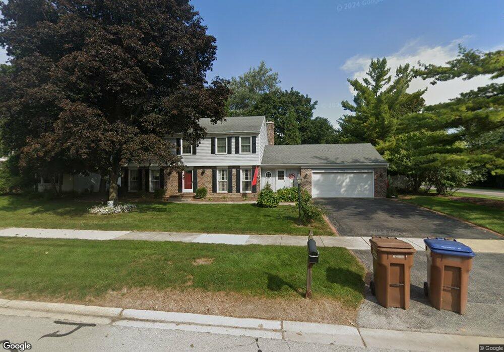
25W614 Red Maple Ln Wheaton, IL 60189
Arrowhead NeighborhoodEstimated Value: $701,000 - $851,000
4
Beds
3
Baths
2,616
Sq Ft
$291/Sq Ft
Est. Value
About This Home
This home is located at 25W614 Red Maple Ln, Wheaton, IL 60189 and is currently estimated at $760,247, approximately $290 per square foot. 25W614 Red Maple Ln is a home located in DuPage County with nearby schools including Wiesbrook Elementary School, Hubble Middle School, and Wheaton Warrenville South High School.
Ownership History
Date
Name
Owned For
Owner Type
Purchase Details
Closed on
May 19, 2014
Sold by
Telzrow Amy L
Bought by
Telzrow Jonathan J
Current Estimated Value
Purchase Details
Closed on
Oct 1, 2012
Sold by
Telzrow Jonathan J and Telzrow Amy L
Bought by
Telzrow Jonathan J and Telzrow Amy L
Home Financials for this Owner
Home Financials are based on the most recent Mortgage that was taken out on this home.
Original Mortgage
$391,000
Outstanding Balance
$271,519
Interest Rate
3.57%
Mortgage Type
New Conventional
Estimated Equity
$488,728
Purchase Details
Closed on
Mar 13, 2007
Sold by
Johnston David and Johnston Georgia
Bought by
Telzrow Jonathan J
Home Financials for this Owner
Home Financials are based on the most recent Mortgage that was taken out on this home.
Original Mortgage
$384,000
Interest Rate
6.27%
Mortgage Type
Purchase Money Mortgage
Create a Home Valuation Report for This Property
The Home Valuation Report is an in-depth analysis detailing your home's value as well as a comparison with similar homes in the area
Home Values in the Area
Average Home Value in this Area
Purchase History
| Date | Buyer | Sale Price | Title Company |
|---|---|---|---|
| Telzrow Jonathan J | -- | None Available | |
| Telzrow Jonathan J | -- | Old Republic National Title | |
| Telzrow Jonathan J | $480,000 | None Available |
Source: Public Records
Mortgage History
| Date | Status | Borrower | Loan Amount |
|---|---|---|---|
| Open | Telzrow Jonathan J | $391,000 | |
| Closed | Telzrow Jonathan J | $384,000 |
Source: Public Records
Tax History
| Year | Tax Paid | Tax Assessment Tax Assessment Total Assessment is a certain percentage of the fair market value that is determined by local assessors to be the total taxable value of land and additions on the property. | Land | Improvement |
|---|---|---|---|---|
| 2024 | $12,320 | $219,051 | $36,123 | $182,928 |
| 2023 | $11,803 | $201,630 | $33,250 | $168,380 |
| 2022 | $11,427 | $190,550 | $31,420 | $159,130 |
| 2021 | $11,069 | $186,020 | $30,670 | $155,350 |
| 2020 | $10,674 | $184,280 | $30,380 | $153,900 |
| 2019 | $10,402 | $179,420 | $29,580 | $149,840 |
| 2018 | $9,714 | $169,060 | $27,880 | $141,180 |
| 2017 | $9,553 | $162,820 | $26,850 | $135,970 |
| 2016 | $9,433 | $152,100 | $25,780 | $126,320 |
| 2015 | $9,366 | $145,100 | $24,590 | $120,510 |
| 2014 | $8,364 | $127,840 | $29,600 | $98,240 |
| 2013 | $8,116 | $128,230 | $29,690 | $98,540 |
Source: Public Records
Map
Nearby Homes
- 25W773 Sunnyridge Ct
- 2S671 Arrowhead Dr
- 141 Loretto Ct
- 2631 Weatherbee Ln
- 1127 Hibbard Rd
- 1605 Burning Trail
- 30 Danada Dr
- 1620 Hemstock Ave
- 1601 W Wiesbrook Rd
- 1612 Stonebridge Trail
- 2099 Creekside Dr Unit 1-4
- Lot 1 Foothill Dr
- 1028 Lodalia Ct
- 1420 Stonebridge Trail Unit 1-3
- 2043 Spring Green Dr
- 1533 S County Farm Rd Unit 1-4
- 1442 Stonebridge Cir Unit I8
- 1462 Stonebridge Cir Unit F10
- 1219 Golf Ln
- 1974 Wexford Cir Unit 123
- 25W628 Red Maple Ln
- 1984 Dorset Dr Unit 7
- 25W640 Red Maple Ln
- 1378 Colonial Square
- 1992 Dorset Dr
- 25W613 Red Maple Ln Unit 1
- 25W625 Red Maple Ln
- 1970 Orchard Rd
- 2000 Dorset Dr
- 25W652 Red Maple Ln
- 25W641 Red Maple Ln
- 1968 Dorset Dr
- 2S580 Orchard Rd
- 2006 Dorset Dr
- 25W614 Summerfield Ct
- 25W624 Summerfield Ct
- 97 Landon Cir
- 25W651 Red Maple Ln
- 25W634 Summerfield Ct
- 91 Landon Cir
Your Personal Tour Guide
Ask me questions while you tour the home.