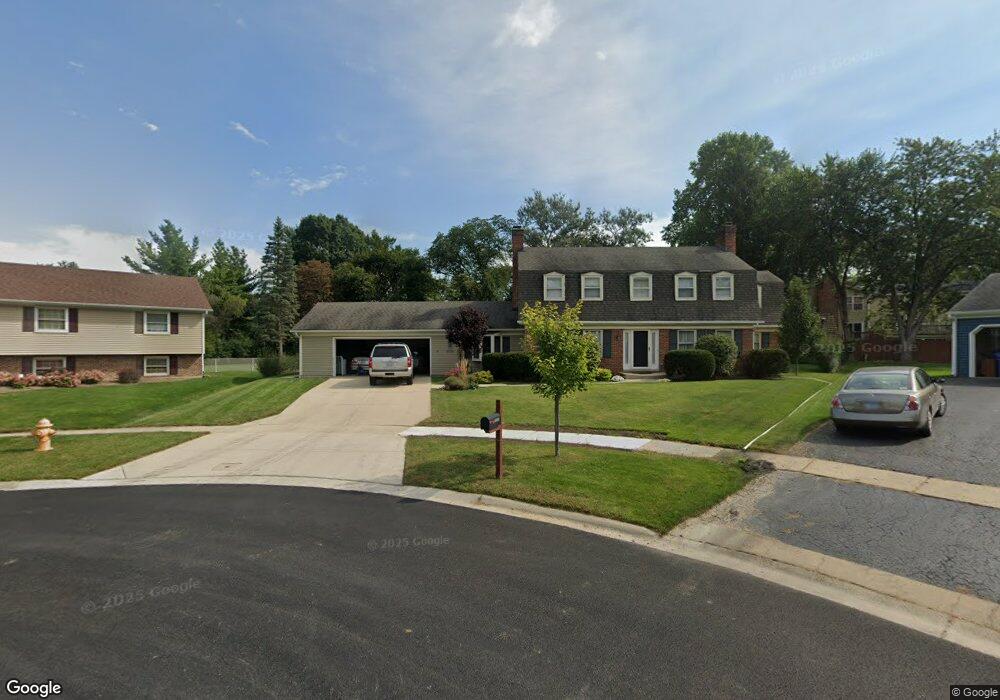
25W638 Towpath Ct Wheaton, IL 60189
Arrowhead NeighborhoodEstimated Value: $726,000 - $895,000
4
Beds
4
Baths
3,336
Sq Ft
$241/Sq Ft
Est. Value
About This Home
This home is located at 25W638 Towpath Ct, Wheaton, IL 60189 and is currently estimated at $805,336, approximately $241 per square foot. 25W638 Towpath Ct is a home located in DuPage County with nearby schools including Wiesbrook Elementary School, Hubble Middle School, and Wheaton Warrenville South High School.
Ownership History
Date
Name
Owned For
Owner Type
Purchase Details
Closed on
May 24, 2006
Sold by
Lyzinski David and Lyzinski Lydia T
Bought by
Edenburn Eric E and Enger Edenburn Jennifer R
Current Estimated Value
Home Financials for this Owner
Home Financials are based on the most recent Mortgage that was taken out on this home.
Original Mortgage
$315,000
Outstanding Balance
$185,134
Interest Rate
6.66%
Mortgage Type
Fannie Mae Freddie Mac
Estimated Equity
$620,202
Create a Home Valuation Report for This Property
The Home Valuation Report is an in-depth analysis detailing your home's value as well as a comparison with similar homes in the area
Home Values in the Area
Average Home Value in this Area
Purchase History
We collect this data history from publicly available records. To have your information removed, we recommend requesting removal directly through your county’s website.
| Date | Buyer | Sale Price | Title Company |
|---|---|---|---|
| Edenburn Eric E | $475,500 | Atg |
Source: Public Records
Mortgage History
We collect this data history from publicly available records. To have your information removed, we recommend requesting removal directly through your county’s website.
| Date | Status | Borrower | Loan Amount |
|---|---|---|---|
| Open | Edenburn Eric E | $315,000 |
Source: Public Records
Tax History
| Year | Tax Paid | Tax Assessment Tax Assessment Total Assessment is a certain percentage of the fair market value that is determined by local assessors to be the total taxable value of land and additions on the property. | Land | Improvement |
|---|---|---|---|---|
| 2024 | $13,875 | $225,309 | $36,134 | $189,175 |
| 2023 | $13,289 | $207,390 | $33,260 | $174,130 |
| 2022 | $12,848 | $195,990 | $31,430 | $164,560 |
| 2021 | $12,731 | $191,340 | $30,680 | $160,660 |
| 2020 | $12,653 | $189,550 | $30,390 | $159,160 |
| 2019 | $12,332 | $184,550 | $29,590 | $154,960 |
| 2018 | $12,437 | $186,890 | $27,880 | $159,010 |
| 2017 | $12,240 | $179,990 | $26,850 | $153,140 |
| 2016 | $12,086 | $172,800 | $25,780 | $147,020 |
| 2015 | $12,010 | $164,850 | $24,590 | $140,260 |
| 2014 | $10,262 | $139,110 | $27,600 | $111,510 |
| 2013 | $9,948 | $139,530 | $27,680 | $111,850 |
Source: Public Records
Map
Nearby Homes
- 1862 W Wiesbrook Rd
- 1570 Orchard Rd
- 1601 W Wiesbrook Rd
- 81 Landon Cir
- 1519 Foothill Dr
- 1262 Midwest Ln
- 141 Loretto Ct
- 2101 Timber Ln
- 2105 Timber Ln
- 1520 Stonebridge Trail Unit 2-1
- 26W421 Wiesbrook Rd
- 26W180 Arrow Glen Ct
- 2010 Canterbury Place
- 2S560 Seneca Dr
- 1028 Lodalia Ct
- 2S510 Seneca Dr
- 1921 Wexford Cir
- 1477 S County Farm Rd Unit 1-1
- 1420 Stonebridge Cir Unit 5N
- 2017 Somerset Ln
- 25W641 Towpath Ct
- 25W646 Towpath Ct
- 2S144 Orchard Rd
- 2S134 Orchard Rd
- 2S156 Orchard Rd
- 25W658 Towpath Ct
- 2S168 Orchard Rd
- 2S122 Orchard Rd
- 25W665 Towpath Ct
- 2S109 Apache Dr
- 2S111 Apache Dr
- 2S110 Orchard Rd
- 2S119 Apache Dr
- 25W677 Towpath Ct
- 25W676 Towpath Ct
- 25W658 Durfee Rd
- 25W634 Durfee Rd
- 25W646 Durfee Rd
- 25W618 Durfee Rd
- 147 Orchard Rd
Your Personal Tour Guide
Ask me questions while you tour the home.