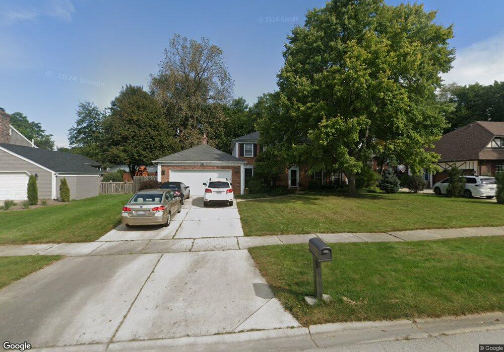
25W664 Red Maple Ln Unit 1 Wheaton, IL 60189
Arrowhead NeighborhoodEstimated Value: $707,475 - $851,000
4
Beds
4
Baths
2,656
Sq Ft
$293/Sq Ft
Est. Value
About This Home
This home is located at 25W664 Red Maple Ln Unit 1, Wheaton, IL 60189 and is currently estimated at $777,619, approximately $292 per square foot. 25W664 Red Maple Ln Unit 1 is a home located in DuPage County with nearby schools including Wiesbrook Elementary School, Hubble Middle School, and Wheaton Warrenville South High School.
Ownership History
Date
Name
Owned For
Owner Type
Purchase Details
Closed on
Oct 27, 1995
Sold by
Quaid Paula J and Sogge Paula J
Bought by
Mckee Harold E and Mckee Kathleen J
Current Estimated Value
Home Financials for this Owner
Home Financials are based on the most recent Mortgage that was taken out on this home.
Original Mortgage
$245,000
Interest Rate
7.36%
Create a Home Valuation Report for This Property
The Home Valuation Report is an in-depth analysis detailing your home's value as well as a comparison with similar homes in the area
Home Values in the Area
Average Home Value in this Area
Purchase History
| Date | Buyer | Sale Price | Title Company |
|---|---|---|---|
| Mckee Harold E | $260,000 | -- |
Source: Public Records
Mortgage History
| Date | Status | Borrower | Loan Amount |
|---|---|---|---|
| Previous Owner | Mckee Harold E | $245,000 |
Source: Public Records
Tax History
| Year | Tax Paid | Tax Assessment Tax Assessment Total Assessment is a certain percentage of the fair market value that is determined by local assessors to be the total taxable value of land and additions on the property. | Land | Improvement |
|---|---|---|---|---|
| 2024 | $12,168 | $216,444 | $36,123 | $180,321 |
| 2023 | $11,656 | $199,230 | $33,250 | $165,980 |
| 2022 | $11,287 | $188,280 | $31,420 | $156,860 |
| 2021 | $10,933 | $183,810 | $30,670 | $153,140 |
| 2020 | $10,835 | $182,090 | $30,380 | $151,710 |
| 2019 | $10,559 | $177,290 | $29,580 | $147,710 |
| 2018 | $9,870 | $167,040 | $27,880 | $139,160 |
| 2017 | $9,708 | $160,880 | $26,850 | $134,030 |
| 2016 | $9,585 | $154,460 | $25,780 | $128,680 |
| 2015 | $9,517 | $147,350 | $24,590 | $122,760 |
| 2014 | $8,526 | $130,200 | $29,600 | $100,600 |
| 2013 | $8,273 | $130,590 | $29,690 | $100,900 |
Source: Public Records
Map
Nearby Homes
- 26W055 Cree Ln
- 141 Loretto Ct
- 76 Somerset Cir
- 1127 Hibbard Rd
- 2552 Weatherbee Ln
- 1605 Burning Trail
- 1620 Hemstock Ave
- 1601 W Wiesbrook Rd
- 1612 Stonebridge Trail
- 30 Danada Dr
- 24 Winners Cup Cir Unit 3
- 1519 Foothill Dr
- 121 Brighton Dr
- Lot 1 Foothill Dr
- 1245 Josiah Rd
- 3S700 Delles Rd
- 1533 S County Farm Rd Unit 1-4
- 2043 Spring Green Dr
- 1440 Stonebridge Cir Unit J7
- 1442 Stonebridge Cir Unit I8
- 25W652 Red Maple Ln
- 25W676 Red Maple Ln
- 2S580 Orchard Rd
- 25W640 Red Maple Ln
- 25W700 Red Maple Ln
- 1970 Orchard Rd
- 25W665 Red Maple Ln
- 25W675 Red Maple Ln
- 25W651 Red Maple Ln
- 25W628 Red Maple Ln
- 25W701 Red Maple Ln Unit 1
- 25W641 Red Maple Ln
- 25W720 Red Maple Ln
- 25W625 Red Maple Ln
- 25W713 Red Maple Ln
- 25W646 Summerfield Ct
- 71 Landon Cir
- 25W730 Red Maple Ln Unit 1
- 75 Landon Cir
- 25W644 Summerfield Ct
Your Personal Tour Guide
Ask me questions while you tour the home.