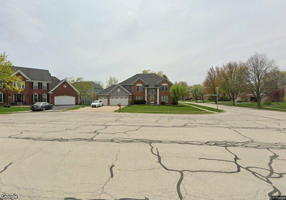
25W665 Prairie Rose Cir Carol Stream, IL 60188
Estimated Value: $722,823 - $751,000
4
Beds
4
Baths
2,740
Sq Ft
$267/Sq Ft
Est. Value
About This Home
This home is located at 25W665 Prairie Rose Cir, Carol Stream, IL 60188 and is currently estimated at $732,706, approximately $267 per square foot. 25W665 Prairie Rose Cir is a home located in DuPage County with nearby schools including Pleasant Hill Elementary School, Monroe Middle School, and Wheaton North High School.
Ownership History
Date
Name
Owned For
Owner Type
Purchase Details
Closed on
May 25, 2017
Sold by
Mooney Robert F and Mooney Ann
Bought by
Achillides Christos and Strati Anna D
Current Estimated Value
Home Financials for this Owner
Home Financials are based on the most recent Mortgage that was taken out on this home.
Original Mortgage
$388,000
Outstanding Balance
$322,049
Interest Rate
4.03%
Mortgage Type
New Conventional
Estimated Equity
$410,658
Purchase Details
Closed on
Oct 7, 1994
Sold by
American National Bk & Tr Co Of Chicago
Bought by
Mooney Robert F and Mooney Ann
Home Financials for this Owner
Home Financials are based on the most recent Mortgage that was taken out on this home.
Original Mortgage
$240,400
Interest Rate
6.75%
Create a Home Valuation Report for This Property
The Home Valuation Report is an in-depth analysis detailing your home's value as well as a comparison with similar homes in the area
Home Values in the Area
Average Home Value in this Area
Purchase History
| Date | Buyer | Sale Price | Title Company |
|---|---|---|---|
| Achillides Christos | $485,000 | Regency Title Services Inc | |
| Mooney Robert F | $284,000 | -- |
Source: Public Records
Mortgage History
| Date | Status | Borrower | Loan Amount |
|---|---|---|---|
| Open | Achillides Christos | $388,000 | |
| Previous Owner | Mooney Robert F | $240,400 |
Source: Public Records
Tax History Compared to Growth
Tax History
| Year | Tax Paid | Tax Assessment Tax Assessment Total Assessment is a certain percentage of the fair market value that is determined by local assessors to be the total taxable value of land and additions on the property. | Land | Improvement |
|---|---|---|---|---|
| 2024 | $11,926 | $196,780 | $51,756 | $145,024 |
| 2023 | $11,431 | $181,130 | $47,640 | $133,490 |
| 2022 | $11,138 | $171,180 | $45,020 | $126,160 |
| 2021 | $10,528 | $167,120 | $43,950 | $123,170 |
| 2020 | $10,367 | $165,560 | $43,540 | $122,020 |
| 2019 | $10,132 | $161,190 | $42,390 | $118,800 |
| 2018 | $11,002 | $172,740 | $39,950 | $132,790 |
| 2017 | $10,802 | $166,370 | $38,480 | $127,890 |
| 2016 | $10,642 | $159,720 | $36,940 | $122,780 |
| 2015 | $10,554 | $152,370 | $35,240 | $117,130 |
| 2014 | $11,099 | $157,330 | $39,630 | $117,700 |
| 2013 | $10,727 | $157,800 | $39,750 | $118,050 |
Source: Public Records
Map
Nearby Homes
- 1N153 Mission Ct
- 0N 634 Knollwood Dr
- 0N632 Gables Blvd
- 26W185 Meadowview Ct
- 0N510 Gary Ave
- 26W137 Prestwick Ln
- 26W130 Prestwick Ln
- 26W181 Grand Ave
- 1N599 Golf View Ln
- 1N607 Golf View Ln
- 25W277 Doris Ave
- 25W275 Doris Ave
- 1N280 Morse St
- 0 Ellis Ave
- 1N100 Harriet St
- 570 Amy Ln
- 1N321 Morse St
- Lot 11 Ellis Ave
- 0N337 Herrick Dr
- 26W199 Klein Creek Dr
- 25W655 Prairie Rose Cir
- 25W668 Wheatberry Ct
- 25W658 Wheatberry Ct
- 25W653 Prairie Rose Cir
- 1N050 Wheatberry Dr
- 1N060 Wheatberry Dr
- 1N040 Wheatberry Dr
- 25W652 Wheatberry Ct
- 1N070 Wheatberry Dr
- 25W660 Prairie Rose Cir
- 25W654 Prairie Rose Cir
- 1N030 Wheatberry Dr
- 1N048 Mission Ct
- 1N052 Mission Ct
- 1N040 Mission Ct
- 1N062 Mission Ct
- 25W679 Thistledown Ct
- 25W653 Wheatberry Ct
- 1N066 Mission Ct
- 1N016 Wheatberry Dr