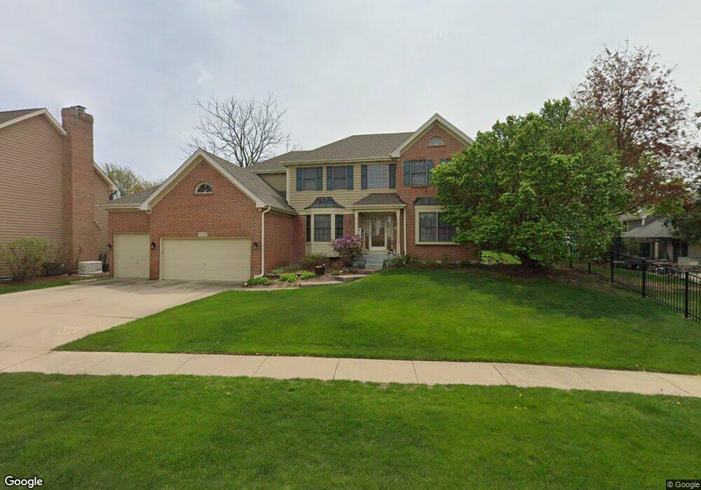
25W689 Macarthur Ave Carol Stream, IL 60188
Estimated Value: $711,644 - $782,000
--
Bed
1
Bath
3,124
Sq Ft
$239/Sq Ft
Est. Value
About This Home
This home is located at 25W689 Macarthur Ave, Carol Stream, IL 60188 and is currently estimated at $745,161, approximately $238 per square foot. 25W689 Macarthur Ave is a home located in DuPage County with nearby schools including Pleasant Hill Elementary School, Monroe Middle School, and Wheaton North High School.
Ownership History
Date
Name
Owned For
Owner Type
Purchase Details
Closed on
Nov 23, 2005
Sold by
Domeier John and Domeier Sue
Bought by
Domeier Sue
Current Estimated Value
Home Financials for this Owner
Home Financials are based on the most recent Mortgage that was taken out on this home.
Original Mortgage
$215,000
Outstanding Balance
$118,951
Interest Rate
6.2%
Mortgage Type
Fannie Mae Freddie Mac
Estimated Equity
$626,210
Purchase Details
Closed on
Sep 1, 1994
Sold by
American National Bk & Tr Co Of Chicago
Bought by
Domeier John P and Domeier Sue Ann
Create a Home Valuation Report for This Property
The Home Valuation Report is an in-depth analysis detailing your home's value as well as a comparison with similar homes in the area
Home Values in the Area
Average Home Value in this Area
Purchase History
| Date | Buyer | Sale Price | Title Company |
|---|---|---|---|
| Domeier Sue | -- | First American Title | |
| Domeier John P | $305,833 | -- |
Source: Public Records
Mortgage History
| Date | Status | Borrower | Loan Amount |
|---|---|---|---|
| Open | Domeier Sue | $215,000 |
Source: Public Records
Tax History Compared to Growth
Tax History
| Year | Tax Paid | Tax Assessment Tax Assessment Total Assessment is a certain percentage of the fair market value that is determined by local assessors to be the total taxable value of land and additions on the property. | Land | Improvement |
|---|---|---|---|---|
| 2024 | $12,882 | $211,924 | $51,756 | $160,168 |
| 2023 | $12,352 | $195,070 | $47,640 | $147,430 |
| 2022 | $12,026 | $184,350 | $45,020 | $139,330 |
| 2021 | $11,368 | $179,970 | $43,950 | $136,020 |
| 2020 | $11,195 | $178,290 | $43,540 | $134,750 |
| 2019 | $10,941 | $173,580 | $42,390 | $131,190 |
| 2018 | $12,353 | $193,220 | $39,950 | $153,270 |
| 2017 | $12,131 | $186,100 | $38,480 | $147,620 |
| 2016 | $11,954 | $178,660 | $36,940 | $141,720 |
| 2015 | $11,857 | $170,440 | $35,240 | $135,200 |
| 2014 | $11,183 | $158,480 | $39,630 | $118,850 |
| 2013 | $10,809 | $158,960 | $39,750 | $119,210 |
Source: Public Records
Map
Nearby Homes
- 1N153 Mission Ct
- 26W137 Prestwick Ln
- 26W130 Prestwick Ln
- 0N 634 Knollwood Dr
- 1N599 Golf View Ln
- 1N607 Golf View Ln
- 26W185 Meadowview Ct
- 0N632 Gables Blvd
- 25W277 Doris Ave
- 26W199 Klein Creek Dr
- 25W275 Doris Ave
- 1N100 Harriet St
- 26W036 Klein Creek Dr Unit 36
- 1N280 Morse St
- 26W181 Grand Ave
- 0N510 Gary Ave
- 1N321 Morse St
- 26W237 Pinehurst Dr
- Lot 11 Ellis Ave
- 0 Ellis Ave
- 25W685 Macarthur Ave
- 1N145 Coventry Dr
- 1N135 Coventry Dr
- 25W684 Thistledown Ct
- 25W680 Thistledown Ct
- 1N144 Wheatberry Dr
- 25W671 Macarthur Ave
- 1N171 Coventry Dr
- 25W688 Macarthur Ave
- 1N125 Coventry Dr
- 25W771 Macarthur Ave
- 25W684 Macarthur Ave
- 25W670 Thistledown Ct
- 25W685 Thistledown Ct
- 1N181 Coventry Dr
- 1N115 Coventry Dr
- 181 Coventry Dr
- 1N150 Coventry Dr
- 1N140 Coventry Dr
- 1N170 Coventry Dr