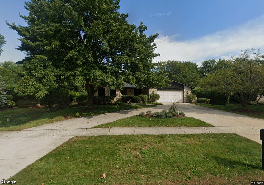
25W740 Red Maple Ln Wheaton, IL 60189
Arrowhead NeighborhoodEstimated Value: $477,451 - $694,000
3
Beds
2
Baths
1,881
Sq Ft
$324/Sq Ft
Est. Value
About This Home
This home is located at 25W740 Red Maple Ln, Wheaton, IL 60189 and is currently estimated at $608,613, approximately $323 per square foot. 25W740 Red Maple Ln is a home located in DuPage County with nearby schools including Wiesbrook Elementary School, Hubble Middle School, and Wheaton Warrenville South High School.
Ownership History
Date
Name
Owned For
Owner Type
Purchase Details
Closed on
Sep 17, 2025
Sold by
Ebalo Donald Jeffrey and Ebalo Rosemarie
Bought by
Brian J Ebalo Trust and Ebalo
Current Estimated Value
Purchase Details
Closed on
Feb 25, 2002
Sold by
Ebalo Donald Jeffrey and Ebalo Rosemarie
Bought by
Ebalo Rosemarie and Ebalo Donald Jeffrey
Purchase Details
Closed on
Aug 19, 1999
Sold by
Ebalo Donald Jeffery and Ebalo Rosemarie
Bought by
Ebalo Rosemarie and Rosemarie Ebalo Declaration Of Trust
Purchase Details
Closed on
Jan 19, 1998
Sold by
Ebalo Donald Jeffrey and Ebalo Rosemarie
Bought by
Rosemarie Ebalo 1997 Declaration Of Tr
Create a Home Valuation Report for This Property
The Home Valuation Report is an in-depth analysis detailing your home's value as well as a comparison with similar homes in the area
Home Values in the Area
Average Home Value in this Area
Purchase History
| Date | Buyer | Sale Price | Title Company |
|---|---|---|---|
| Brian J Ebalo Trust | -- | None Listed On Document | |
| Ebalo Rosemarie | -- | -- | |
| Ebalo Rosemarie | -- | -- | |
| Rosemarie Ebalo 1997 Declaration Of Tr | -- | -- |
Source: Public Records
Tax History
| Year | Tax Paid | Tax Assessment Tax Assessment Total Assessment is a certain percentage of the fair market value that is determined by local assessors to be the total taxable value of land and additions on the property. | Land | Improvement |
|---|---|---|---|---|
| 2024 | -- | $141,319 | $36,123 | $105,196 |
| 2023 | $7,441 | $130,080 | $33,250 | $96,830 |
| 2022 | $7,240 | $122,930 | $31,420 | $91,510 |
| 2021 | $6,765 | $120,010 | $30,670 | $89,340 |
| 2020 | $6,946 | $118,890 | $30,380 | $88,510 |
| 2019 | $6,765 | $115,750 | $29,580 | $86,170 |
| 2018 | $6,740 | $115,970 | $27,880 | $88,090 |
| 2017 | $6,624 | $111,690 | $26,850 | $84,840 |
| 2016 | $6,536 | $107,230 | $25,780 | $81,450 |
| 2015 | $6,483 | $102,290 | $24,590 | $77,700 |
| 2014 | $6,269 | $97,310 | $29,600 | $67,710 |
| 2013 | $5,750 | $97,600 | $29,690 | $67,910 |
Source: Public Records
Map
Nearby Homes
- 25W773 Sunnyridge Ct
- 2S671 Arrowhead Dr
- 141 Loretto Ct
- 2631 Weatherbee Ln
- 1605 Burning Trail
- 1620 Hemstock Ave
- 1612 Stonebridge Trail
- 1601 W Wiesbrook Rd
- 1127 Hibbard Rd
- 30 Danada Dr
- 2099 Creekside Dr Unit 1-4
- Lot 1 Foothill Dr
- 1420 Stonebridge Trail Unit 1-3
- 1533 S County Farm Rd Unit 1-4
- 2043 Spring Green Dr
- 1442 Stonebridge Cir Unit I8
- 1462 Stonebridge Cir Unit F10
- 1028 Lodalia Ct
- 1S728 Shaffner Rd
- 1S710 Shaffner Rd
- 25W730 Red Maple Ln Unit 1
- 2S585 White Birch Ln
- 25W741 Embden Ln
- 25W731 Embden Ln
- 25W720 Red Maple Ln
- 2S567 White Birch Ln
- 2S621 White Birch Ln Unit 1
- 25W741 Red Maple Ln
- 25W700 Red Maple Ln
- 2S543 White Birch Ln
- 2S580 White Birch Ln
- 2S602 White Birch Ln
- 25W731 Red Maple Ln
- 2S568 White Birch Ln
- 2S641 White Birch Ln
- 2S616 White Birch Ln
- 63 Landon Cir
- 25W713 Red Maple Ln
- 25W676 Red Maple Ln
- 2S630 White Birch Ln
Your Personal Tour Guide
Ask me questions while you tour the home.