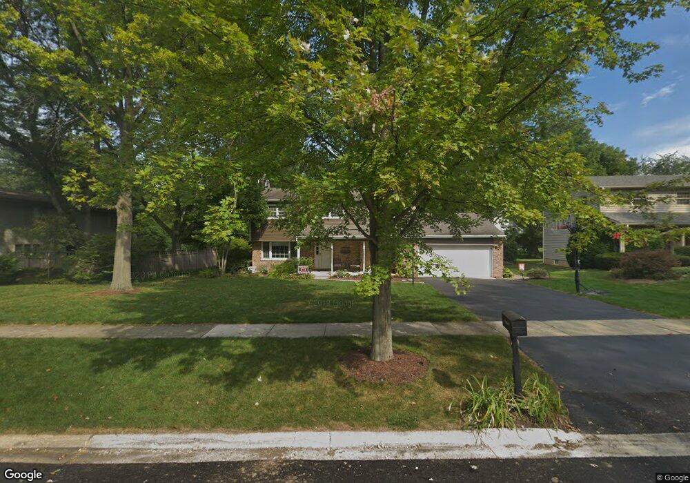
25W746 Flint Creek Dr Wheaton, IL 60189
Arrowhead NeighborhoodEstimated Value: $660,501 - $723,000
4
Beds
3
Baths
2,450
Sq Ft
$282/Sq Ft
Est. Value
About This Home
This home is located at 25W746 Flint Creek Dr, Wheaton, IL 60189 and is currently estimated at $690,125, approximately $281 per square foot. 25W746 Flint Creek Dr is a home located in DuPage County with nearby schools including Wiesbrook Elementary School, Hubble Middle School, and Wheaton Warrenville South High School.
Ownership History
Date
Name
Owned For
Owner Type
Purchase Details
Closed on
Jul 10, 2009
Sold by
Patterson Michael R and Patterson Sally K
Bought by
Haw Thomas J and Haw Audra D
Current Estimated Value
Home Financials for this Owner
Home Financials are based on the most recent Mortgage that was taken out on this home.
Original Mortgage
$356,000
Outstanding Balance
$234,465
Interest Rate
5.49%
Mortgage Type
Purchase Money Mortgage
Estimated Equity
$455,660
Create a Home Valuation Report for This Property
The Home Valuation Report is an in-depth analysis detailing your home's value as well as a comparison with similar homes in the area
Home Values in the Area
Average Home Value in this Area
Purchase History
| Date | Buyer | Sale Price | Title Company |
|---|---|---|---|
| Haw Thomas J | $445,000 | Multiple |
Source: Public Records
Mortgage History
| Date | Status | Borrower | Loan Amount |
|---|---|---|---|
| Open | Haw Thomas J | $356,000 |
Source: Public Records
Tax History Compared to Growth
Tax History
| Year | Tax Paid | Tax Assessment Tax Assessment Total Assessment is a certain percentage of the fair market value that is determined by local assessors to be the total taxable value of land and additions on the property. | Land | Improvement |
|---|---|---|---|---|
| 2024 | $11,395 | $186,470 | $36,134 | $150,336 |
| 2023 | $10,906 | $171,640 | $33,260 | $138,380 |
| 2022 | $10,563 | $162,200 | $31,430 | $130,770 |
| 2021 | $10,465 | $158,350 | $30,680 | $127,670 |
| 2020 | $10,400 | $156,870 | $30,390 | $126,480 |
| 2019 | $10,134 | $152,730 | $29,590 | $123,140 |
| 2018 | $10,192 | $154,230 | $27,880 | $126,350 |
| 2017 | $10,027 | $148,540 | $26,850 | $121,690 |
| 2016 | $9,898 | $142,610 | $25,780 | $116,830 |
| 2015 | $9,832 | $136,050 | $24,590 | $111,460 |
| 2014 | $9,231 | $125,740 | $27,600 | $98,140 |
| 2013 | $8,948 | $126,110 | $27,680 | $98,430 |
Source: Public Records
Map
Nearby Homes
- 1601 W Wiesbrook Rd
- 1519 Foothill Dr
- Lot 1 Foothill Dr
- 1420 Stonebridge Trail Unit 1-3
- 1460 Stonebridge Cir Unit G9
- 1961 Wexford Cir Unit 116
- 1477 S County Farm Rd Unit 23F
- 1521 S County Farm Rd Unit 1-1
- 2S501 Seneca Dr
- 2S386 Seneca Dr
- 1028 Lodalia Ct
- 1110 S Gables Blvd
- 141 Loretto Ct
- 1S728 Shaffner Rd
- 1S710 Shaffner Rd
- 27W041 Walz Way
- 27W020 Walz Way
- 1907 Gresham Cir Unit D
- 1219 Golf Ln
- 1785 Grosvenor Cir Unit A
- 25W746 Flint Creek Dr
- 25W734 Flint Creek Dr
- 25W758 Flint Creek Dr
- 25W722 Flint Creek Dr
- 25W722 Flint Creek Rd
- 1650 Waldorth Ct
- 25W786 Flint Creek Dr
- 25W786 Flint Creek Dr
- 25W745 Flint Creek Dr
- 25W757 Flint Creek Dr
- 25W731 Flint Creek Dr
- 25W710 Flint Creek Dr
- 25W719 Flint Creek Dr
- 25W780 Flint Creek Dr
- 1655 Burning Trail Ct
- 25W752 Chieftain Ln
- 1600 Waldorth Ct
- 25W738 Chieftain Ln
- 25W700 Flint Creek Dr
- 25W707 Flint Creek Dr