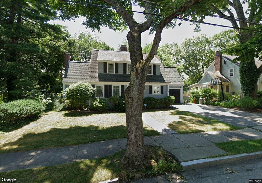
26 Alexander Rd Newton Highlands, MA 02461
Newton Highlands NeighborhoodEstimated Value: $1,233,000 - $1,574,000
3
Beds
3
Baths
2,016
Sq Ft
$706/Sq Ft
Est. Value
About This Home
This home is located at 26 Alexander Rd, Newton Highlands, MA 02461 and is currently estimated at $1,422,504, approximately $705 per square foot. 26 Alexander Rd is a home located in Middlesex County with nearby schools including Countryside Elementary School, Charles E Brown Middle School, and Newton South High School.
Ownership History
Date
Name
Owned For
Owner Type
Purchase Details
Closed on
Sep 2, 2014
Sold by
Darcy Dennis R and Darcy Debra L
Bought by
26 Alexander Road Rt and Arcy D L
Current Estimated Value
Purchase Details
Closed on
Aug 11, 2011
Sold by
Darcy Dennis R and Darcy Debra L
Bought by
Darcy Gregory
Purchase Details
Closed on
Dec 9, 1992
Sold by
Springer Allen L and Springer Nancy J
Bought by
Darcy Dennis R and Darcy Debra L
Home Financials for this Owner
Home Financials are based on the most recent Mortgage that was taken out on this home.
Original Mortgage
$160,000
Interest Rate
8.16%
Mortgage Type
Purchase Money Mortgage
Create a Home Valuation Report for This Property
The Home Valuation Report is an in-depth analysis detailing your home's value as well as a comparison with similar homes in the area
Home Values in the Area
Average Home Value in this Area
Purchase History
| Date | Buyer | Sale Price | Title Company |
|---|---|---|---|
| 26 Alexander Road Rt | -- | -- | |
| Darcy Gregory | -- | -- | |
| Darcy Dennis R | $320,000 | -- |
Source: Public Records
Mortgage History
| Date | Status | Borrower | Loan Amount |
|---|---|---|---|
| Previous Owner | Darcy Dennis R | $100,000 | |
| Previous Owner | Darcy Dennis R | $160,000 | |
| Previous Owner | Darcy Dennis R | $160,000 | |
| Closed | Darcy Dennis R | $26,900 |
Source: Public Records
Tax History Compared to Growth
Tax History
| Year | Tax Paid | Tax Assessment Tax Assessment Total Assessment is a certain percentage of the fair market value that is determined by local assessors to be the total taxable value of land and additions on the property. | Land | Improvement |
|---|---|---|---|---|
| 2025 | $10,354 | $1,056,500 | $861,700 | $194,800 |
| 2024 | $10,011 | $1,025,700 | $836,600 | $189,100 |
| 2023 | $9,346 | $918,100 | $633,600 | $284,500 |
| 2022 | $8,943 | $850,100 | $586,700 | $263,400 |
| 2021 | $8,630 | $802,000 | $553,500 | $248,500 |
| 2020 | $8,373 | $802,000 | $553,500 | $248,500 |
| 2019 | $8,136 | $778,600 | $537,400 | $241,200 |
| 2018 | $7,812 | $722,000 | $486,800 | $235,200 |
| 2017 | $7,574 | $681,100 | $459,200 | $221,900 |
| 2016 | $7,243 | $636,500 | $429,200 | $207,300 |
| 2015 | $6,907 | $594,900 | $401,100 | $193,800 |
Source: Public Records
Map
Nearby Homes
- 19 Selwyn Rd
- 250 Woodcliff Rd
- 125 Oakdale Rd
- 1308 Walnut St
- 671 Boylston St
- 628 Boylston St
- 1292 Walnut St
- 36 Cannon St
- 21 Philbrick Rd
- 625 Boylston St
- 42 Sunhill Ln
- 35 Haynes Rd
- 45 Brandeis Rd
- 1623-1625 Centre St
- 1629 Centre St
- 1597 Centre St Unit 1597
- 1597 Centre St
- 116 Upland Ave
- 5 Halcyon Rd
- 15 Buff Cir