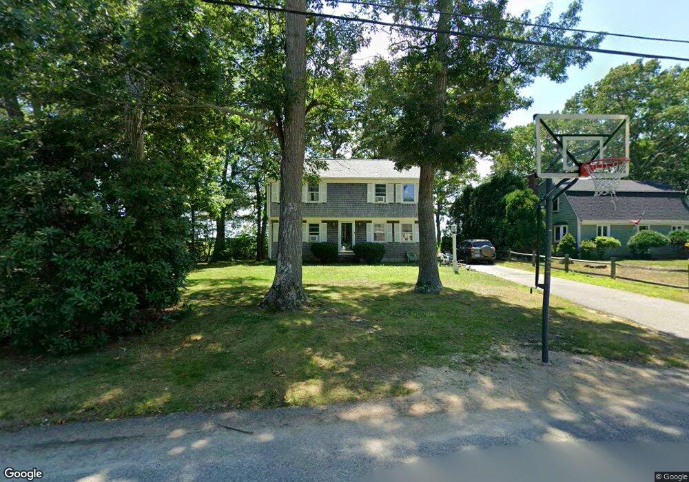
26 Bay Point Path Marshfield, MA 02050
Green Harbor-Cedar Crest NeighborhoodEstimated Value: $721,855 - $876,000
4
Beds
2
Baths
1,742
Sq Ft
$455/Sq Ft
Est. Value
About This Home
This home is located at 26 Bay Point Path, Marshfield, MA 02050 and is currently estimated at $792,464, approximately $454 per square foot. 26 Bay Point Path is a home located in Plymouth County with nearby schools including Governor Edward Winslow School, Furnace Brook Middle School, and Marshfield High School.
Ownership History
Date
Name
Owned For
Owner Type
Purchase Details
Closed on
Jan 13, 1993
Sold by
Mullin Edward J and Mullin Maureen A
Bought by
Berchtold William J and Berchtold Evelyn M
Current Estimated Value
Home Financials for this Owner
Home Financials are based on the most recent Mortgage that was taken out on this home.
Original Mortgage
$116,000
Interest Rate
8.3%
Mortgage Type
Purchase Money Mortgage
Create a Home Valuation Report for This Property
The Home Valuation Report is an in-depth analysis detailing your home's value as well as a comparison with similar homes in the area
Home Values in the Area
Average Home Value in this Area
Purchase History
| Date | Buyer | Sale Price | Title Company |
|---|---|---|---|
| Berchtold William J | $156,000 | -- |
Source: Public Records
Mortgage History
| Date | Status | Borrower | Loan Amount |
|---|---|---|---|
| Open | Berchtold William J | $114,000 | |
| Closed | Berchtold William J | $116,000 |
Source: Public Records
Tax History
| Year | Tax Paid | Tax Assessment Tax Assessment Total Assessment is a certain percentage of the fair market value that is determined by local assessors to be the total taxable value of land and additions on the property. | Land | Improvement |
|---|---|---|---|---|
| 2025 | $6,109 | $617,100 | $346,400 | $270,700 |
| 2024 | $5,955 | $573,100 | $326,000 | $247,100 |
| 2023 | $5,492 | $508,200 | $293,400 | $214,800 |
| 2022 | $5,492 | $424,100 | $244,500 | $179,600 |
| 2021 | $5,354 | $405,900 | $244,500 | $161,400 |
| 2020 | $4,944 | $370,900 | $214,000 | $156,900 |
| 2019 | $4,840 | $361,700 | $214,000 | $147,700 |
| 2018 | $4,796 | $358,700 | $214,000 | $144,700 |
| 2017 | $4,694 | $342,100 | $214,000 | $128,100 |
| 2016 | $4,623 | $333,100 | $214,000 | $119,100 |
| 2015 | $4,251 | $319,900 | $203,800 | $116,100 |
| 2014 | $4,362 | $328,200 | $214,000 | $114,200 |
Source: Public Records
Map
Nearby Homes
- 71 Gurnet Rd
- 106 Careswell St
- 116 Outlook Rd
- 98 Cherry St
- 122 June St
- 86 Barouche Dr
- 116 Island St
- 39 Bay Pond Rd
- 387 Lot 2A Old Cove Rd
- 387 Lot 3A Old Cove Rd
- 387 Lot 4A Old Cove Rd
- 78 Tower Ave
- 236 Powder Point Ave
- 17 Dyke Rd
- 256 Ocean St
- 568 Webster St
- 242 Enterprise St
- 32 Gratto Rd
- 66 Simmons Dr
- 184 King Phillips Pathe
- 18 Bay Point Path
- 32 Bay Point Path
- 12 Bay Point Path
- 40 Bay Point Path
- 17 Bay Point Path
- 27 Bay Point Path
- 5 Bay Point Path
- 6 Bay Point Path
- 140 Atwell Cir
- 76 Bay Point Path
- 44 Bay Point Path
- 146 Atwell Cir
- 120 Atwell Cir
- 70 Bay Point Path
- 123 Atwell Cir
- 141 Atwell Cir
- 66 Bay Point Path
- 50 Bay Point Path
- 148 Atwell Cir
- 58 Bay Point Path
Your Personal Tour Guide
Ask me questions while you tour the home.