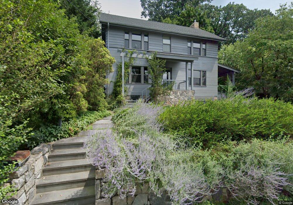
26 Bellair Dr Dobbs Ferry, NY 10522
Estimated Value: $1,147,000 - $1,460,000
3
Beds
1
Bath
1,750
Sq Ft
$773/Sq Ft
Est. Value
About This Home
This home is located at 26 Bellair Dr, Dobbs Ferry, NY 10522 and is currently estimated at $1,352,459, approximately $772 per square foot. 26 Bellair Dr is a home located in Westchester County with nearby schools including Springhurst Elementary School, Dobbs Ferry High School, and The Masters School.
Ownership History
Date
Name
Owned For
Owner Type
Purchase Details
Closed on
Feb 10, 2010
Sold by
Tackett Mildred B
Bought by
Bausch Rebecca and Burns David
Current Estimated Value
Home Financials for this Owner
Home Financials are based on the most recent Mortgage that was taken out on this home.
Original Mortgage
$514,000
Interest Rate
5.11%
Mortgage Type
New Conventional
Purchase Details
Closed on
Aug 7, 2009
Sold by
Tackett William M and Tackett Mildred B
Bought by
Tackett Mildred B
Create a Home Valuation Report for This Property
The Home Valuation Report is an in-depth analysis detailing your home's value as well as a comparison with similar homes in the area
Home Values in the Area
Average Home Value in this Area
Purchase History
| Date | Buyer | Sale Price | Title Company |
|---|---|---|---|
| Bausch Rebecca | $642,500 | Chicago Title Insurance Co | |
| Tackett Mildred B | -- | None Available |
Source: Public Records
Mortgage History
| Date | Status | Borrower | Loan Amount |
|---|---|---|---|
| Previous Owner | Bausch Rebecca | $514,000 |
Source: Public Records
Tax History Compared to Growth
Tax History
| Year | Tax Paid | Tax Assessment Tax Assessment Total Assessment is a certain percentage of the fair market value that is determined by local assessors to be the total taxable value of land and additions on the property. | Land | Improvement |
|---|---|---|---|---|
| 2024 | $35,916 | $1,236,800 | $718,700 | $518,100 |
| 2023 | $34,507 | $1,142,300 | $598,900 | $543,400 |
| 2022 | $32,666 | $1,092,700 | $598,900 | $493,800 |
| 2021 | $33,619 | $993,300 | $598,900 | $394,400 |
| 2020 | $33,044 | $988,100 | $608,000 | $380,100 |
| 2019 | $31,829 | $988,100 | $608,000 | $380,100 |
| 2018 | $38,808 | $960,400 | $608,000 | $352,400 |
| 2017 | $3,893 | $960,400 | $608,000 | $352,400 |
| 2016 | $700,473 | $857,100 | $634,400 | $222,700 |
| 2015 | -- | $19,500 | $2,050 | $17,450 |
| 2014 | -- | $19,500 | $2,050 | $17,450 |
| 2013 | $9,876 | $17,050 | $2,050 | $15,000 |
Source: Public Records
Map
Nearby Homes
- 7 Ravine Dr
- 132 Edgars Ln
- 72 Magnolia Dr
- 737 N Broadway Unit 2D
- 40 Floral Dr
- 78 Oliphant Ave
- 177 Clinton Ave
- 11 Fairlawn Ave
- 65 Circle Dr
- 565 Broadway Unit 4A
- 565 Broadway Unit 1A
- 18 Eldredge Place
- 555 Broadway Unit 1H
- 33 Livingston Ave
- 31 Maple Ave Unit 2A
- 31 Hillside Ave
- 57 Maple Ave Unit 2B
- 24 School St
- 445 Broadway Unit 2R
- 445 Broadway Unit 2-O