
Seller's Agent in 2025
Stephan Von Jena
William Pitt
(203) 434-8472
5 in this area
16 Total Sales
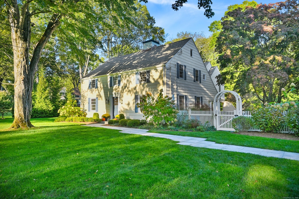
Wonderful opportunity in one of Darien's most sought after neighborhoods; 4,000+ sqft of custom, renovated space that is truly in move-in condition. Designed by a renowned local architect, the home has charm, sophistication with a light filled open floor plan well suited for entertaining. Beautifully sited on .68 acres with mature trees and lush landscaping, there is ample room to expand and add a pool. Come see this exceptional home in top form just minutes from town, train, beaches and everything Darien!
Last Agent to Sell the Property
William Pitt Sotheby's Int'l Brokerage Phone: (203) 434-8472 License #RES.0788236 Listed on: 09/17/2025
| Date | Type | Sale Price | Title Company |
|---|---|---|---|
| Warranty Deed | $3,012,000 | -- | |
| Warranty Deed | $450,000 | -- | |
| Warranty Deed | $1,202,500 | -- |
| Date | Status | Loan Amount | Loan Type |
|---|---|---|---|
| Previous Owner | $612,000 | No Value Available | |
| Previous Owner | $620,000 | No Value Available |
| Date | Event | Price | List to Sale | Price per Sq Ft |
|---|---|---|---|---|
| 11/18/2025 11/18/25 | Sold | $3,012,000 | +11.6% | $725 / Sq Ft |
| 10/29/2025 10/29/25 | Pending | -- | -- | -- |
| 09/17/2025 09/17/25 | For Sale | $2,700,000 | -- | $650 / Sq Ft |
| Year | Tax Paid | Tax Assessment Tax Assessment Total Assessment is a certain percentage of the fair market value that is determined by local assessors to be the total taxable value of land and additions on the property. | Land | Improvement |
|---|---|---|---|---|
| 2025 | $20,296 | $1,311,100 | $797,860 | $513,240 |
| 2024 | $19,260 | $1,311,100 | $797,860 | $513,240 |
| 2023 | $16,992 | $964,880 | $569,870 | $395,010 |
| 2022 | $16,625 | $964,880 | $569,870 | $395,010 |
| 2021 | $2,552 | $964,880 | $569,870 | $395,010 |
| 2020 | $2,552 | $964,880 | $569,870 | $395,010 |
| 2019 | $15,238 | $925,190 | $530,180 | $395,010 |
| 2018 | $4,086 | $933,310 | $513,730 | $419,580 |
| 2017 | $2,423 | $933,310 | $513,730 | $419,580 |
| 2016 | $14,718 | $933,310 | $513,730 | $419,580 |
| 2015 | $14,489 | $943,880 | $524,300 | $419,580 |
| 2014 | $14,168 | $943,880 | $524,300 | $419,580 |
Seller's Agent in 2025
Stephan Von Jena
William Pitt
(203) 434-8472
5 in this area
16 Total Sales
Buyer's Agent in 2025
Susan Larsen
William Raveis Real Estate
(203) 856-1074
1 in this area
64 Total Sales
Source: SmartMLS
MLS Number: 24132151
APN: DARI-000013-000000-000036
Disclaimer: Certain information contained herein is derived from information provided by parties other than Homes.com. All information provided is deemed reliable, but is not guaranteed to be accurate and should be independently verified.
![]() IDX information is provided exclusively for personal, non-commercial use, and may not be used for any purpose other than to identify prospective properties consumers may be interested in purchasing. Information is deemed reliable but not guaranteed.
IDX information is provided exclusively for personal, non-commercial use, and may not be used for any purpose other than to identify prospective properties consumers may be interested in purchasing. Information is deemed reliable but not guaranteed.
Ask me questions while you tour the home.